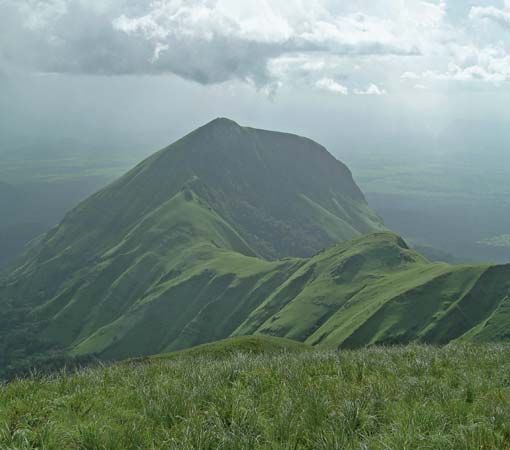
Kwahu Plateau
The Kwahu Plateau serves as a vital geographical feature in southern Ghana, functioning as the country's primary watershed. By separating river systems that…
How has the Kwahu Plateau influenced tourism and development in Ghana?
The Kwahu Plateau serves as a vital geographical feature in southern Ghana, functioning as the country’s primary watershed. By separating river systems that flow toward the Atlantic Ocean from those belonging to the Volta River basin, the plateau plays a critical role in the nation’s hydrology and agricultural landscape.
Regarding development, the plateau supports distinct economic activities: the western sector has seen the introduction of cacao cultivation, while the eastern sector emphasizes vegetable farming. Major towns such as Mpraeso, Abetifi, Mampong, and Wenchi serve as regional hubs. Additionally, the plateau’s elevation and bold erosional scarps provide a unique climate, shielding the southern forest regions from the dry harmattan winds.
While the provided information details the plateau’s physical geography and agricultural contributions, it does not explicitly document its specific impact on the tourism industry.
Are there any notable landmarks or cultural sites located on the Kwahu Plateau?
The Kwahu Plateau is primarily recognized for its significant role as a watershed and its unique geological features, such as the bold erosional scarps and prominent peaks like Mount Akwawa, which reaches an elevation of 2,586 feet (788 m).1
While the plateau is home to several principal towns, including Mpraeso, Abetifi, Mampong, and Wenchi, the available information does not identify specific cultural sites or landmarks designated for tourism on the plateau.1
What is the average elevation of the Kwahu Plateau, and how does it compare to other plateaus in West Africa?
The Kwahu Plateau in southern Ghana has an average elevation of 1,500 feet (460 m), with some peaks, such as Mount Akwawa, reaching up to 2,586 feet (788 m).1
When compared to other plateaus in West Africa, the Kwahu Plateau falls within a similar range to many regional highlands. For instance, the plateaus of southern and southwestern Mali—which are extensions of the Guinea Highlands—typically lie between 1,000 and 1,600 feet (300 and 500 m), though they can reach heights of over 2,100 feet (640 m) in specific areas like the Mandingue Plateau.2
While the Kwahu Plateau is comparable to these general elevations, other West African features exhibit greater vertical extremes. The Bandiagara Escarpment of the Dogon Plateau reaches nearly 3,300 feet (1,000 m), and Mount Hombori Tondo in Mali rises to 3,789 feet (1,155 m).2
How does the climate of the Kwahu Plateau differ from surrounding areas in Ghana?
The climate of the Kwahu Plateau is distinct from surrounding regions primarily due to its elevation and its role as a physical barrier. While the plateau experiences the same general climate patterns as the rest of Ghana—driven by the interplay between the humid maritime tropical air mass and the dry harmattan winds—its topography provides a moderating effect.13
Specifically, the plateau acts as a shield for the dense forest country to its south, protecting the region from the harsh, dry harmattan winds that originate from the Sahara. Furthermore, the higher altitude of the plateau helps to mitigate the enervating conditions often caused by the combination of high temperatures and high humidity found in lower-lying areas of the country. While the northern savanna experiences a single long, intense dry season, the plateau’s position and elevation contribute to a more complex moisture environment compared to the moisture-deficient northern plains.13
Sources
- Kwahu Plateau — Encyclopædia Britannica
- Mali - Relief — Encyclopædia Britannica
- Ghana - Climate — Encyclopædia Britannica
Published on · 2 min read