Lake Izabal
Lake Izabal is located in northeastern Guatemala, situated in the lowlands between the Santa Cruz Mountains to the northwest and the Minas and San Isidro…
What is the geographical location and size of Lake Izabal in Guatemala?
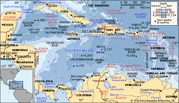
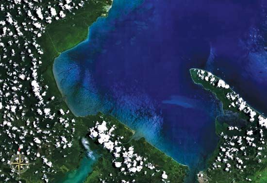
Lake Izabal is located in northeastern Guatemala, situated in the lowlands between the Santa Cruz Mountains to the northwest and the Minas and San Isidro mountains to the southwest and southeast.1
As the country’s largest lake, it lies at an elevation of 26 feet (8 metres) above sea level. Its dimensions are approximately 30 miles (48 km) long by 15 miles (24 km) wide, covering an area of 228 square miles (590 square km) with a maximum depth of 59 feet (18 metres). The lake is fed by the Polochic River and drains into the Caribbean Sea via the Dulce River and Amatique Bay.1
How does Lake Izabal connect to other water bodies in Guatemala?
Lake Izabal serves as a vital hydrological hub in northeastern Guatemala, acting as a link between inland river systems and the Caribbean Sea. Its connectivity is defined by the following water bodies:
- Polochic River: This river flows eastward for 150 miles from the Chamá and Minas mountain ranges, forming a delta that feeds directly into Lake Izabal south of the town of El Estor.12
- Dulce River: Acting as the lake’s primary outlet, the Dulce River drains the waters of Lake Izabal, flowing toward the coast.13
- Amatique Bay: The Dulce River empties into this inlet of the Gulf of Honduras, which is part of the Caribbean Sea.13
Through this network, the lake facilitates a continuous flow of water from the Guatemalan highlands to the Atlantic basin.12
How does Lake Izabal contribute to the local economy and livelihoods of nearby communities?
Lake Izabal has long served as a vital economic artery for Guatemala, supporting both historical trade and modern industrial activity. Its contributions to local livelihoods include:
- Trade and Logistics: Historically, the lake functioned as a primary export hub for products from the highlands. Today, the Polochic River remains navigable as far as Panzós, facilitating the transport of coffee and lumber.12
- Industrial Development: The town of El Estor serves as a key settlement on the lake’s shores. Originally established as a trading outpost for the United Fruit Company, the area has also seen significant activity in nickel mining.1
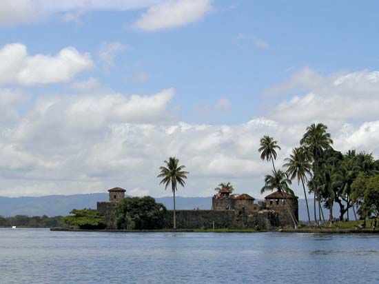
- Tourism and Heritage: The restoration of the San Felipe fort—a 17th-century structure built to defend against pirates—has transformed the site into a national landmark, contributing to the local economy through heritage preservation and tourism.1
We could dive deeper into the history of the United Fruit Company’s influence in the region or explore the environmental challenges associated with industrial development near the lake.
Are there any legends or myths associated with Lake Izabal?
Sorry, the Britannica knowledge base does not contain this information.
Sources
- Lake Izabal — Encyclopædia Britannica
- Polochic River — Encyclopædia Britannica
- Amatique Bay — Encyclopædia Britannica
Published on · 2 min read