Eurasia
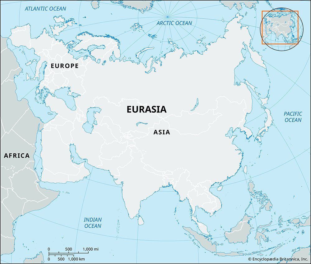
Eurasia is a portmanteau of Europe and Asia, referring to the single, enormous landmass that encompasses both continents.
What is Eurasia?
Eurasia is a portmanteau of Europe and Asia, referring to the single, enormous landmass that encompasses both continents.1
The term is used in two primary ways:
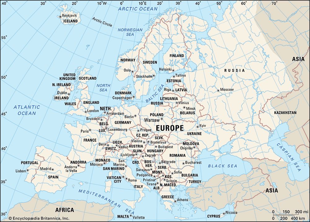
- Geological: It describes the physical landmass shared by Europe and Asia. While this is a clear physical entity, the boundary between the two continents is a historical and cultural construct rather than a universally agreed-upon physical line. Most geographers adopt a boundary running from the Arctic Ocean along the Ural Mountains, southwest to the Caspian Sea, and through the Kuma-Manych Depression to the Black Sea.12
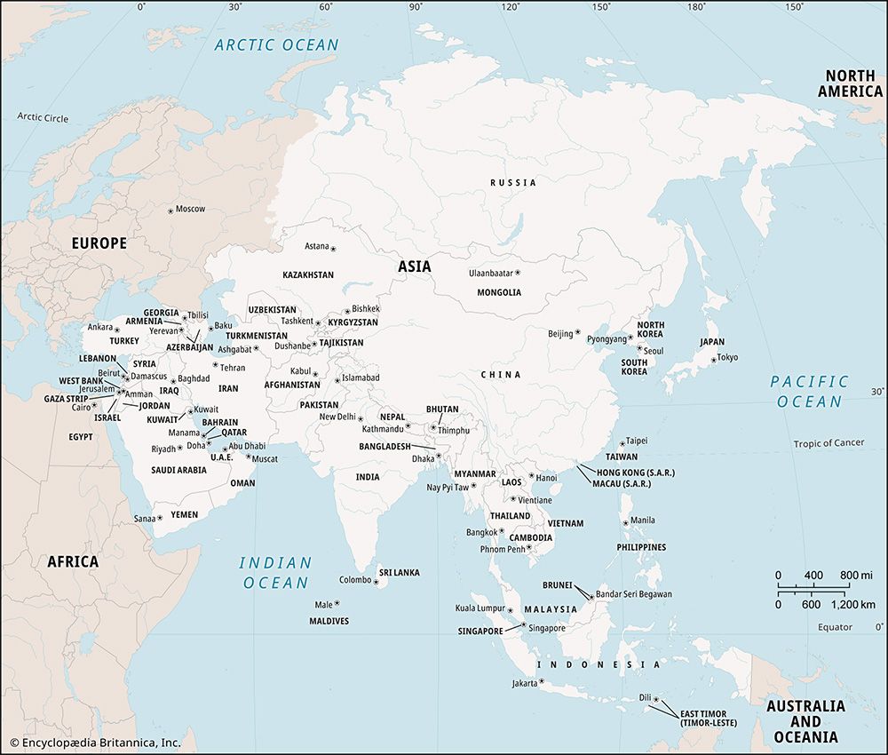
- Geopolitical: This definition is more fluid and debated. It often refers to sociopolitical entities within the landmass, with meanings varying based on the political orientation of the speaker. For example, some definitions focus on the integration of Russia and Europe, while others, such as the concept of “Greater Eurasia,” include Russia, China, and Central Asia.1
Why is the boundary between Europe and Asia considered a cultural construct?
The boundary between Europe and Asia is considered a cultural construct because it lacks a definitive physical basis that separates the two as distinct continents. While they form a single, continuous landmass known as Eurasia, the division into two continents is a historical and conceptual tradition rather than a geological necessity.14
For geographers, the definition of a “continent” extends beyond physical landmass into the realm of culture and history. Because there is no universal agreement on where one ends and the other begins, the boundary is established through convention. The most widely accepted line—running from the Arctic Ocean along the Ural Mountains, through the Caspian Sea, and across the Kuma-Manych Depression to the Black Sea—is a matter of agreement rather than a natural divide.1
This conceptual framework dates back to ancient Greece, where the world was divided into three units: Europe, Asia, and Libya (Africa). Consequently, the separation remains a human-defined classification shaped by historical, political, and social perspectives rather than plate tectonics or physical geography.41
What are some major mountain ranges that define the landscape of Eurasia?
Eurasia is defined by a complex network of mountain systems that shape its vast and varied landscape. These ranges are generally categorized into stable platform mountains and active orogenic zones, which are characterized by higher elevations and more complicated geological structures.8
Major Mountain Systems
- The Alpine-Himalayan Belt: This massive west-east mountain system includes some of the world’s most prominent ranges, such as the Himalayas, the Karakoram Range, the Hindu Kush, the Pamirs, the Caucasus, the Zagros, and the Taurus Mountains.8
- The Ural Mountains: Serving as a traditional physiographic boundary between Europe and Asia, the Ural Mountains stretch approximately 1,550 miles from the Ural River to the Arctic.9
- Central and East Asian Ranges: This region features extensive systems such as the Tien Shan, the Altai Mountains, the Kunlun Mountains, and the Sayan Mountains, which are integral to the continent’s interior relief.8
- Eastern Coastal Ranges: The eastern edge of the continent is defined by ranges like the Chersky Range, the Verkhoyansk Mountains, and the Sikhote-Alin range, often associated with the volcanic activity of the Pacific Rim.8
These mountains have been shaped by millions of years of tectonic movement, erosion, and glaciation, creating the dramatic topography that characterizes the Eurasian landmass.810
How did the movement of tectonic plates shape the Eurasian landmass?
The Eurasian landmass is the product of a complex geologic history driven by plate tectonics, a process where the movement of crustal sections leads to the opening and closing of oceans and the collision of continental fragments.14
Continental Collisions and Mountain Building
The modern landscape of Eurasia is largely defined by the closure of ancient oceans, most notably the Tethys Sea. This tropical body of water once separated the northern supercontinent of Laurasia from Gondwana in the south.15
- The Himalayan Orogeny: Approximately 50 million years ago, the Indian subcontinent collided with the southern margin of Asia. This ongoing collision caused the crust of the Tibetan Plateau to thicken and forced the uplift of the Himalayas and surrounding ranges like the Karakoram and Kunlun MountainsKarakoram-Range) and Kunlun Mountains.14
- The Uralian Orogenic Belt: The Ural Mountains formed during the late Paleozoic Era through the collision of the European and Asian continental blocks, which eliminated the ancient Uralian Sea.1617
- Caledonian Orogeny: Earlier in the Paleozoic, the closure of the Iapetus Ocean resulted in the formation of the Caledonian orogenic belt, which stretches across parts of the British Isles and Norway.18
Tectonic Deformation
Beyond initial collisions, the continued penetration of India into Eurasia has caused secondary tectonic effects, such as the eastward extrusion of crustal blocks and the formation of rift systems like the Baikal Rift Zone. These processes, involving folding, faulting, and the thrusting of ocean-floor material (ophiolites) onto continental margins, continue to shape the continent’s relief today.192014
Sources
- Eurasia — Encyclopædia Britannica
- Europe - Mesozoic and Cenozoic eras — Encyclopædia Britannica
- Europe — Encyclopædia Britannica
- Where Does the Name Europe Come From? — Encyclopædia Britannica
- plate tectonics - Precursors — Encyclopædia Britannica
- continental drift — Encyclopædia Britannica
- Europe - Culture groups — Encyclopædia Britannica
- Ural Mountains — Encyclopædia Britannica
- Asia - The mountain belts — Encyclopædia Britannica
- Caucasus - Geology of Caucasus — Encyclopædia Britannica
- Himalayas — Encyclopædia Britannica
- Asia - Geologic and climatic influences — Encyclopædia Britannica
- Tien Shan - Physiography — Encyclopædia Britannica
- mountain - The Himalayan chain — Encyclopædia Britannica
- Tethys Sea — Encyclopædia Britannica
- tectonic landform — Encyclopædia Britannica
- Europe - Caledonian orogenic belt — Encyclopædia Britannica
- Asia - Tectonic framework — Encyclopædia Britannica
- Uralian orogenic belt — Encyclopædia Britannica
- Europe - Uralian orogenic belt — Encyclopædia Britannica
Published on · 4 min read