Lüliang Mountains
The Luliang Mountains, located in Shanxi province, are primarily recognized for their significant coal reserves. These deposits, found within rocks dating to…
What natural resources are found in the Lüliang Mountains, and how are they utilized?
The Luliang Mountains, located in Shanxi province, are primarily recognized for their significant coal reserves. These deposits, found within rocks dating to the Carboniferous and Permian periods, are mined on a large scale, particularly at Fenxi.1
Beyond coal, the broader region of Shanxi—which encompasses the Luliang range—is rich in various mineral resources that support heavy industry and energy production. These include:2
- Iron Ore: Extracted from vast deposits in central Shanxi.2
- Metallic Elements: The area near Fenxi contains China’s largest deposits of titanium and vanadium, which are essential for producing steel alloys.2
- Other Minerals: The region also yields aluminium, cobalt, copper, and edible salt.2
These resources are utilized to drive the province’s heavy industry and support the thermal generation of electricity, alongside some development of hydroelectric power/electricity), alongside some development of hydroelectric power.1
How do the Lüliang Mountains compare to other mountain ranges in China?
The Lüliang Mountains, located in Shanxi province, represent a distinct regional landform when compared to the broader, more extreme topography of China. While China is characterized by a massive three-step relief system—ranging from the “roof of the world” in the Plateau of Tibet to low-lying eastern plains—the Lüliang range occupies a more moderate elevation zone.23
Key comparisons include:
- Elevation: With a mean elevation of 5,000 to 6,500 feet (1,500 to 2,000 meters) and a highest peak of 9,288 feet (Guandi Mountain), the Lüliang Mountains are significantly lower than the towering ranges of southwestern China, such as those surrounding the Himalayas, which feature peaks like Mount Everest exceeding 29,000 feet.234
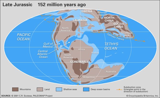
- Geological Context: Unlike the tectonically active, high-altitude mountains of the southwest formed by the collision of the Indian and Asian plates, the Lüliang range was shaped by Jurassic Period downwarps and faulting.23
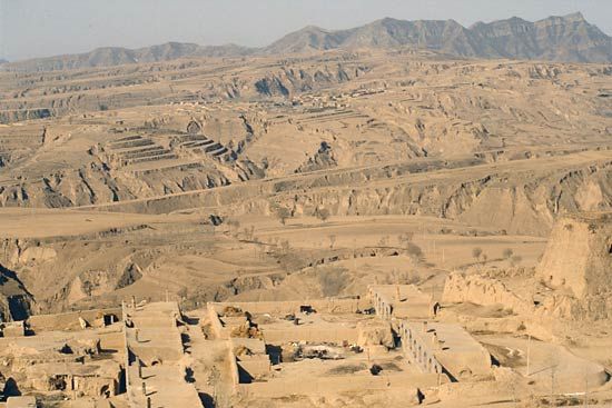
- Landscape Features: The range is defined by its position on the Loess Plateau. Its western slopes exhibit the heavily dissected, silt-covered landscape characteristic of the loess regions, contrasting with the more rugged, rocky mountain chains found elsewhere in the country.23
What is the average elevation of the Lüliang Mountains?
The Lüliang Mountains, located in Shanxi province, have a mean elevation ranging from 5,000 to 6,500 feet (1,500 to 2,000 meters).2
While the range maintains this average elevation, its topography varies, with the highest areas situated in the north. The highest peak in the system is Guandi Mountain, which reaches an elevation of 9,288 feet (2,831 meters).24
Are there any cultural or historical significance associated with the Lüliang Mountains?
The provided search results do not contain information regarding specific cultural or historical significance associated with the Lüliang Mountains. While the results detail the range’s geological formation, elevation, and economic importance due to its coal reserves, they do not mention historical events, cultural traditions, or religious associations for this specific region.
It is important to note that other Chinese mountain ranges, such as the Lu Mountains and Mount Wutai, are well-documented for their deep historical and religious significance, but these are distinct geographical entities from the Lüliang range.
Sources
- Shanxi - Resources and power — Encyclopædia Britannica
- Lüliang Mountains — Encyclopædia Britannica
- China - Relief of China — Encyclopædia Britannica
- Shanxi - Relief — Encyclopædia Britannica
- Lu Mountains — Encyclopædia Britannica
- Mount Wutai — Encyclopædia Britannica
Published on · 2 min read