Mafinga Hills
The Mafinga Hills are a prominent range located along the border between Malawi and Zambia, situated southeast of Chitipa, Malawi.
What is Mafinga Hills?
The Mafinga Hills are a prominent range located along the border between Malawi and Zambia, situated southeast of Chitipa, Malawi.1
These hills are composed of sedimentary rocks, including phyllites, feldspathic sandstones, and quartzite1. The range is divided into three distinct sections—the Mafingi Ridge, the Pilewombe Hills, and the Kayuni-Misissi Hills—which have been shaped by the erosional forces of the North Rukuru, Lufilya, and Mbalizi rivers.1
Characterized by steep, grassy slopes, deep gullies, and craggy ridges, the terrain reaches elevations exceeding 7,000 feet (2,130 meters). These hills represent the highest point in Zambia, standing as a significant relief feature on the eastern edge of the country’s high plateau.12
What is the significance of the East African Rift System?
The East African Rift System is one of the most extensive rift systems on Earth, stretching approximately 4,000 miles (6,400 km) from Jordan through eastern Africa to Mozambique. Its significance lies in its role as a primary example of active continental rifting, providing a window into the fundamental processes of plate tectonics.3
Key aspects of its significance include:
- Geological Evolution: The system represents a divergent plate boundary where the lithosphere is being uplifted and stretched by upwelling magma. This process is actively thinning the continental crust, which may eventually lead to the separation of tectonic plates and the creation of a new ocean basin.4
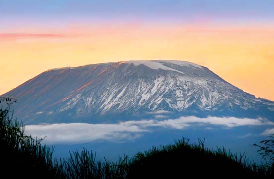
- Landscape and Volcanism: The rift has been forming for roughly 30 million years, accompanied by extensive volcanic activity that has produced major massifs such as Kilimanjaro and Mount Kenya aro) and Mount Kenya.3
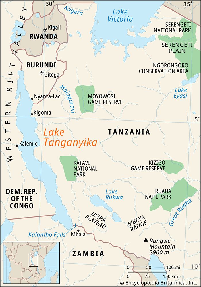
- Hydrological Impact: The rift hosts a series of deep, fjordlike lakes, including Lake Tanganyika and Lake Nyasa, which are highly sensitive to climatic fluctuations and play a critical role in the regional environment.35
How do rivers shape mountain landscapes over time?
Rivers are among the most significant agents in shaping mountain landscapes, acting as powerful forces that transform geologic settings into distinct topographic forms through erosion and the deposition of sediment.6
Mechanisms of Landscape Modification
Rivers mold mountains primarily by transporting sediment-laden water, which exerts erosive force on the underlying bedrock. In the initial phases of development, particularly in areas experiencing tectonic uplift, rivers expend most of their energy in vertical entrenchment. This process creates deep, narrow valleys, canyons, and gorges as the river cuts downward into the rock. Over time, as the river reaches an elevation closer to its baselevel, its energy shifts from vertical downcutting to lateral erosion, which progressively broadens the valley floor.678
Structural Influence
The interaction between rivers and mountain structures is complex:
- Transverse Canyons: Rivers can cut across resistant ridges, creating water gaps or canyons. This occurs through headward erosion along fault zones or through processes like antecedence (where a river maintains its course while the land rises beneath it) and superimposition (where a river cuts down from a younger sedimentary cover into an older, resistant rock structure).7
- Structural Control: In many mountain belts, such as the Appalachian Mountains, the orientation and form of valleys are heavily dictated by existing folds and faults in the geologic framework.8
What are the main geographical features of Zambia?
Zambia’s geography is defined primarily by its position on a high plateau, which generally sits between 3,000 and 5,000 feet (900 to 1,500 meters) above sea level.2
Key Geographical Features
- Plateau and Relief: Most of the country consists of this elevated plateau, which slopes toward the southwest. In the east, the terrain rises significantly, with the Nyika Plateau exceeding 6,000 feet (1,800 meters) and the Mafinga Hills reaching over 7,000 feet (2,100 meters).2
- River Valleys and Rifts: The plateau is dissected by major river valleys and rifted troughs. The Luangwa River occupies a significant rift valley that acts as a major barrier to communication. In the north, younger rifts associated with the East African Rift System contain Lake Tanganyika and Lake Mweru.2
- Wetlands and Depressions: Central and eastern regions feature downwarped depressions that host extensive swamps and lakes, such as Lake Bangweulu and the Lukanga Swamp.213
- Western Sands: In the west, the ancient crystalline rocks of the plateau are covered by sandy deposits, which are remnants of the Kalahari desert.2
- Drainage: The country is drained by major river systems, most notably the Zambezi River, which flows through vast floodplains before forming the border with Zimbabwe and plunging over Victoria Falls.214
Sources
- Mafinga Hills — Encyclopædia Britannica
- Zambia - Relief — Encyclopædia Britannica
- East African Rift System — Encyclopædia Britannica
- plate tectonics - Continental rifting — Encyclopædia Britannica
- East African lakes - Geology, climate, and hydrology — Encyclopædia Britannica
- river - Rivers as agents of landscape evolution — Encyclopædia Britannica
- continental landform - Orogenic geomorphic systems — Encyclopædia Britannica
- river - Formation of canyons and gorges — Encyclopædia Britannica
- river - Valley evolution — Encyclopædia Britannica
- glacial landform - Cirques , tarns, U-shaped valleys, arêtes, and horns — Encyclopædia Britannica
- continental landform — Encyclopædia Britannica
- soil - Erosive processes — Encyclopædia Britannica
- Zambia - Soils — Encyclopædia Britannica
- Zambezi River - Physiography — Encyclopædia Britannica
- Zambia - Plant and animal life — Encyclopædia Britannica
- Bangweulu — Encyclopædia Britannica
Published on · 3 min read