Luzon Strait
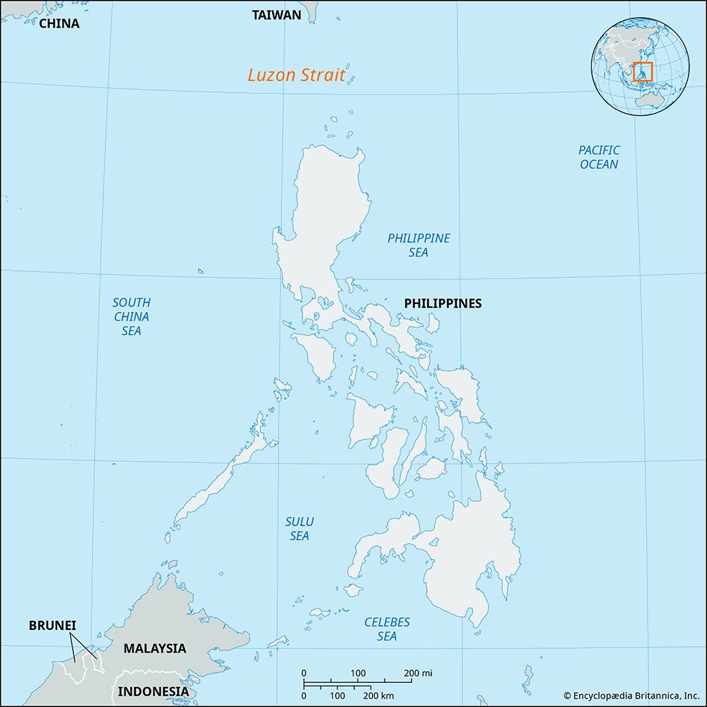
The Luzon Strait is a significant waterway extending over 200 miles (320 km) between Taiwan to the north and the island of Luzon in the Philippines to the…
What is Luzon Strait?
The Luzon Strait is a significant waterway extending over 200 miles (320 km) between Taiwan to the north and the island of Luzon in the Philippines to the south.1
This strait serves as a vital connection between the South China Sea in the west and the Philippine Sea in the east. Geographically, it is composed of a series of channels, including the Bashi, Balintang, and Babuyan channels, and is dotted with the Batan and Babuyan island groups in its southern reaches. Due to its strategic location, it functions as a major shipping route for international maritime traffic.1
It is important to distinguish this from the San Bernardino Strait, which is a separate body of water located between southeastern Luzon and northern Samar.2
What are the Batan and Babuyan island groups?
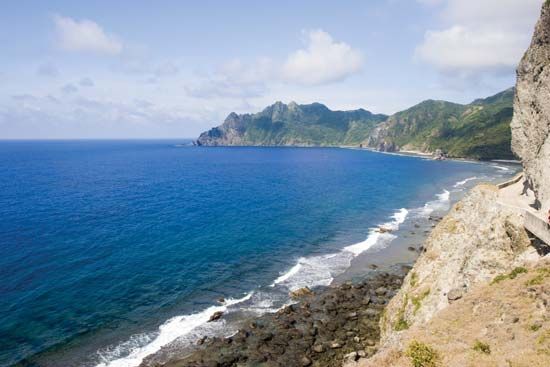
The Batan Islands and Babuyan Islands are two distinct island groups located within the Luzon Strait, serving as a northern extension of the Philippines.341
Batan Islands
Located approximately 190 miles north of Luzon, this chain consists of 14 volcanic islands.4
- Geography: The terrain is rugged, rocky, and windswept.4
- Inhabitation: Only the four largest islands—Itbayat, Batan, Sabtang, and Ibuhos—are inhabited.4
- Culture and Economy: Residents primarily speak the Ivatan dialect and are Roman Catholic. Due to frequent typhoons, homes are constructed of stone and tile. Agriculture focuses on root crops like sweet potatoes, supplemented by livestock and fishing.4
Babuyan Islands
Situated about 20 miles north of Luzon, this group comprises 24 volcanic-coralline islands.3
- Key Islands: The primary islands include Babuyan, Camiguin, Calayan, Fuga, and Dalupiri.3
- Economy: The population relies on fishing and farming. Similar to the Batan group, they cultivate root crops due to the prevalence of strong winds.3
- Connectivity: Calayan serves as the main port, though shipping links to Aparri and Manila are often disrupted during the typhoon season.3
Why is the Luzon Strait important for international shipping?
The Luzon Strait is a critical waterway for international shipping because it serves as the primary deep-water channel connecting the South China Sea to the Pacific Ocean.15
Its importance is defined by several key factors:
- Strategic Connectivity: By linking the South China Sea with the Philippine Sea, it provides a vital passage for maritime traffic moving between major regional ports and the broader Pacific.15
- Deep-Water Access: Unlike many shallower passages in the region, the Luzon Strait offers a deep channel—reaching depths of approximately 8,500 feet (2,600 meters)—which allows for the safe transit of large commercial vessels.5
- Navigational Hub: As part of a major global shipping route, it facilitates the movement of goods, including the flow of oil, minerals, food, and manufactured products that characterize trade in the region.15
What are the differences between the South China Sea and the Philippine Sea?
The South China Sea and the Philippine Sea are distinct bodies of water in the western Pacific, separated by the Philippine archipelago and connected by the Luzon Strait.617
Key Differences
- Geographic Position: The South China Sea is a marginal sea bordering the Southeast Asian mainland to the west and the Philippines to the east. In contrast, the Philippine Sea is a section of the western North Pacific Ocean located east and north of the Philippines, bounded by island arcs including the Marianas, the Ryukyus, and Japan.76
- Physiography: The South China Sea features a broad, shallow continental shelf in the northwest and a deep central basin (the China Sea Basin) with a maximum depth of 16,457 feet. The Philippine Sea is characterized by a structural basin with a general depth of 19,700 feet, plunging to extreme depths in trenches, such as the Philippine Trench, which reaches 34,578 feet.76
- Economic and Geopolitical Context: The South China Sea is a major global shipping artery and is the site of intense territorial disputes regarding fishing rights and potential oil and natural gas reserves. The Philippine Sea is primarily known for its deep-ocean environment, complex current systems like the Kuroshio, and its role as a region where typhoons frequently originate.576
Sources
- Luzon Strait — Encyclopædia Britannica
- San Bernardino Strait — Merriam-Webster
- Babuyan Islands — Encyclopædia Britannica
- Batan Islands — Encyclopædia Britannica
- South China Sea — Encyclopædia Britannica
- Philippine Sea — Encyclopædia Britannica
- territorial disputes in the South China Sea - Physiography and economic factors — Encyclopædia Britannica
Published on · 3 min read