Manitoba Cuesta
The Manitoba Cuesta is a prominent, steep, east-facing escarpment located in southeastern Manitoba, Canada. Rising 500–1,000 feet (150–300 metres) above the…
What is Manitoba Cuesta?
The Manitoba Cuesta is a prominent, steep, east-facing escarpment located in southeastern Manitoba, Canada. Rising 500–1,000 feet (150–300 metres) above the surrounding lowlands, this ridge stretches approximately 350 miles (560 km) from the Canada-U.S. border northwestward to the Carrot River in Saskatchewan.1
Geologically, a cuesta is defined by a steep cliff on one side and a gentle back slope on the other, formed by the differential erosion of tilted rock layers. In the case of the Manitoba Cuesta, rivers such as the Assiniboine and Swan have eroded the escarpment into distinct groups of hills, including the Riding, Duck, and Porcupine mountains, whose summits align with the prairies of Saskatchewan.21
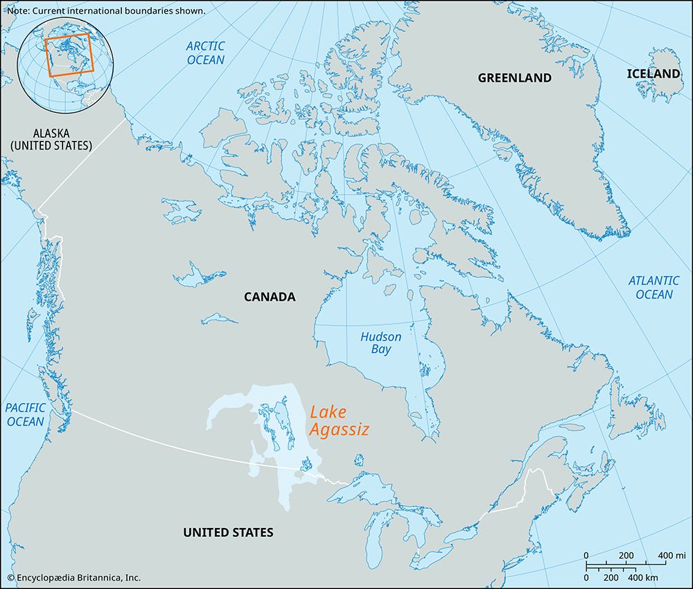
Historically, this feature served as the western shoreline of the glacial Lake Agassiz. Today, it is a significant recreational region that includes Riding Mountain National Park and contains Baldy Mountain, the highest point in Manitoba.1
What was the significance of glacial Lake Agassiz in shaping the region?
Glacial Lake Agassiz was a massive ice-margin lake that played a transformative role in shaping the geography and ecology of central North America during the Pleistocene Epoch. Its significance is evident in several key areas:
- Landscape Formation: The lake basin created the Manitoba Lowland, a vast, relatively flat region. The western boundary of this basin was defined by the Manitoba Cuesta, an escarpment that served as the lake’s shoreline.451
- Soil Fertility: As the lake occupied the region, it accumulated fine, claylike silt on its floor. This sediment is directly responsible for the exceptional fertility of the Red River of the North and Souris River valleys, which remain vital agricultural hubs today.4
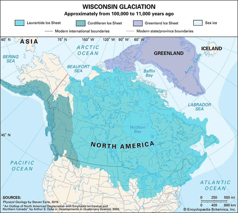
- Modern Hydrology: The retreat of the Laurentide Ice Sheet eventually allowed the lake to drain northward via the Nelson River. The remnants of this immense body of water persist today as major lakes, including Lake Winnipeg, Lake Winnipegosis, Lake Manitoba, and Lake of the Woods.45
How does differential weathering create landforms like cuestas?
A cuesta is a landform created in areas of tilted strata through the process of differential weathering and erosion. This process relies on the varying resistance of adjacent rock layers to environmental forces.2
The formation occurs when a sequence of tilted sedimentary rocks consists of alternating hard and soft layers. The harder, more resistant rock acts as a “capping layer,” while the softer underlying rock—often referred to as the “cliff maker”—erodes much more rapidly. As the softer material is worn away, the overlying hard layer is undermined, causing it to break off and maintain a steep, rugged escarpment on one side.2
In contrast, the opposite side of the landform consists of a gentle “dip slope,” which follows the natural inclination of the rock strata. Because the steep scarp face is prone to rapid erosion from short, fast-flowing streams, these areas often develop into hilly country characterized by numerous ravines and valleys.27
What are the main differences between the Manitoba Lowlands and the Saskatchewan plains?
The Manitoba Lowland and the Saskatchewan plains represent distinct geological and topographical regions within the interior plains of North America. Their primary differences include:
- Elevation and Topography: The Manitoba Lowland is the flattest part of the interior plains, with elevations generally below 1,000 feet (300 meters). In contrast, the land rises to the west in steps, with the Saskatchewan plain reaching elevations between 1,500 and 2,100 feet (450 to 650 meters).5
- Geological Origin: The Manitoba Lowland is a basin that once held the glacial Lake Agassiz, and its surface is underlain by lacustrine sediments. The Saskatchewan plains are characterized by rolling landscapes formed by glacial deposits laid over nearly horizontal bedrock, often interspersed with glacial moraines and valleys carved by meltwater.354
- Hydrological Features: The Manitoba Lowland is defined by large remnants of Lake Agassiz, including Lake Winnipeg, Lake Winnipegosis, and Lake Manitoba. The Saskatchewan plains are marked by ponds known as sloughs and river systems like the Saskatchewan River.35
Sources
- Manitoba Cuesta — Encyclopædia Britannica
- cuesta — Encyclopædia Britannica
- Canada - The interior plains — Encyclopædia Britannica
- Lake Agassiz — Encyclopædia Britannica
- Manitoba - Relief, drainage, and soils — Encyclopædia Britannica
- North America - Lakes of North America — Encyclopædia Britannica
- stratification — Encyclopædia Britannica
- valley - Drainage patterns — Encyclopædia Britannica
- continental landform - Consideration of unique landforms and other distinctive topographic features — Encyclopædia Britannica
- Saskatchewan - Soils — Encyclopædia Britannica
- Saskatchewan - Relief — Encyclopædia Britannica
- Lake Manitoba — Encyclopædia Britannica
- Manitoba - Settlement patterns — Encyclopædia Britannica
Published on · 3 min read