Mantiqueira Mountains
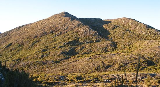
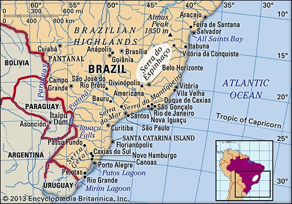
The Mantiqueira Mountains are a prominent mountain range located in eastern Brazil. Rising abruptly from the northwestern bank of the Paraíba do Sul River…
What is Mantiqueira Mountains?
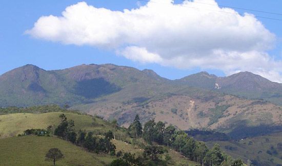
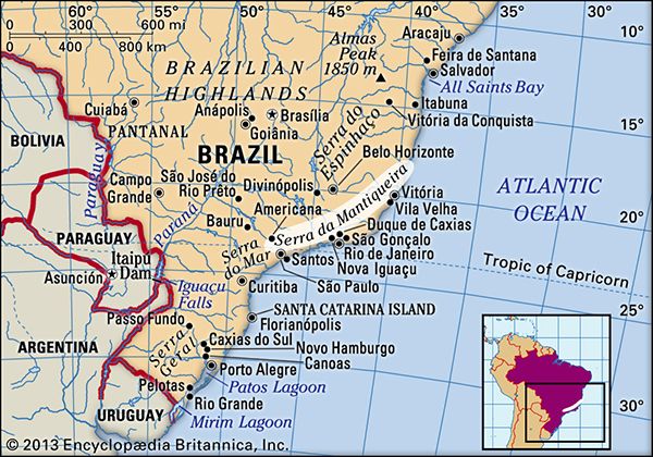
The Mantiqueira Mountains are a prominent mountain range located in eastern Brazil. Rising abruptly from the northwestern bank of the Paraíba do Sul River, the range extends northeastward for approximately 200 miles (320 km). Its highest point is the Pico das Agulhas Negras, which reaches an elevation of 9,255 feet (2,821 meters).1
Geologically, the range is part of the Serra do Mar, a great escarpment along the eastern margins of the Brazilian Highlands. The name “Mantiqueira” originates from a Native American term meaning “the place where the clouds lie”.21
Historically forest-covered, the mountains now support cattle pasture and provide charcoal. The lower slopes are also home to several health resorts, most notably Campos do Jordão. Eventually, the range merges with the Espinhaço Mountains.1
What is the significance of the Pico das Agulhas Negras?
The Pico das Agulhas Negras is significant primarily as the highest point of the Mantiqueira Mountains in eastern Brazil. Reaching an elevation of 9,255 feet (2,821 meters), it stands as a prominent peak that rises above the tree line of the surrounding range.1
How does the Serra do Mar influence Brazil’s geography?
The Serra do Mar is a massive escarpment along the eastern edge of the Brazilian Highlands that significantly shapes the country’s geography and development.
Physical and Climatic Influence
Extending approximately 1,600 miles (2,600 km) along the Atlantic coast, the range acts as a major topographic barrier. Its sea-facing rim experiences significantly heavier precipitation than the interior, as the mountains force moisture-laden air upward, resulting in high rainfall levels. This dramatic rise from the coast to the highlands historically created a formidable obstacle to inland exploration and settlement.23
Historical and Economic Impact
For the first two centuries of colonization, the Serra do Mar rendered the interior nearly inaccessible. The shift of Brazil’s economic and political center from the Northeast to the Southeast was only made possible after settlers constructed roads over the escarpment, eventually followed by 19th-century railroads. This connectivity facilitated the rise of the mining and coffee industries, which transformed the region and led to the relocation of the colonial capital to Rio de Janeiro in 1763.24
What kind of wildlife lives in the Mantiqueira Mountains?
Sorry, the Britannica knowledge base does not contain information regarding the specific wildlife that inhabits the Mantiqueira Mountains.
Sources
- Mantiqueira Mountains — Encyclopædia Britannica
- Serra do Mar — Encyclopædia Britannica
- Brazil - Climate of Brazil — Encyclopædia Britannica
- Serra do Mar — Merriam-Webster
- Brazil - The Southeast: Mining and coffee — Encyclopædia Britannica
Published on · 2 min read