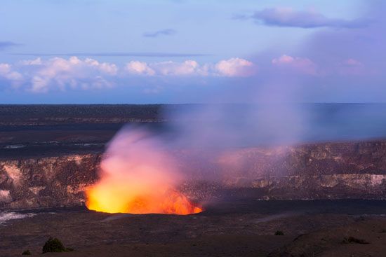
Mauna Loa
Scientists monitor and predict eruptions at Mauna Loa by employing a variety of geophysical techniques designed to detect the movement of magma beneath the…
How do scientists monitor and predict eruptions of Mauna Loa?
Scientists monitor and predict eruptions at Mauna Loa by employing a variety of geophysical techniques designed to detect the movement of magma beneath the surface.1
Key monitoring methods include:
- Seismicity: Researchers use seismographs to track earthquake swarms. An increase in the frequency and intensity of tremors often signals that magma is moving upward from the asthenosphere, which serves as a primary indicator for predicting the onset of an eruption.12
- Surface Deformation: As rising molten rock fills magma chambers, the volcano may inflate. Tiltmeters are used to detect subtle changes in the slope angle of the volcano’s surface.12
- Additional Instrumentation: Scientists also utilize laser beams to measure slope changes, as well as specialized equipment to monitor variations in magnetic and gravity fields.1
- Gas and Temperature: Monitoring volcanic gas emissions and temperature fluctuations provides further data on the activity levels of the volcano.1
These efforts are coordinated by volcano observatories, which analyze this data to issue warnings and manage risks for nearby communities.12
What is Mauna Loa and where is it located in Hawaii?
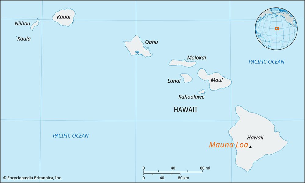
Mauna Loa is the world’s largest active shield volcano, rising to 13,677 feet (4,169 meters) above sea level6. Its name means “Long Mountain” in Hawaiian, and it constitutes approximately half of the total area of Hawaii Island, which is part of the U.S. state of Hawaii.S. state of Hawaii.6
Located in the south-central portion of the island, the volcano is a prominent feature of Hawaii Volcanoes National Park, a designated UNESCO World Heritage site. Mauna Loa is characterized by its massive dome, which measures 75 miles (120 km) long and 64 miles (103 km) wide, and its summit caldera, known as Moku‘āweoweo. Since its first well-documented eruption in 1843, the volcano has erupted roughly three dozen times, with its most recent activity occurring in 2022.26
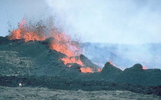
What are the potential hazards and impacts of a Mauna Loa eruption on the surrounding areas?
Eruptions from Mauna Loa present significant challenges to the communities and infrastructure on the island of Hawaii. The primary hazards and impacts include:
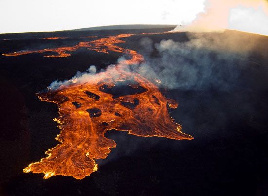
- Lava Flows: Mauna Loa is known for producing massive, fast-moving lava flows that can travel long distances downslope. These flows have historically threatened populated areas, such as the city of Hilo, and have caused property damage, including the destruction of roads and buildings. In 1950, a flow from a 13-mile fissure destroyed an entire village.34
- Infrastructure Disruption: Beyond direct destruction, eruptions can sever critical infrastructure. Past events have resulted in the cutting of power lines and the blocking of essential transportation routes, complicating emergency response and daily life.34
- Mitigation Challenges: Protecting communities involves complex efforts, such as monitoring and emergency preparedness. Historically, authorities have attempted to divert lava flows using barrier walls and even aerial bombing, illustrating the difficulty of managing the volcano’s unpredictable path.4
- General Volcanic Hazards: While Mauna Loa’s eruptions are often characterized by lava, volcanic activity generally carries risks such as toxic gas clouds, ash falls, and pyroclastic flows, which can impact air quality, agriculture, and public health.72
What is the geological history of Mauna Loa and how was it formed?
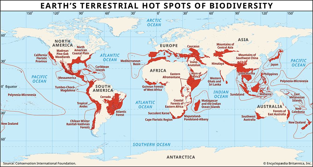
Mauna Loa is a classic shield volcano formed through a process known as intraplate volcanism. It is situated over a hot spot—a region in the Earth’s mantle where a deep-seated plume of heat causes the lithosphere to melt, allowing magma to rise to the surface.63
As the Pacific Plate moves slowly over this stationary hot spot, it creates a chain of volcanic islands. Mauna Loa, being one of the younger volcanoes in the Hawaiian chain, is currently positioned over this heat source, which has fueled its growth for less than one million years.6
The volcano was built over this long span by hundreds of thousands of effusive eruptions of fluid, basaltic lava. These eruptions occur not only from its summit caldera but also from persistent rift zones, resulting in its characteristic broad, gently sloping dome shape.1011
Sources
- geology - Volcanology — Encyclopædia Britannica
- Mauna Loa — Encyclopædia Britannica
- volcano - Mauna Loa , Hawaii, 1984 — Encyclopædia Britannica
- volcano - Gas clouds — Encyclopædia Britannica
- volcano - Volcano forecasting and warning — Encyclopædia Britannica
- Mauna Loa: Top Questions — Encyclopædia Britannica
- volcano - Lava , gas, and other hazards — Encyclopædia Britannica
- Kilauea — Encyclopædia Britannica
- volcano - Ash falls — Encyclopædia Britannica
- volcano - Shield volcanoes — Encyclopædia Britannica
- volcano - Intraplate volcanism — Encyclopædia Britannica
- volcanism — Encyclopædia Britannica
Published on · 3 min read