Mesa Central
The Mesa Central is a high plateau in central Mexico, situated at elevations between 6,000 and 7,500 feet (1,800 to 2,300 meters). It features a temperate…
What is the climate like in the Mesa Central, and how does it affect the region’s ecology?
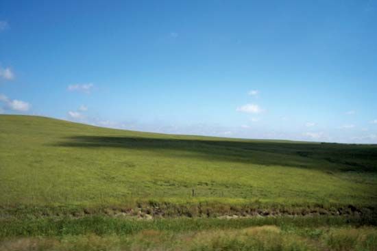
The Mesa Central is a high plateau in central Mexico, situated at elevations between 6,000 and 7,500 feet (1,800 to 2,300 meters). It features a temperate climate with relatively abundant rainfall, making it significantly wetter than the northern section of the Mexican Plateau, the Mesa del Norte.1
This climate, combined with rich alluvial and volcanic soils, creates favorable ecological and agricultural conditions. The region supports extensive farming of crops such as corn, beans, wheat, and sugarcane, as well as cattle grazing in drier basins.1
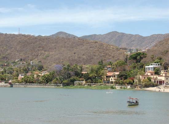
The plateau’s topography also influences its hydrology; in areas of high volcanic activity, blocked streams and rivers have formed extensive shallow lakes and swamps, such as Lake Chapala, Lake Pátzcuaro, and Lake Cuitzeo. These water bodies are integral to the region’s landscape, reflected in the Nahuatl name Anáhuac, meaning “Land on the Edge of the Water”. Because of these hospitable conditions, the Mesa Central is one of the most densely populated regions in Mexico.1
What is the average elevation of the Mesa Central, and how does it compare to other plateau regions in North America?
The Mesa Central is a high plateau region in central Mexico with an average elevation ranging from 6,000 to 7,500 feet (1,800 to 2,300 meters), though its southern end near Mexico City rises to between 7,000 and 9,000 feet (2,100 to 2,700 meters).14
When compared to other plateau regions in North America, the Mesa Central is distinct in its geography and climate:
- Mexican Plateau Comparison: The Mesa Central is significantly higher and wetter than the Mesa del Norte, which lies to its north. While the Mesa del Norte tilts upward from about 4,000 feet (1,200 meters) at its northern end, the Mesa Central is characterized by a series of fertile, level intermontane basins separated by volcanic peaks.14
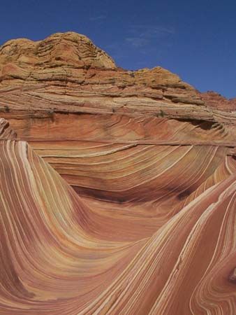
- Colorado Plateau Comparison: The Colorado Plateau in the southwestern United States features a wider range of elevations, extending from 2,000 feet (600 meters) in the Grand Canyon to over 12,700 feet (3,870 meters) in the La Sal Mountains. Unlike the Mesa Central, which is heavily populated and defined by its fertile basins, the Colorado Plateau is often characterized by deeply dissected river canyons, arid basins, and vast desert landscapes.5
How has the Mesa Central influenced the historical development and settlement patterns of Mexico?
The Mesa Central has served as the historical and cultural heart of Mexico for centuries, primarily due to its favorable environment. Its temperate climate, abundant rainfall, and fertile volcanic soils supported high agricultural productivity, which allowed for the development of dense populations and complex societies long before European contact.17
Historical Significance and Settlement
- Pre-Columbian Era: The region was the center of the Aztec empire and home to other advanced indigenous civilizations, such as those speaking Nahuatl, Otomi, and Tarascan. These groups utilized sophisticated agricultural techniques, including chinampas (floating gardens), to sustain large urban centers.87
- Colonial and Modern Core: Following the Spanish conquest, the region became the core of New Spain. Mexico City was founded in 1521 atop the ruins of the Aztec capital, Tenochtitlán. Its location in the Mesa Central made it a natural crossroads for trade between the arid north, the coasts, and the southern highlands, cementing its role as the nation’s political, religious, and economic hub.9
Impact on Development
The region’s centralism has defined Mexico’s national character. Historically, trade routes converged on the Mesa Central, and today it remains the primary center of urbanization and industrialization in Mexico. The area continues to support significant agriculture, including corn, beans, and wheat, while its urban centers like Guadalajara and Querétaro drive modern industrial growth.1091
How was the Mesa Central formed, and what are its major geological features?
The Mesa Central was formed through complex geological processes involving the uplift and folding of Mesozoic-era strata, a process contemporaneous with the rise of the Rocky Mountains. Early in the Cenozoic Era, extensive lava flows covered the region, followed by a significant uplift of the plateau block, which was more pronounced in the south than in the north.1
The region’s major geological features include:
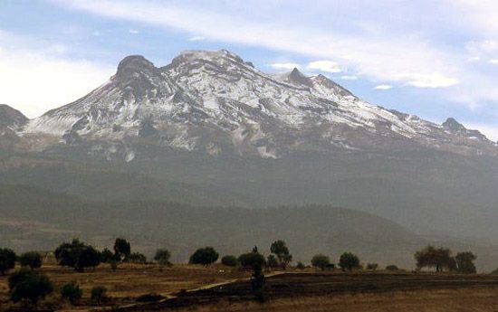
- Cordillera Neo-Volcánica: This volcanic belt marks the southern boundary of the plateau. It was formed during two major volcanic episodes, the second of which began in the Pliocene Epoch and continues today. This activity created spectacular peaks such as Pico de Orizaba, Popocatépetl, and Iztaccíhuatl.1
- Intermontane Basins and Lakes: High volcanic activity has frequently blocked streams and rivers, leading to the formation of extensive shallow lakes and swamps, such as Lake Chapala, Lake Pátzcuaro, and Lake Cuitzeo.61
- Fertile Soils: The combination of volcanic activity and alluvial deposits has created rich soils that support the region’s high agricultural productivity.6
Sources
- Mesa Central — Encyclopædia Britannica
- Mexico - Climate — Encyclopædia Britannica
- Sierra Madre - Climate — Encyclopædia Britannica
- Colorado Plateau — Encyclopædia Britannica
- Mexico - Physiographic regions — Encyclopædia Britannica
- Sierra Madre - Geology — Encyclopædia Britannica
- Mexico - Cultural regions — Encyclopædia Britannica
- New Mexico - Settlement patterns — Encyclopædia Britannica
- Mexico - Ethnic groups — Encyclopædia Britannica
- Mexico - Pre-Columbian Mexico — Encyclopædia Britannica
- Pre-Columbian civilizations - Mesoamerican civilization — Encyclopædia Britannica
- Mexico City — Encyclopædia Britannica
Published on · 4 min read