Minamitori Island
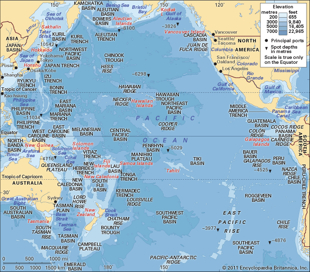
Minamitori Island is a coral atoll located in the central Pacific Ocean, approximately 700 miles southeast of Japan. The island covers an area of 740 acres…
What is Minamitori Island?
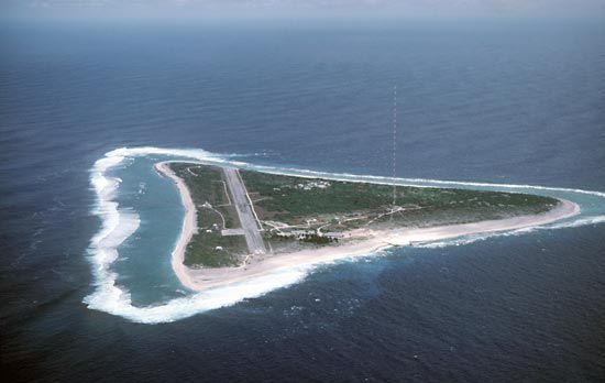
Minamitori Island is a coral atoll located in the central Pacific Ocean, approximately 700 miles southeast of Japan. The island covers an area of 740 acres and reaches an elevation of 204 feet.
Discovered by Japanese navigator Shinroku Mizutani in 1868, the island was annexed by Japan in 1898. Before World War II, it was administered as part of the Tokyo prefecture. Following U.S. occupation during the war, the island was returned to Japan in 1968. Today, it is administered alongside the Bonin Islands and the Volcano Islands. Historically, the atoll served as a site for a meteorological station used to study typhoons, and its surrounding waters support the harvesting of marine products such as swordfish, seaweed, and squid.1
What is a coral atoll?
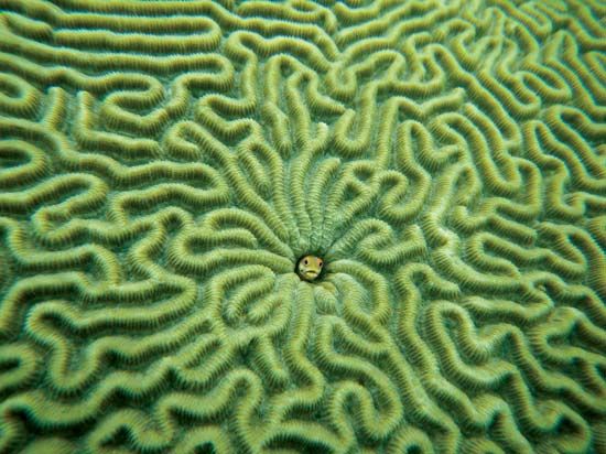
A coral atoll is a coral reef that forms a closed or roughly circular shape, enclosing a central lagoon of quiet water. These structures are typically found in tropical oceans within 25° latitude of the Equator, where conditions support the growth of reef-building coral polyps.234
The formation of an atoll is often explained by the subsidence theory, originally proposed by Charles Darwin. According to this model, an atoll represents the final stage of a reef growing upward around a sinking, extinct volcanic island. As the island subsides beneath the sea, the reef continues to grow toward the surface, eventually leaving behind only the reef rim and the central lagoon.3
Atolls can range from simple reefs surrounding a lagoon to complex structures that include low-lying, flat islands along the reef rim. These features are vital to many island communities, often providing the only protected harbors in open tropical seas.23
How do meteorological stations help track typhoons?
Meteorological stations play a foundational role in tracking tropical cyclones—known as typhoons in the northwestern Pacific—by providing the data necessary for synoptic forecasting. By organizing networks of stations to take consistent measurements and report them to central observatories, meteorologists can map and monitor evolving weather systems.6
Historically, tracking relied on surface observations of changing weather conditions and reports from areas already affected by a storm, which often resulted in insufficient warning time. Today, these ground-based networks are complemented by advanced technology:1
- Satellite Monitoring: Geostationary weather satellites provide continuous infrared imagery, allowing forecasters to detect cloud top temperatures and identify the deep, organized convection characteristic of a developing cyclone.71
- Direct Reconnaissance: When satellite data indicates a potential storm, aircraft may be deployed to collect precise data. Instruments called dropsondes are released to measure atmospheric pressure, wind speed, temperature, and humidity, which are critical for determining a storm’s intensity and structure.7
What are the Bonin and Volcano Islands?
The Bonin Islands and Volcano Islands are two volcanic archipelagos located in the western Pacific Ocean, currently administered as part of the Tokyo metropolis in Japan.1011
Bonin Islands
The Bonin Islands consist of approximately 30 volcanic islands and islets situated about 500 miles southeast of Japan. They are divided into three primary groups: the Chichijima, Mukojima, and Hahajima groups. Chichi Island is the largest and features the best harbor, Futami Anchorage. Historically, these islands were annexed by Japan in 1876 and held strategic importance due to their position near the approaches to East Asia.11
Volcano Islands
The Volcano Islands lie south of the Bonin Islands and north of the Mariana Islands. This archipelago comprises three small volcanic islands: Kita-Iō, Iō Island (Iwo Jima), and Minami-Iō. Iwo Jima, the largest, is famously known as the site of a major World War II battle in 1945.10
Both archipelagos were under U.S. military control following World War II until they were returned to Japan in 1968.1011
Sources
- Minamitori Island — Encyclopædia Britannica
- lagoon - Coral lagoons — Encyclopædia Britannica
- atoll — Encyclopædia Britannica
- atoll — Merriam-Webster
- Marine ecosystem - Benthos — Encyclopædia Britannica
- tropical cyclone - Use of satellites and aircraft — Encyclopædia Britannica
- Weather forecasting - Establishment of weather-station networks and services — Encyclopædia Britannica
- tropical cyclone - Tracking and forecasting — Encyclopædia Britannica
- What Is the Difference Between a Typhoon and a Super Typhoon? — Encyclopædia Britannica
- Volcano Islands — Encyclopædia Britannica
- Bonin Islands — Encyclopædia Britannica
Published on · 3 min read