Minas Basin
The Minas Basin is an eastern inlet of the Bay of Fundy that protrudes into central Nova Scotia, Canada. It is connected to the Bay of Fundy by the Minas…
What is the Minas Basin and where is it specifically located in Nova Scotia, Canada?
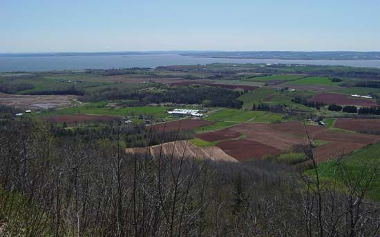
The Minas Basin is an eastern inlet of the Bay of Fundy that protrudes into central Nova Scotia, Canada. It is connected to the Bay of Fundy by the Minas Channel and serves as a northeastern extension of the larger bay.123
Measuring up to 25 miles (40 km) in width and over 50 miles (80 km) in length—including its eastern extension, Cobequid Bay—the basin is world-renowned for its extreme tidal fluctuations, which have been recorded at heights exceeding 50 feet (15 meters). The area was named in 1604 by Samuel de Champlain, derived from the French Le Bassin des Mines, due to the mineral deposits found along its shores. The basin receives drainage from several rivers, including the Avon, Cornwallis, Salmon, and Shubenacadie.13
What are the unique tidal characteristics of the Minas Basin?
The Minas Basin is characterized by some of the most extreme tidal fluctuations in the world. Because of the basin’s specific shape and narrow connection to the Bay of Fundy via the Minas Channel, the tidal range is significantly magnified, with rises commonly reaching 53 feet (16 meters) and recorded fluctuations exceeding 50 feet (15 meters).13
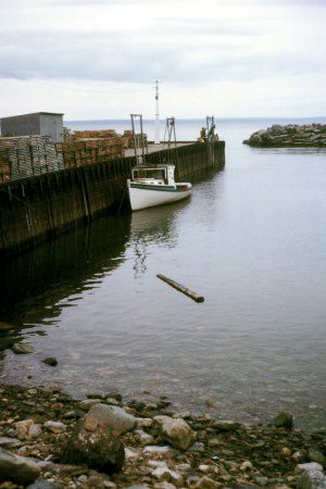
These powerful tides create a dynamic landscape. As the tide recedes, the water channels transform into expansive veins of red mud, a result of the erosion of local red sandstone and shale outcrops along the coastline. The basin also serves as a drainage point for several rivers, including the Avon, Cornwallis, Salmon, and Shubenacadie, which interact with these massive water movements.31
How does the Minas Basin contribute to the economy of Nova Scotia?
The Minas Basin contributes to the economy of Nova Scotia primarily through its role in the province’s mining and agricultural sectors.
- Mining: The basin is historically and economically significant for its mineral deposits. The town of Walton, located on the southeast coast of the basin, serves as the province’s principal center for mining metallic minerals, including zinc, copper, lead, and silver.4
- Agriculture: The extreme tides of the Bay of Fundy, which affect the Minas Basin, have historically shaped the local economy. Since the mid-17th century, the marshlands created by these tides have been reclaimed for agricultural use through the construction of dikes. Additionally, the presence of sedimentary rock in areas like Cobequid Bay supports the cultivation of field crops and orchards.1
While the broader province of Nova Scotia utilizes the tides of the Bay of Fundy for tidal energy to enhance hydroelectric output, the Minas Basin itself remains a vital hub for mineral extraction and specialized agricultural land use.541
What major rivers flow into the Minas Basin?
The Minas Basin receives the drainage of several major rivers. The primary rivers that flow into the basin include the Avon, Cornwallis, Salmon, and Shubenacadie rivers.1
Sources
- Minas Basin — Encyclopædia Britannica
- Minas Basin — Merriam-Webster
- Bay of Fundy — Encyclopædia Britannica
- Nova Scotia - Resources and power — Encyclopædia Britannica
- Minas Triangle — Encyclopædia Britannica
- Minas Gerais — Encyclopædia Britannica
- Nova Scotia - Relief, drainage, and soils — Encyclopædia Britannica
- tidal bore — Encyclopædia Britannica
Published on · 2 min read