Sogn Fjord
Sogn Fjord (also known as Sogne Fjord) is the longest and deepest fjord in Norway.
What is the length and depth of Sogn Fjord, and how does it compare to other fjords in Norway?
Sogn Fjord (also known as Sogne Fjord) is the longest and deepest fjord in Norway.12
Stretching from the offshore island of Outer Sula in the North Sea to Skjolden at the head of its longest branch, Lustra Fjord, it reaches a total length of 128 miles (206 km). The fjord reaches a maximum depth of 4,291 feet (1,308 meters).1
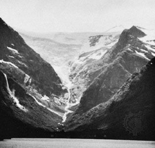
Compared to other fjords in the region, Sogn Fjord is distinguished by its record-breaking dimensions, serving as a central feature of Norway’s geography. Its narrow, deep tributary channels extend toward the Jotunheim Mountains and the Jostedals Glacier, creating a landscape renowned for its picturesque scenery and significant tourism potential. Beyond its natural beauty, the fjord is economically vital, with its numerous waterfalls harnessed to provide hydroelectric power for local industries, such as the aluminum-processing plant at Årdal.12
What role did glaciers play in shaping Sogn Fjord during the Ice Age?
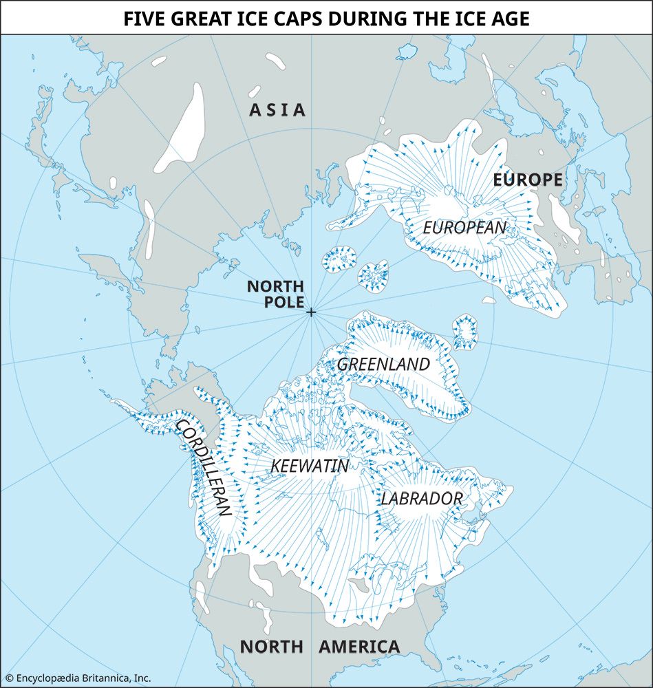
During the Quaternary Period’s Great Ice Age, glaciers played a transformative role in shaping Sogn Fjord. Originally, the landscape featured V-shaped valleys carved by westward-flowing rivers that followed weaknesses in the Earth’s crust. As glaciers moved through these valleys, their intense scouring action widened and deepened them, ultimately creating the characteristic U-shaped, drowned fjords seen along the Norwegian coast today.13
To achieve the current depth of Sogn Fjord, the glacier occupying the valley during the peak of the Pleistocene likely reached a thickness of 1,800 to 1,900 meters. This glacial activity also created a distinct “rock threshold” at the mouth of the fjord, where the floor rises significantly—at Sogn Fjord, the depth decreases from over 1,300 meters to just 150 meters at this threshold. While some researchers suggest that tectonic activity may have contributed to the initial relief, it is widely accepted that glaciers significantly modified these valleys through abrasion and plucking.31
What are some of the notable towns or villages along Sogn Fjord?
Several notable communities are situated along the branches and shores of Sogn Fjord, serving as hubs for the region’s industry and tourism:
- Skjolden: Located at the head of the Lustra Fjord, this village marks the inland terminus of the fjord’s longest branch.1
- Årdal: Situated at the head of the Årdals Fjord, this town is economically significant for its large aluminum-processing plant, which is powered by the region’s abundant hydroelectric resources.1
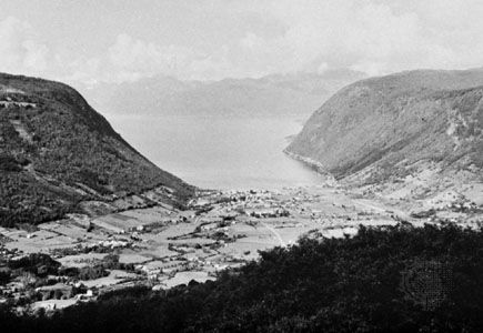
- General Settlements: While the region is characterized by its rugged, mountainous terrain, many inhabitants reside in smaller fishing villages and agricultural communities located at the fjord heads, where alluvial-soil deposits have historically supported farming.15
The broader Vestlandet region, which contains Sogn Fjord, is home to major urban centers like Bergen, though these are located outside the immediate fjord system. Transportation throughout these areas relies heavily on coastal ferries and ships, which connect the various settlements along the fjords and islands.5
Where is Sogn Fjord located in Norway, and what are its key geographical features?
Sogn Fjord is located in the Vestlandet region of western Norway, with its mouth situated approximately 45 miles (72 km) north of Bergen. It is the longest and deepest fjord in the country, stretching 128 miles (206 km) from the offshore island of Outer Sula in the North Sea to the village of Skjolden.12
Key geographical features include:
- Dimensions: The fjord reaches a maximum depth of 4,291 feet (1,308 meters) and follows an east-west axis.1
- Tributaries: Its narrow, deep branches extend toward the Jostedals Glacier in the north and the Jotunheim Mountains in the east.12
- Landscape: The area is renowned for its picturesque scenery, featuring numerous waterfalls that have been harnessed for hydroelectric power. While the terrain is largely mountainous, alluvial-soil deposits at the fjord heads support limited farming.12
Sources
- Sogn Fjord — Encyclopædia Britannica
- Sogne Fjord — Merriam-Webster
- Norway - Relief — Encyclopædia Britannica
- glacial landform - Erosional landforms of continental glaciers — Encyclopædia Britannica
- Vestlandet — Encyclopædia Britannica
Published on · 3 min read