Molopo River
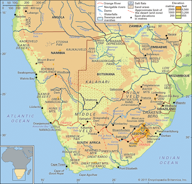
The Molopo River is a river in Southern Africa that rises east of Mahikeng in the North West province of South Africa. It flows westward for approximately…
What is Molopo River?
The Molopo River is a river in Southern Africa that rises east of Mahikeng in the North West province of South Africa. It flows westward for approximately 600 miles (1,000 km) to join the Orange River near the southeastern border of Namibia.1
The river serves as part of the southern boundary between Botswana and South Africa. In its lower course, it passes through the Kalahari basin. The Molopo is an intermittent, ephemeral watercourse that is usually dry; today, it and its Ramatlhabama tributary rarely flood more than 50 miles (80 km) from their sources.12
What defines an ephemeral river compared to a perennial one?
The classification of rivers as perennial, intermittent, or ephemeral is based on the consistency of their flow, though these terms lack rigid, universal definitions.3
Perennial Rivers
Perennial streams are characterized by a continuous flow of water throughout the year. In humid regions, the middle and lower reaches of rivers rarely cease flowing, maintaining a steady presence of water.3
Ephemeral Rivers
An ephemeral stream is a watercourse that flows only briefly during and immediately following periods of local rainfall. These streams are common in arid or semiarid environments, where they are often referred to as arroyos, wadis, or oueds. Key characteristics include:45
- Flow Pattern: They are dry most of the time and subject to flash flooding during irregular or seasonal storms.5
- Channel Morphology: Their beds are typically sandy and flat in cross-section. They often become shallower downstream as water is lost to evaporation and percolation into the dry streambed, sometimes dissipating into terminal mudflows.35
- Geological Impact: Despite their transitory nature, they can cause significant erosion, transportation, and deposition of sediment, often resulting in the formation of deep, flat-floored trenches.35
There is a continuous progression between these types, with intermittent streams occupying the space between perennial and ephemeral systems, often flowing only when the groundwater table is sufficiently high.3
How does the Kalahari Desert environment affect local water sources?
The Kalahari Desert environment profoundly limits surface water availability due to its unique geological and climatic conditions. Across much of the region, deep sand cover causes rainwater to disappear almost instantly, either by percolating into underlying rock strata or being lost to high evaporation rates. This phenomenon creates “edaphic drought,” where soil remains devoid of moisture despite receiving rainfall.78
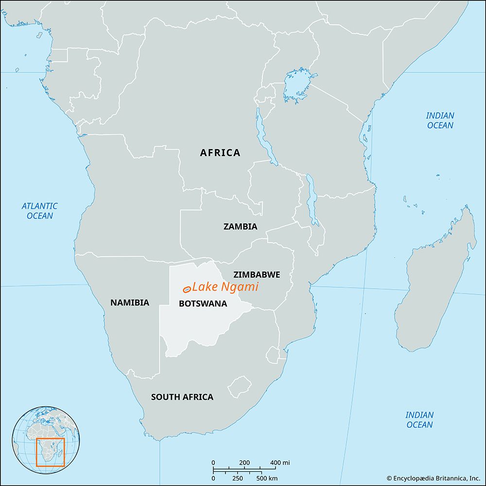
In the central and southern regions, surface water is restricted to small, widely scattered waterholes, and traditional surface drainage is nonexistent. While ancient drainage systems exist, they are no longer functional. In contrast, the northern Kalahari experiences a paradox: despite being a water-scarce region, it receives significant runoff from the Okavango and Kwando rivers, which originate in the well-watered uplands of Angola. This water feeds vast swamps and, during exceptionally wet seasons, flows into Lake Ngami and the Makgadikgadi Pans.7
Ultimately, the desert’s drainage is characterized by terminal features known as pans, which serve as “dry lakes” at the end of ephemeral streams where water evaporates, leaving behind silt and mineral deposits.9
What is the significance of the Orange River in Southern Africa?
The Orange River is of vital economic and geographic significance to Southern Africa. As one of the continent’s longest rivers, it serves as a critical boundary, defining the southern limit of the Kalahari Desert and forming the border between South Africa and Namibia.11
Its primary significance lies in its role as a water lifeline for a largely arid region. Through major infrastructure projects, such as the Orange River Project and the Lesotho Highlands Water Project, the river supports:
- Irrigation: It enables the cultivation of crops like cotton, alfalfa, grapes, and dates in otherwise dry areas.12
- Urban and Industrial Development: Water is diverted to support major cities, including Gqeberha, Bloemfontein, and Kimberley, as well as central industrial zones.1112
- Energy: Large dams, such as the Gariep Dam, provide hydroelectric power to the region.13
Despite challenges like heavy silt accumulation, the river remains a cornerstone for regional development and water conservation.1113
Sources
- Molopo River — Encyclopædia Britannica
- Botswana - Drainage — Encyclopædia Britannica
- ephemeral stream — Merriam-Webster
- river - Effects of climatic change — Encyclopædia Britannica
- river - Variation of stream regime — Encyclopædia Britannica
- arroyo — Encyclopædia Britannica
- Kalahari Desert - Drainage — Encyclopædia Britannica
- Kalahari Desert - Climate of the Kalahari Desert — Encyclopædia Britannica
- Kalahari Desert - Physiography and geology — Encyclopædia Britannica
- Kalahari Desert - Plant life — Encyclopædia Britannica
- Orange River — Encyclopædia Britannica
- Orange River - Irrigation — Encyclopædia Britannica
- Orange River - People and economy — Encyclopædia Britannica
- Orange River - Physiography — Encyclopædia Britannica
Published on · 3 min read