Nizhnyaya Tunguska River
The Nizhnyaya Tunguska River is a major waterway located in western Siberia, Russia, serving as a right-bank tributary of the Yenisey River. Spanning 1,857…
What is Nizhnyaya Tunguska River?
The Nizhnyaya Tunguska River is a major waterway located in western Siberia, Russia, serving as a right-bank tributary of the Yenisey River. Spanning 1,857 miles (2,989 km), it flows through the Irkutsk oblast and Krasnoyarsk kray regions.1
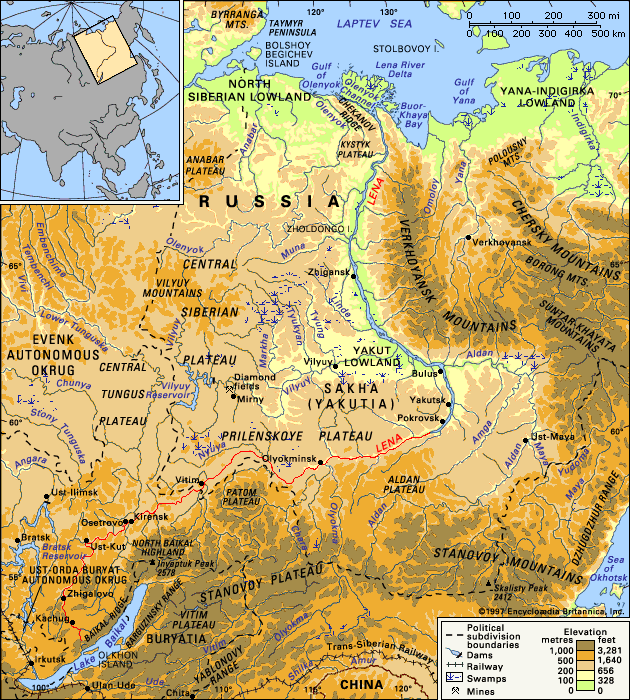
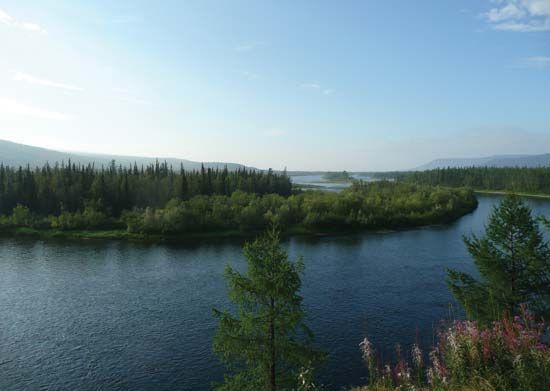
The river originates near the watershed separating the Yenisey and Lena River basins, traversing the Central Siberian Plateau. Its geography is diverse: the upper course features a broad valley with many sandbanks, while the lower course narrows significantly, characterized by numerous gorges and rapids. The river basin is also home to the extensive Tunguska coalfield. Unlike the Podkamennaya Tunguska River, which turns west at a lower latitude, the Nizhnyaya Tunguska continues its northwestward path to approximately 66° N before turning west to join the Yenisey.12
What is the Central Siberian Plateau like?
The Central Siberian Plateau is a vast, rugged upland region in north-central Siberia, Russia, covering approximately 600,000 square miles (1,500,000 square km) across the Krasnoyarsk kray, Sakha, and Irkutsk oblast regions.3
Physical Characteristics
The plateau is defined by a series of stratified plains and plateaus uplifted during the Cenozoic Era. Its landscape features:
- Topography: The region consists of dissected mesas, plains formed from uplifted Precambrian blocks, and exposed horizontal volcanic intrusions. Notable elevations include the Putoran Mountains and the Yenisey Ridge, with average elevations ranging from 1,650 to 2,300 feet (500–700 meters).34
- Boundaries: It is bordered by the Yenisey River to the west, the North Siberian Lowland to the north, the Lena River to the east, and the Vostochny Sayan Mountains to the south.3
Vegetation and Climate
The plateau’s environment is shaped by its harsh, continental climate and varies significantly by latitude:
- Vegetation Zones: The northern areas are characterized by tundra, while the southern portions transition into steppe-grasslands. Much of the region is covered by taiga, or boreal forest, dominated by hardy coniferous trees.35
How does the Tunguska coalfield impact the region?
The Tunguska coalfield, located within the basin of the Nizhnyaya Tunguska River, represents one of the most extensive coal reserves in Siberia and the world.81
Despite the vastness of these deposits, the Tunguska coalfield currently has a minimal impact on the regional economy because it remains largely untapped. Unlike the Kuznetsk Basin or other southerly fields located along the Trans-Siberian Railroad, which serve as the primary drivers of Russia’s coal output, the remote location of the Tunguska basin has prevented significant industrial development.1
Because the field is not currently being exploited, it does not contribute to the regional environmental hazards often associated with coal mining, such as habitat destruction, acid mine drainage, or the health risks posed to miners. While these reserves hold significant potential for future energy production, they currently exist as a vast, undeveloped natural resource within the Central Siberian Plateau.981
What is the difference between the Nizhnyaya and Podkamennaya Tunguska rivers?
The Nizhnyaya Tunguska River and the Podkamennaya Tunguska River are two distinct, roughly parallel tributaries of the Yenisey River in Siberia, Russia. Their primary differences lie in their geography, size, and course:2
- Course and Location: Both rivers flow generally northwestward, but they diverge in their final paths. The Podkamennaya Tunguska turns west at approximately 62° N to join the Yenisey, whereas the Nizhnyaya Tunguska continues its northwestward journey to about 66° N before turning west to meet the Yenisey.2
- Size and Scale: The Nizhnyaya Tunguska is significantly larger, with a length of 1,857 miles (2,989 km) and a basin area of 187,900 square miles (471,300 square km). In contrast, the Podkamennaya Tunguska is shorter, measuring 1,159 miles (1,865 km) with a drainage basin of 96,100 square miles (249,000 square km).111
- Regional Significance: The Nizhnyaya Tunguska basin is notable for containing the extensive Tunguska coalfield. The Podkamennaya Tunguska is historically significant as the site of the Tunguska event, a massive 1908 atmospheric explosion.112
Sources
- Nizhnyaya Tunguska River — Encyclopædia Britannica
- Tunguska River — Encyclopædia Britannica
- Central Siberian Plateau — Encyclopædia Britannica
- Siberia — Encyclopædia Britannica
- Asia - North Asia — Encyclopædia Britannica
- Asia - North and Central Asia — Encyclopædia Britannica
- Altai Mountains - Climate — Encyclopædia Britannica
- Asia - Coal — Encyclopædia Britannica
- Russia - Resources and power — Encyclopædia Britannica
- coal - Hazards of mining and preparation — Encyclopædia Britannica
- Podkamennaya Tunguska River — Encyclopædia Britannica
- Yenisey River - Physiography — Encyclopædia Britannica
- Tunguska event — Encyclopædia Britannica
Published on · 3 min read