Makgadikgadi
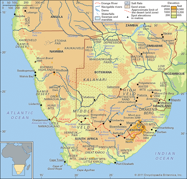
The Makgadikgadi region, located in northeastern Botswana, is a unique environment characterized by vast, alkaline pans that form part of the Kalahari basin.
What unique wildlife can be found in the Makgadikgadi region?
The Makgadikgadi region, located in northeastern Botswana, is a unique environment characterized by vast, alkaline pans that form part of the Kalahari basin.
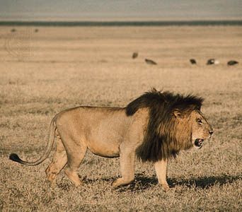
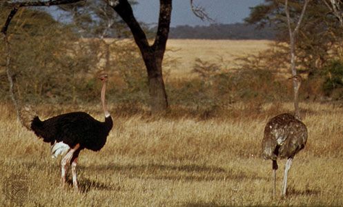
During the rainy season, when these pans are flooded by the Boteti and Nata rivers, they become a vital habitat for thousands of flamingos. The surrounding area, which features open grasslands, also supports a diverse array of wildlife common to the broader region. The Makgadikgadi Pans Game Reserve serves as a protected space for various species, including lions, black-backed jackals, elephants, ostriches, springboks, and zebras.12
While the region is famous for its seasonal birdlife and large mammals, the broader Botswana landscape is home to over 150 species of mammals and more than 460 species of birds, reflecting the rich biodiversity found within this unique “thirstland” environment.2
What is the significance of the Makgadikgadi salt pans, and how were they formed?
The Makgadikgadi region in northeastern Botswana consists of a vast inland basin of sandy, alkaline clay depressions known as pans. These features represent the lowest point of the Kalahari basin.1
Formation and History
The pans were formed as the remnants of a massive lake that occupied the region at various times during the Pleistocene Epoch. Over time, as the climate shifted and drainage patterns evolved, the area transitioned into the arid, salt-crusted landscape seen today. While the southern tributaries of the basin are now dry fossil valleys, the pans are still periodically flooded by the Boteti River and the ephemeral Nata River.12
Significance
The Makgadikgadi pans are among the largest in the world, serving as a critical ecological site. During the rainy season, they transform into shallow pools that provide a vital habitat for thousands of flamingos. Economically, the region holds significant potential due to its salt and soda deposits, though commercial exploitation has been limited by a lack of infrastructure, such as water and electricity.1
What is the geological history of the Makgadikgadi region?
The Makgadikgadi region in northeastern Botswana is a vast inland basin of sandy, alkaline clay depressions known as pans. Geologically, these pans represent the lowest point of the Kalahari basin, with elevations ranging between 2,975 and 4,000 feet.1
The region’s history is defined by the Pleistocene Epoch, during which the area was occupied by a great lake at various times. Over the course of the Quaternary Period, the broader Kalahari region experienced alternating humid and arid phases. As the climate shifted toward the current arid conditions, the ancient lake receded, leaving behind the salt-crusted depressions observed today.16
While the southern tributaries of the basin are now dry fossil valleys, the pans remain geologically active in their drainage patterns. They are periodically flooded by the Boteti River—which receives water from the Okavango River—and the ephemeral Nata River, which flows from the highlands of Zimbabwe.124
How do the Makgadikgadi pans transform during different seasons?
The Makgadikgadi pans undergo a dramatic transformation based on seasonal rainfall patterns, shifting between arid, salt-crusted basins and expansive, life-sustaining wetlands.
- Dry Season: During periods of low rainfall, the pans are largely characterized by sandy, alkaline clay surfaces. In this state, they appear as vast, barren depressions that reflect the arid nature of the surrounding Kalahari environment1.1
- Rainy Season: In normal rainy seasons, the landscape changes significantly as the pans are flooded. The Boteti River, which receives overflow from the Okavango River delta, feeds the western portion of the basin. Simultaneously, the eastern pans are flooded annually by the ephemeral Nata River, which originates in the highlands of Zimbabwe.241
When flooded, the pans transform into a series of shallow pools interspersed with islands of grass. This seasonal influx of water is ecologically vital, as it creates a temporary habitat that attracts thousands of flamingos and supports a variety of other wildlife.2
Sources
- Makgadikgadi — Encyclopædia Britannica
- Botswana - Drainage — Encyclopædia Britannica
- Botswana - Plant and animal life — Encyclopædia Britannica
- Kalahari Desert - Drainage — Encyclopædia Britannica
- Makgadikgadi Pans — Merriam-Webster
- Africa - Pleistocene and Holocene developments — Encyclopædia Britannica
Published on · 3 min read