Mount Ash-Shaʿnabī
Mount Ash-Shaʿnabī, also known as Mount Chambi, is the highest mountain in Tunisia, reaching an elevation of 5,066 feet (1,544 meters).
What is Mount Ash-Shaʿnabī?
Mount Ash-Shaʿnabī, also known as Mount Chambi, is the highest mountain in Tunisia, reaching an elevation of 5,066 feet (1,544 meters).12
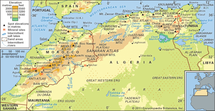
It is situated near the Algerian border, approximately 6 miles (10 km) west-northwest of the city of Al-Qaṣrayn (Kasserine). Geologically, the mountain is a spur of the Tebessa Mountains, which form part of the Saharan Atlas range. It serves as a prominent feature of the Tunisian Dorsale, a mountain range that trends southwest-northeast across the country.12
What are the Saharan Atlas Mountains?
The Saharan Atlas is the southern section of the Atlas Mountains system, extending across North Africa from Algeria into Tunisia. As its name suggests, this range is subject to desert influences, distinguishing it from the more humid Tell Atlas to the north.345
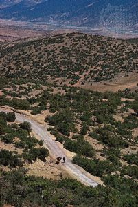
The range consists of several principal massifs, including the Ksour, Amour, Ouled-Naïl, Zab, Aurès, and Tébessa mountains. These formations serve as a geographic barrier between the Mediterranean basin and the Sahara to the south. Due to the arid climate, vegetation in the Saharan Atlas is sparse, consisting primarily of scattered stands of green oak and juniper trees.34657
Economically, the region is significant for its natural resources, including iron ore deposits near Mount Ouenza and extensive phosphate reserves near the town of Tébessa in Algeria.3
What is the significance of the Majardah River valley?
The Wadi Majardah valley is of critical significance to Tunisia as it is home to the country’s only perennially flowing river.89
The valley serves as a vital agricultural hub, particularly for wheat production. Because the region is arid, the river and its tributaries are essential for water management; a series of dams have been constructed to provide irrigation for the surrounding plains, control seasonal flooding, and recharge the water table.89
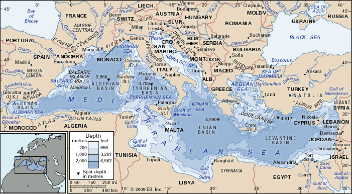
Geographically, the river flows 290 miles (460 km) from the mountains in northeastern Algeria to the Gulf of Tunis, emptying into the Mediterranean Sea near the historic site of ancient Carthage. This consistent water source makes the valley a central feature of the nation’s drainage system, contrasting sharply with the intermittent, seasonal streams found in the southern parts of the country.89
What are the High Steppes of Tunisia?
The High Steppes (Haute Steppe) of Tunisia are a hilly region located south of the Tunisian Dorsale, a mountain range that serves as an extension of the Saharan Atlas.2
Key characteristics of the High Steppes include:
- Geography: The region features elevations ranging from approximately 600 to 1,500 feet (180 to 460 meters) and is intersected by secondary mountain ranges that trend north-south.2
- Climate: The area experiences semiarid conditions, which represent a transition between the Mediterranean climate of the north and the desert environment of the far south.10
- Precipitation: Rainfall in the steppe region is generally between 4 and 16 inches (100 to 400 mm) annually. This precipitation is highly irregular from year to year, which significantly impacts agricultural harvests in the area.10
To the east of the High Steppes lies the Basse Steppe (Low Steppes), and further south, the landscape transitions into a series of chott (salty lake) depressions and the sandy desert of the Sahara.2
Sources
- Mount Ash-Shaʿnabī — Encyclopædia Britannica
- Tunisia - Relief — Encyclopædia Britannica
- Saharan Atlas — Encyclopædia Britannica
- Atlas Mountains — Encyclopædia Britannica
- Atlas Mountains - Physiography — Encyclopædia Britannica
- Atlas Mountains - Climate of the Atlas Mountains — Encyclopædia Britannica
- Atlas Mountains - Plant and animal life — Encyclopædia Britannica
- Wadi Majardah — Encyclopædia Britannica
- Tunisia - Drainage — Encyclopædia Britannica
- Tunisia - Climate — Encyclopædia Britannica
Published on · 2 min read