Mun River
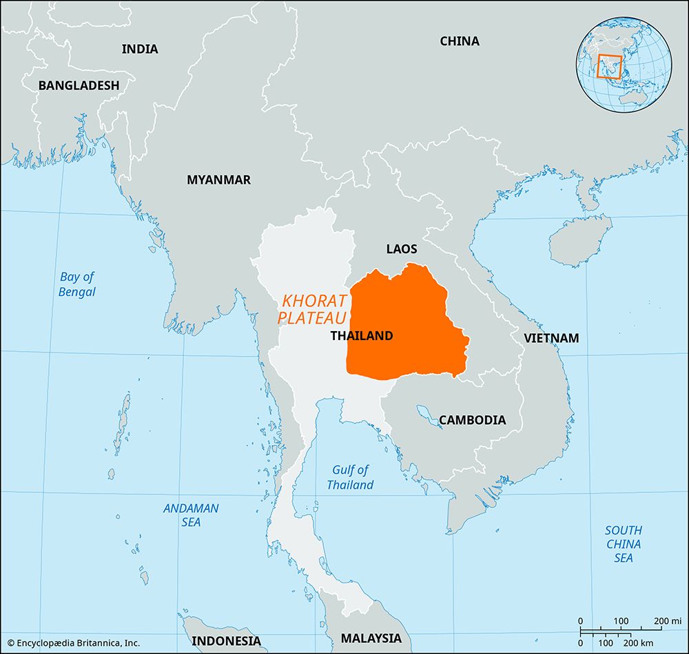
The Mun River is the primary river system of the Khorat Plateau in eastern Thailand. Rising in the San Kamphaeng Range northeast of Bangkok, it flows…
What is Mun River?
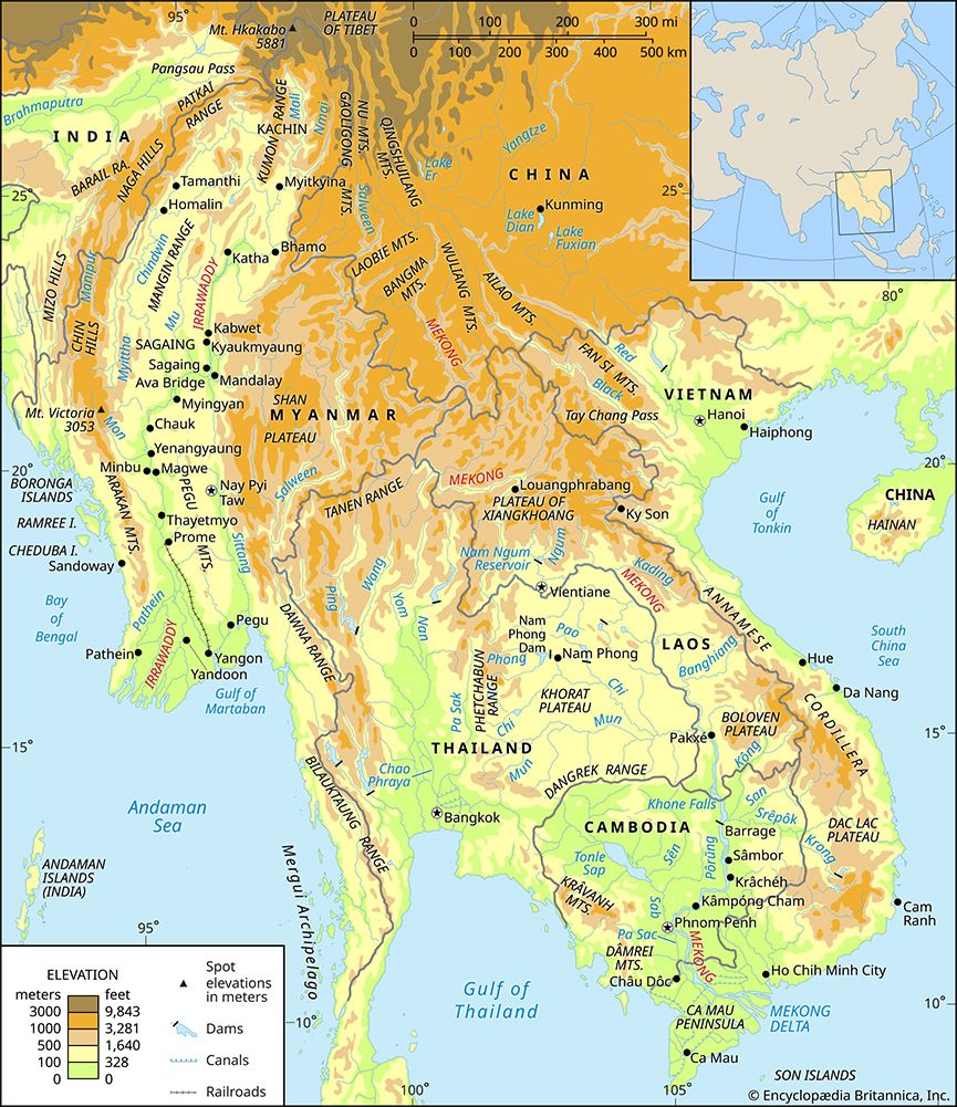
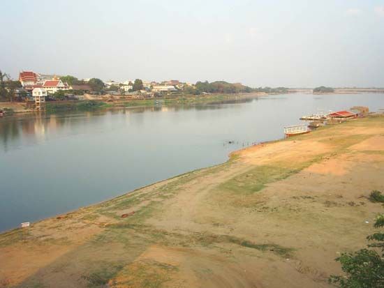
The Mun River is the primary river system of the Khorat Plateau in eastern Thailand. Rising in the San Kamphaeng Range northeast of Bangkok, it flows eastward for 418 miles (673 km). Along its course, it receives the Chi River as its main tributary before joining the Mekong River at the Laotian border near Ban Dan.12
The river serves as a vital resource for the region, providing water for irrigation and supporting seasonal navigation below the city of Ubon Ratchathani. In addition to Ubon Ratchathani, Nakhon Ratchasima is another major town situated along its banks. As one of the most important tributaries of the Mekong, the Mun River effectively drains the majority of the Khorat Plateau.12
What is the significance of the Khorat Plateau to the region’s geography?
The Khorat Plateau is a significant saucer-shaped tableland in northeastern Thailand, covering approximately 60,000 square miles (155,000 square km). Its geography is defined by a landscape of gently rolling hills and relatively flat alluvial plains, situated between 300 and 650 feet above sea level.52
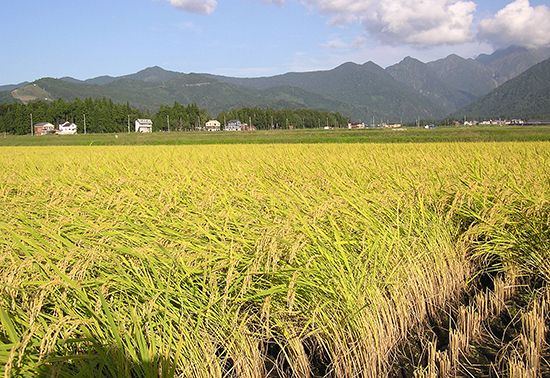
The plateau plays a vital role in the regional hydrology, as it is drained primarily by the Chi River and the Mun River, the latter being one of the most important tributaries of the Mekong River. These river systems are essential for irrigation and support the agricultural activities of the region, where inhabitants cultivate crops such as rice, corn, and cotton.521
The plateau’s environment is characterized by distinct seasonal changes; its impermeable soils lead to flooding during the rainy season (April–November), while the land becomes parched during the dry season. Major urban centers, including Nakhon Ratchasima, Khon Kaen, and Ubon Ratchathani, are located on the plateau and are connected to Bangkok by rail.5
How does the Chi River contribute to the Mun River system?
The Chi River serves as the primary tributary to the Mun River system in eastern Thailand. By flowing into the Mun River, the Chi contributes significantly to the drainage of the Khorat Plateau, which is the largest plateau in the region. Together, these rivers form a vital hydrological network that eventually discharges into the Mekong River at the Laotian border near Ban Dan.12
What are some of the main environmental challenges facing the Mekong River basin?
The Mekong River basin faces several significant environmental challenges, primarily driven by human activity and land-use changes that impact the river’s delicate ecosystem.
- Forest Degradation: Widespread deforestation is a major concern across the basin. In the northern highlands, dense deciduous forests have deteriorated due to frequent cutting and burning for shifting cultivation. Similarly, in the eastern highlands, forest loss has resulted from intensive lumbering, grazing, and agricultural expansion.6
- Soil and Vegetation Loss: On the Khorat Plateau, the original forest cover has been largely replaced by grassland. This transformation is the direct result of repeated burning and grazing, which has left the remaining soils on the hills thin and vulnerable.6
- Hydrological Stress: The basin’s reliance on seasonal monsoon rains creates extreme fluctuations in water levels. While water management projects, such as hydroelectric power dams, aim to improve economic productivity and irrigation, they also alter the natural flow regimes that local ecosystems and agricultural cycles depend upon.72
Sources
- Mun River — Encyclopædia Britannica
- Mekong River - Physiography — Encyclopædia Britannica
- Mekong River — Encyclopædia Britannica
- Ping River — Encyclopædia Britannica
- Khorat Plateau — Encyclopædia Britannica
- Mekong River - Climate and hydrology — Encyclopædia Britannica
- Mekong River - Irrigation and flood control — Encyclopædia Britannica
- Mekong River - Physical features — Encyclopædia Britannica
Published on · 2 min read