Khorat Plateau
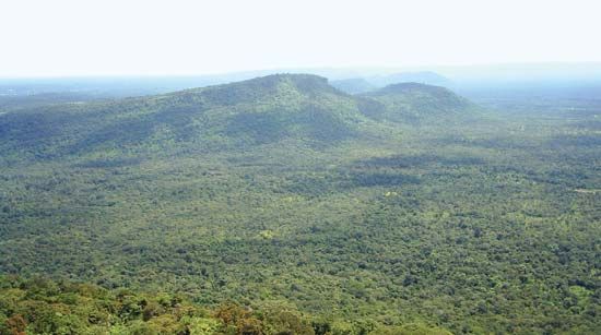
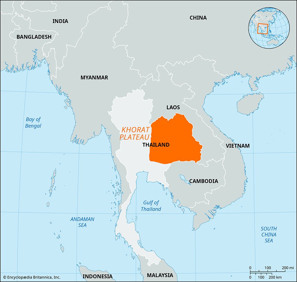
The Khorat Plateau is a vast, saucer-shaped tableland located in northeastern Thailand. Covering approximately 60,000 square miles (155,000 square km), the…
What is Khorat Plateau?
The Khorat Plateau is a vast, saucer-shaped tableland located in northeastern Thailand. Covering approximately 60,000 square miles (155,000 square km), the region is defined by a southeastward tilt, with elevations ranging from about 650 feet (200 meters) in the northwest to 300 feet (90 meters) in the southeast.12
The plateau was formed by crustal faulting that caused underlying sedimentary rocks to tilt, creating low hills and mountain ranges along its western and southern borders, including the Phetchabun and Phanom Dong Rak ranges. It is bounded to the north and east by the Mekong River, which forms the border with Laos.12
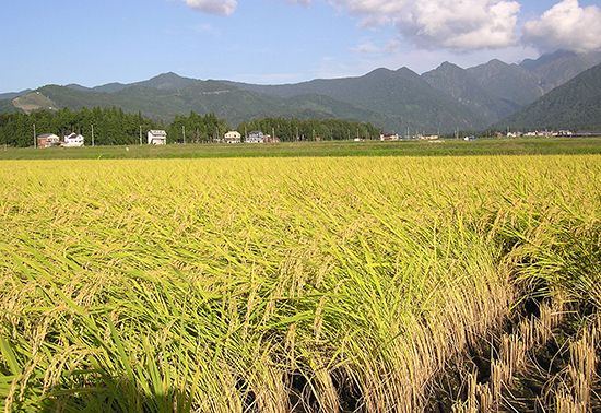
The region’s climate is characterized by seasonal extremes; its impermeable soils are prone to flooding during the rainy season (April–November) and become parched during the dry season. The local economy relies on agriculture, including the cultivation of rice, cotton, and peanuts, as well as livestock raising. Major urban centers like Nakhon Ratchasima connect the region to Bangkok via rail.1
How do the Chi and Mun rivers shape the landscape of the plateau?
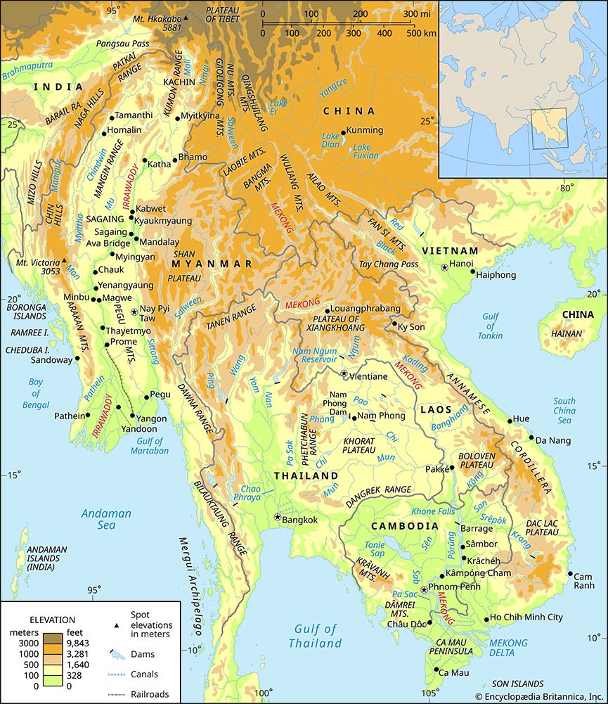
The Mun River and its primary tributary, the Chi River, serve as the principal drainage system for the Khorat Plateau, shaping its landscape through a southeastward flow that eventually empties into the Mekong River.345
The rivers influence the plateau’s environment in several key ways:
- Hydrological Shaping: The rivers traverse an area defined by gently rolling hills and flat alluvial plains. Their floodwaters are essential for regional rice production, though the unpredictability of these floods—exacerbated by deforestation and agricultural expansion—has historically posed significant challenges.35
- Economic Utility: Beyond agriculture, the Mun River system is utilized for irrigation and is seasonally navigable below Ubon Ratchathani.4
- Infrastructure Integration: Since the mid-20th century, the construction of dams across the region has been used to improve flood control, expand irrigation capacity, and generate hydroelectric power, further altering the natural flow and impact of these river systems on the landscape.3
What are the primary challenges of farming on the Khorat Plateau?
Farming on the Khorat Plateau faces several significant environmental and hydrological challenges that complicate agricultural productivity:
- Water Extremes: The plateau is characterized by impermeable soils that suffer from severe seasonal imbalances. The region experiences flooding during the rainy season (April–November) and becomes parched during the dry season, making consistent water management difficult.1
- Soil Salinity: A major obstacle is the high water table, which often contains brackish, unpotable water. In areas with high evaporation rates and poor drainage, salts accumulate in the soil. This excess salinity inhibits plant growth by causing dehydration, as high salt concentrations make it difficult for roots to absorb water through osmosis.637
- Unpredictable Flooding: While floodwaters from the Chi and Mun rivers are vital for rice cultivation, their frequency and volume are highly unpredictable. These flooding issues have been exacerbated by widespread deforestation and the conversion of land for agricultural use.6
- Infrastructure and Land Use: Although dams have been constructed since the mid-20th century to improve flood control and irrigation, the region continues to struggle with the physical limitations of its soil and the environmental impact of intensive farming practices.6
How does the Mekong River influence the border region of Thailand?
The Mekong River plays a multifaceted role in the border region of Thailand, serving as both a physical boundary and a catalyst for regional interaction.
- Geopolitical Boundary: The river forms a significant portion of the international border between Thailand and Laos. This stretch of the river is characterized by gentler terrain compared to its upper reaches, facilitating its role as a natural divider between the two nations.910
- Regional Cooperation and Conflict: The river acts as a focal point for international relations, inspiring both conflict and cooperation among the countries of the lower basin, including Thailand, Laos, Cambodia, and Vietnam. Since 1957, these nations have collaborated through the Mekong Committee to manage water resources, despite historical political tensions.911
- Economic and Infrastructure Development: The river basin is vital to the economy of northeastern Thailand, particularly the Khorat Plateau. Joint efforts have led to the construction of water projects, such as the multipurpose dam near Nam Phong, which aim to improve flood control, irrigation, and hydroelectric power generation to support local agriculture.115
Sources
- Khorat Plateau — Encyclopædia Britannica
- Thailand - Relief — Encyclopædia Britannica
- Thailand - Drainage of Thailand — Encyclopædia Britannica
- Mun River — Encyclopædia Britannica
- Mekong River - Physiography — Encyclopædia Britannica
- Thailand - Agriculture, forestry, and fishing — Encyclopædia Britannica
- salinity — Encyclopædia Britannica
- land reclamation - Reclamation of salt-affected soils — Encyclopædia Britannica
- Mekong River - Physical features — Encyclopædia Britannica
- Mekong River — Encyclopædia Britannica
- Mekong River - Irrigation and flood control — Encyclopædia Britannica
Published on · 3 min read