Mureş River
The Mureș River is a significant river in east-central Romania that rises in the Giurgeu Range of the Eastern Carpathian Mountains. Spanning approximately…
What is Mureş River?
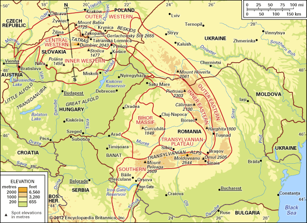
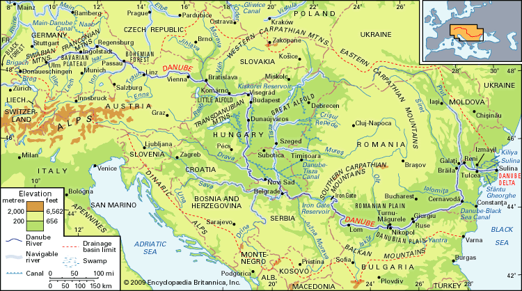
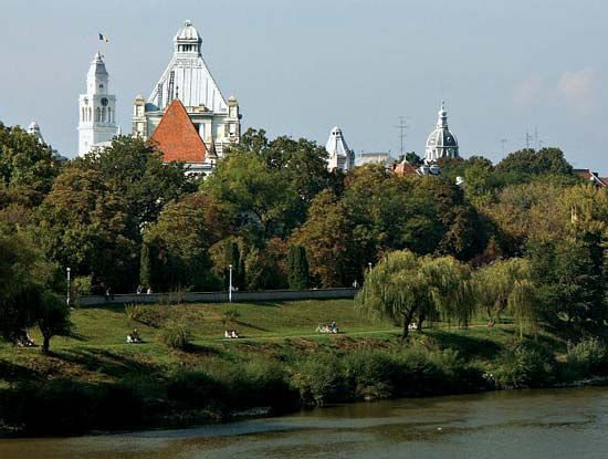
The Mureș River is a significant river in east-central Romania that rises in the Giurgeu Range of the Eastern Carpathian Mountains. Spanning approximately 450 miles (725 km), it flows southwestward across the Transylvanian Basin and through the Western Carpathians before emerging onto the Tisa Plain to join the Tisa (Tisza) River at Szeged, Hungary.1
As the most important tributary of the Tisa in terms of water volume, the Mureș serves as a vital traffic route, with road and rail arteries following its course. It is navigable for small craft below the city of Deva. Additionally, the river gives its name to the Mureș județ (county) in north-central Romania, which is a notable hub for industry, agriculture, and cultural history.12
What is the significance of the Tisa River?
The Tisa (or Tisza) River is a vital waterway and the most significant tributary of the middle Danube River. Spanning 600 miles (966 km), it serves as a critical hydrological and economic artery for Central Europe, draining an area of 60,690 square miles.4
Its significance is defined by several key factors:
- Hydrological Impact: The river is prone to dramatic seasonal fluctuations. Historically, the lack of natural lake regulation in the Carpathian Mountains led to severe flooding, most notably the 1879 disaster in Szeged. This necessitated the construction of 2,400 miles of flood-control levees.4
- Economic and Agricultural Utility: The Tiszalök Dam, completed in 1954, created Hungary’s largest reservoir. This infrastructure provides essential hydroelectric power and supports large-scale irrigation for the Hajdúság and Hortobágy plains via the Eastern Main Canal.4
- Transportation: The river is a key transport route, navigable for river boats up to Szolnok and for smaller craft further upstream, supporting regional trade through ports like Csongrád and Szeged.4
How do the Carpathian Mountains influence rivers in Romania?
The Carpathian Mountains serve as the primary hydrological engine for Romania, dictating the flow and character of its major river systems. Approximately 90 percent of the runoff from these mountains eventually drains into the Black Sea, primarily via the Danube River and its tributaries, such as the Olt, Siret, Prut, and Tisa rivers.5
The influence of the mountains on these rivers is characterized by several key factors:
- Topographic Shaping: The geological evolution of the Carpathians has created deeply incised gap valleys that guide the paths of major rivers like the Olt and the Danube. In the Eastern Carpathians, rivers have carved narrow, scenic gorges known as cheile, such as the Bistriței and Bicazului.67
- Hydrological Regime: Carpathian rivers follow a rain-snow regime, experiencing high-water periods in the spring and summer. Because the terrain often has poor ground retention, these seasonal surges can lead to catastrophic flooding.5
- Economic Infrastructure: To manage these flows and harness their potential, numerous storage basins and hydroelectric stations have been constructed, such as those on the Bistrița River and the joint Romanian-Serbian project at the Iron Gate gorge.587
What are some other major rivers in Romania?
Beyond the Danube River, which serves as the primary drainage outlet for the country, Romania features several other significant rivers that are vital to its geography and economy. These include:9
- Prut River: A major tributary that forms part of the country’s eastern border.9
- Mureș River: Rising in the Eastern Carpathians, this river is a significant traffic route that crosses the Transylvanian Basin before joining the Tisa River.91
- Olt River: Known for carving a critical path through the Southern Carpathians (Transylvanian Alps) at the Turnu Roșu Pass, it is a major tributary of the Danube.92
- Siret River: Another essential tributary that contributes to the drainage of the Moldavian region.9
- Someș River: A significant river in the northern part of the country.9
- Ialomița River: A notable tributary flowing through the southern plains.9
Additionally, rivers such as the Argeș, Bistrița, Jiu, and Sebeș have been central to Romania’s efforts to develop hydroelectric power since the 1940s.98
Sources
- Mureş River — Encyclopædia Britannica
- Olt River — Encyclopædia Britannica
- Mureş — Encyclopædia Britannica
- Tisza River — Encyclopædia Britannica
- Carpathian Mountains - Drainage of the Carpathian Mountains — Encyclopædia Britannica
- Carpathian Mountains - Geology — Encyclopædia Britannica
- Siret River — Encyclopædia Britannica
- Romania - Relief — Encyclopædia Britannica
- Romania - Drainage of Romania — Encyclopædia Britannica
Published on · 3 min read