Neblina Peak
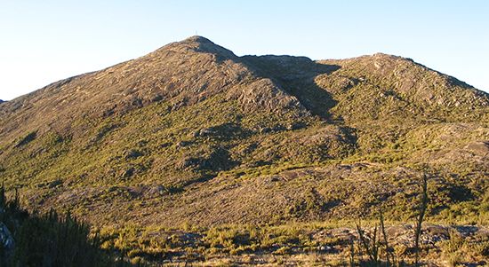
Neblina Peak is a mountain located in the Imeri Mountains within the Amazonas state of northern Brazil, situated near the Venezuelan border.
What is Neblina Peak?
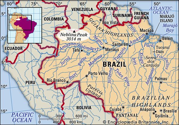
Neblina Peak is a mountain located in the Imeri Mountains within the Amazonas state of northern Brazil, situated near the Venezuelan border.1
Standing at 9,888 feet (3,014 meters) above sea level, it is the highest mountain in Brazil highest mountain in Brazil. Prior to the discovery of Neblina Peak in 1962, Bandeira Peak was incorrectly believed to be the country’s highest point.1
What are the Imeri Mountains?
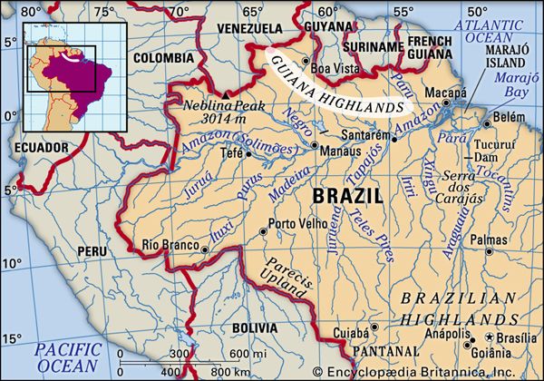
The Imeri Mountains, also known as the Serra do Imeri, are a rugged mountain range located along the border between Brazil and Venezuela.12
As part of the Guiana Highlands, this region is characterized by its dramatic, forested landscape. The range is home to Neblina Peak, which, at 9,888 feet (3,014 meters) above sea level, serves as the highest point in Brazil.12
How does the climate of the Amazon region affect the mountain?
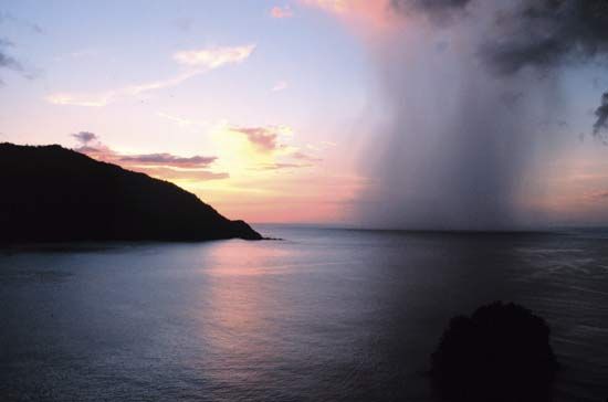
The climate of the Amazon region significantly influences the environment of Neblina Peak and the surrounding Imeri Mountains. Because the region is characterized by a warm, humid, and rainy tropical climate, the mountains are subject to high levels of precipitation and consistent moisture, which support the dense tropical rainforest vegetation found throughout the Guiana Highlands.134
Mountains in this region act as natural barriers to atmospheric water vapor, often leading to increased rainfall on their flanks and contributing to the formation of cloud-steeped environments. While temperatures in the Amazon basin are generally high, they tend to decrease as elevation increases, meaning the higher altitudes of Neblina Peak experience cooler conditions than the surrounding lowlands. Furthermore, the heavy plant cover fostered by this climate can make geological exploration of the range difficult.143
What is the significance of the border between Brazil and Venezuela?
The border between Brazil and Venezuela is significant primarily due to its rugged, remote geography and its role in defining the Guiana Highlands.27
Key aspects of this border include:
- Geographical Landmarks: The boundary traverses the Serra do Imeri, home to Neblina Peak, which is the highest point in Brazil at 9,888 feet (3,014 meters). Farther east, the border meets the borders of Guyana at Mount Roraima, a notable tabular plateau or tepui.278
- Topographic Complexity: The region is characterized by dense tropical rainforest, steep-sided mesas, and ancient crystalline rocks, making it one of the most remote and least explored areas in both countries.78
- Security and Resource Management: The Venezuelan military has historically monitored the border region due to concerns regarding illegal activities, including the unauthorized movement of people, cattle, and narcotics. Additionally, the highlands contain significant natural resources, such as gold, diamonds, and iron ore, which are of economic interest.78
Sources
- Neblina Peak — Encyclopædia Britannica
- Brazil - Guiana Highlands — Encyclopædia Britannica
- Amazon River - Climate — Encyclopædia Britannica
- Guiana Highlands — Encyclopædia Britannica
- South America - Tropical climates — Encyclopædia Britannica
- French Guiana - Land — Encyclopædia Britannica
- Amazon Rainforest — Encyclopædia Britannica
- Venezuela - Relief — Encyclopædia Britannica
Published on · 2 min read