Nechako River
The construction of the Kenney Dam in 1952 significantly altered the Nechako River. Originally a 287-mile-long stream originating in the Coast Mountains, the…
How has the construction of the Kenney Dam affected the Nechako River’s ecosystem and flow?
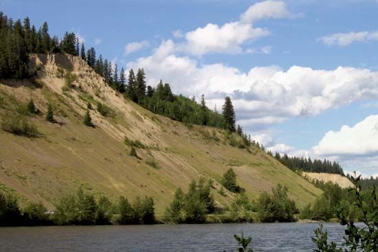
The construction of the Kenney Dam in 1952 significantly altered the Nechako River. Originally a 287-mile-long stream originating in the Coast Mountains, the river was bisected by the dam, which was built as part of a major engineering project by the Aluminum Company of Canada, Ltd.1
The dam created a massive reservoir by flooding Lakes Ootsa, Whitesail, and Tahtsa. Instead of following its natural course, a significant portion of the water is now diverted westward through tunnels in the Coast Mountains to Kemano. This water is used to generate electricity for an aluminum smelter in Kitimat, fundamentally changing the river’s flow and its role as a tributary of the Fraser River.1
What is the length of the Nechako River and how does it compare to other major rivers in British Columbia?
The Nechako River currently flows eastward for nearly 150 miles (240 km) from the Kenney Dam to its confluence with the Fraser River at Prince George. Prior to the dam’s construction in 1952, the river was a 287-mile (462-km) stream originating in the Coast Mountains.1
When compared to other major river systems in British Columbia, the Nechako is classified as a major tributary rather than one of the province’s primary drainage systems. The province’s three main river systems are the Peace, the Fraser, and the Columbia. The Fraser, for instance, is the only major river lying entirely within the province and features a 300-mile (480-km) stretch flowing south from Prince George to Hope. Other tributaries, such as the North Thompson River, also span significant distances, with the North Thompson alone reaching 210 miles (340 km).23
How does the Nechako River contribute to the Fraser River system?
The Nechako River serves as a major tributary of the Fraser River in central British Columbia, Canada. Its primary contribution to the system is the drainage of the Nechako Plateau.
The river flows eastward for nearly 150 miles (240 km) from the Kenney Dam before merging with the Fraser River at Prince George. This confluence at Prince George is a significant geographical feature, as the city serves as a central hub for the region’s transportation and administration. Additionally, the Nechako system is augmented by the Stuart River, a 258-mile-long tributary that joins the Nechako midway between Fort Fraser and Prince George, further contributing to the water volume that eventually enters the Fraser River.15
Where is the Nechako River located in Canada, and what are its major tributaries?
The Nechako River is located in central British Columbia, Canada. It serves as a major tributary to the Fraser River, draining the Nechako Plateau before reaching its confluence at Prince George.1
Regarding its tributaries, the Stuart River is the primary tributary of the Nechako. It is 258 miles (415 km) long and joins the Nechako River midway between the communities of Fort Fraser and Prince George.1
Sources
- Nechako River — Encyclopædia Britannica
- British Columbia - Drainage — Encyclopædia Britannica
- Thompson River — Encyclopædia Britannica
- Nechako — Merriam-Webster
- Prince George — Encyclopædia Britannica
Published on · 2 min read