Orange River
The Orange River has long served as a vital geographical and political landmark in southern Africa. For indigenous groups, such as the Sotho (Basuto), the…
What is the historical significance of the Orange River for indigenous peoples and early European explorers?
The Orange River has long served as a vital geographical and political landmark in southern Africa. For indigenous groups, such as the Sotho (Basuto), the river’s headwaters and adjacent plateaus have historically provided essential grazing land for cattle and sheep. During the 19th century, the Sotho people demonstrated significant resilience, utilizing horses and firearms to maintain their political and military autonomy against colonial encroachment.12
For early European explorers, the river—originally known as the Groot River—became a focal point for 18th-century expeditions led by figures like Jacobus Coetsee, Hendrik Hop, and Robert Jacob Gordon, the latter of whom named it in honor of the Dutch house of Orange. By the 19th century, the river functioned as the northern limit of British power. It also became a central feature of Boer migration; beginning in the 1830s, Boers crossed the river seeking independence from British rule, eventually naming the Orange Free State in its honor.3
What is the origin of the name ‘Orange River’ and does it have any other names?
The Orange River was historically known as the Groot River before it was renamed by the Dutch officer Robert Jacob Gordon in the 18th century. Gordon named the river in honor of the Dutch House of Orange.2
Additionally, the river is known by several other names depending on the specific section or its headwaters:
- Sinqu (Senqu) River: Officially recognized as the main source of the river, rising in the Lesotho Highlands.5
- Seati (Khubedu) River: Another significant headwater located near Mont-aux-Sources.5
- Malibamatso River: A lesser-known headwater situated further north.5
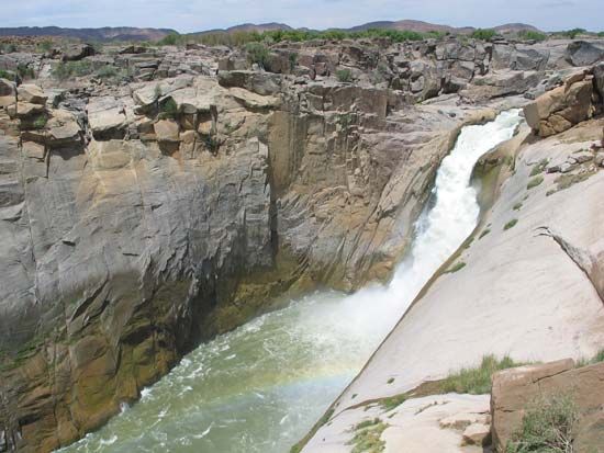
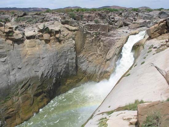
- Gorge Tract: A name sometimes used to refer to the river’s lower course, extending from the Augrabies Falls to the Atlantic Ocean.5
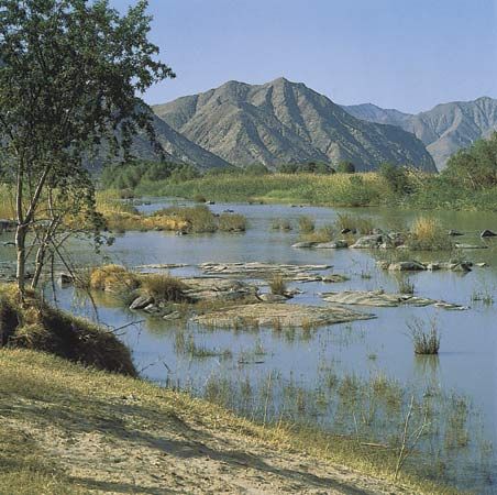
How does the Orange River influence the climate and agriculture of the regions it passes through?
The Orange River is a critical environmental and economic artery in southern Africa, though its influence is heavily dictated by a sharp east-to-west climatic gradient.
Climate and Hydrology
The river’s flow is primarily sustained by the Lesotho Highlands, where high annual rainfall and snowmelt contribute nearly 60 percent of the total volume. As the river moves westward, the climate shifts from temperate to arid. In the west, summer temperatures frequently exceed 86°F (30°C), and the rate of evaporation becomes extreme—in the lower course, water lost to evaporation can be 12 times greater than the total annual precipitation. This aridity makes the western basin largely unamenable to cultivation without significant intervention.13
Agricultural Impact
Agriculture along the river is defined by the availability of water for irrigation:
- Upper Course: In the high valleys and adjacent plateaus, the land is primarily used for grazing cattle and sheep. Between the Lesotho border and Maletswai, the climate supports the cultivation of corn (maize).7
- Lower Course: Downstream of the Boegoeberg Dam, particularly between Upington and the Augrabies Falls, large-scale irrigation supports the production of cotton, alfalfa (lucerne), grapes, and dates.7
To mitigate the natural water scarcity in the region, the Orange River Project and the Lesotho Highland Project divert water to support urbanization and economic development in South Africa’s central industrial areas and distant river valleys.37
What is the geographical location and length of the Orange River?
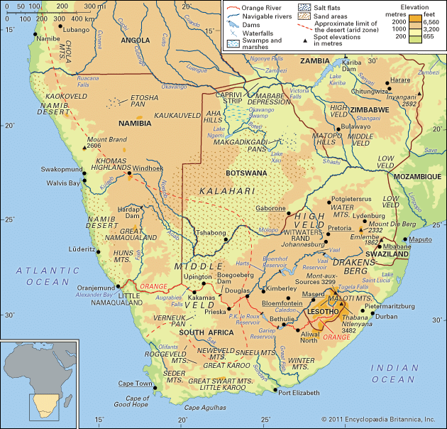
The Orange River is a major waterway in southern Africa, stretching approximately 1,300 miles (about 2,100 kilometers) from its source to the sea.1
Geographical Location
- Source: The river originates in the Lesotho Highlands at an altitude of about 10,800 feet (3,300 meters), located less than 125 miles from the Indian Ocean.15
- Course: It flows in a generally westerly direction across South Africa, traversing the veld region, defining the southern limit of the Kalahari, and bisecting the southern Namib desert.1
- Boundaries: Along its path, the river serves as the eastern boundary of the South African province of Free State and forms the international border between Namibia and South Africa.1
- Mouth: The river drains into the Atlantic Ocean at Alexander Bay, South Africa.15
Sources
- Orange River — Encyclopædia Britannica
- Orange River - Study and exploration — Encyclopædia Britannica
- Orange River - People and economy — Encyclopædia Britannica
- South Africa - The British in Natal — Encyclopædia Britannica
- Orange River - Physiography — Encyclopædia Britannica
- Orange — Merriam-Webster
- Orange River - Climate and hydrology — Encyclopædia Britannica
- Africa - Orange basin — Encyclopædia Britannica
Published on · 3 min read