Orinoco River
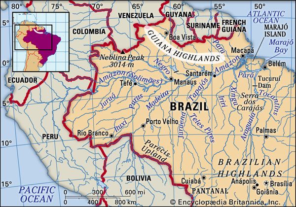
The Orinoco River is a major waterway located in South America. It originates in the Guiana Highlands of Venezuela, specifically near Mount Delgado Chalbaud…
Where is the Orinoco River located, and what countries does it flow through?
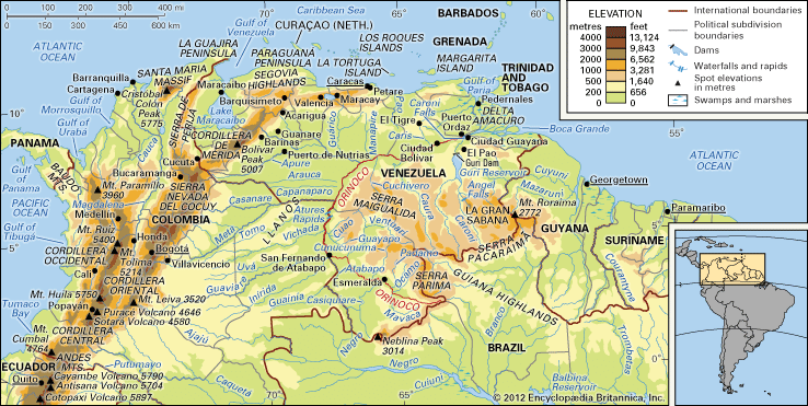
The Orinoco River is a major waterway located in South America. It originates in the Guiana Highlands of Venezuela, specifically near Mount Delgado Chalbaud in the Parima Mountains, and flows in a giant arc for approximately 1,700 miles before reaching its mouth on the Atlantic Ocean.12
Throughout the vast majority of its course, the river flows through Venezuela. A significant section of the river also serves as the international frontier between Venezuela and Colombia. While the river system is linked to the Amazon basin via the Casiquiare channel, the Orinoco itself is primarily associated with the Venezuelan and Colombian landscapes.12
What is the length of the Orinoco River, and how does it compare to other major rivers in South America?
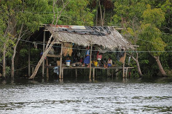
The Orinoco River has a total length of approximately 1,700 miles (2,740 km). It serves as the third-largest drainage system in South America, covering a basin area of about 366,000 square miles (948,000 square km).13
When compared to other major South American river systems, the Orinoco is smaller in both length and drainage area:
- Amazon River: By far the largest system, it stretches some 4,000 miles (6,400 km) and drains roughly 2,722,000 square miles (7,050,000 square km).3
- Paraguay-Paraná-Uruguay System: This is the second most important drainage system, covering approximately 1.2 million square miles (3.2 million square km). The Paraná River alone is significantly longer than the Orinoco, measuring 3,032 miles (4,880 km).3
- São Francisco River: This river is longer than the Orinoco, with a total length of 1,811 miles (2,914 km), though its basin is smaller, encompassing about 244,000 square miles (632,000 square km).3
How does the climate of the Orinoco River basin affect its water levels throughout the year?
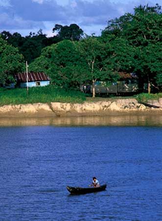
The climate of the Orinoco River basin is tropical, characterized by two distinct seasons—rainy and dry—driven by the annual migration of the intertropical convergence zone. These seasonal rainfall patterns cause significant fluctuations in the river’s water levels throughout the year.45
- High-Water Period (April to October): As the rainy season begins in April, the river levels rise with regularity, reaching a maximum depth of approximately 165 feet (50 meters) near Ciudad Bolívar by July. During the peak of this period, from June to August, the river overflows its banks, causing extensive flooding in the lowlands, which can be submerged under as much as 65 feet (20 meters) of water.5
- Low-Water Period (October to March): Following the peak in July, the waters gradually recede, reaching their lowest point in October. During this dry season, the average depth near Ciudad Bolívar drops to about 49 feet (15 meters).5
How is the Orinoco River used for transportation, energy production, and economic activities in modern times?
The Orinoco River serves as a vital artery for transportation, energy, and industry in modern South America.
Transportation
The river and its tributaries have historically been essential waterways for the region’s inhabitants. Large river steamers navigate up to 700 miles (1,127 km) from the delta to the Atures Rapids. Furthermore, dredging has enabled large oceangoing vessels to travel 225 miles (362 km) from the river’s mouth to its confluence with the Caroní River, facilitating the transport of iron ore from the Guiana Highlands. Infrastructure development, including the Angostura Bridge at Ciudad Bolívar, has further integrated the region.
Energy and Industry
The basin’s industrial growth is centered around Ciudad Guayana, supported by the hydroelectric potential of the Caroní River, harnessed by the Guri and Macagua dams. This power is supplemented by natural gas from nearby fields.
The Orinoco Oil Belt contains one of the world’s largest heavy oil reserves. While extraction is challenging due to the oil’s viscosity and sulfur content, it remains a critical economic resource. Additionally, the Guiana Highlands provide significant deposits of iron ore, bauxite, gold, and diamonds.
Sources
- Orinoco River — Encyclopædia Britannica
- Orinoco River - Physiography of the Orinoco — Encyclopædia Britannica
- South America - Rivers of South America — Encyclopædia Britannica
- Orinoco River - Climate of the Orinoco River — Encyclopædia Britannica
- Orinoco River - Hydrology — Encyclopædia Britannica
- Orinoco River - Transportation — Encyclopædia Britannica
- Orinoco River - Resource exploitation — Encyclopædia Britannica
- How Much Oil Does Venezuela Have, and How Much Is Accessible? — Encyclopædia Britannica
Published on · 3 min read