Panj River
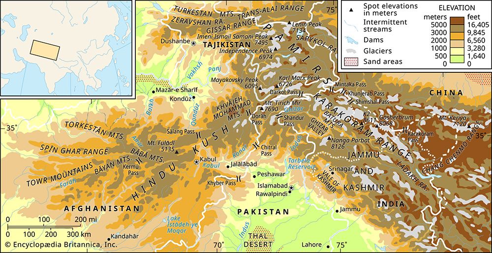
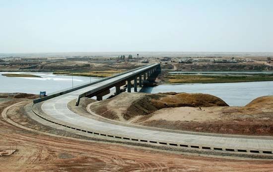
The Panj River holds significant geopolitical importance as it serves as a natural international boundary between Afghanistan and Tajikistan.
What is the significance of the Panj River in terms of international borders?
The Panj River holds significant geopolitical importance as it serves as a natural international boundary between Afghanistan and Tajikistan.1
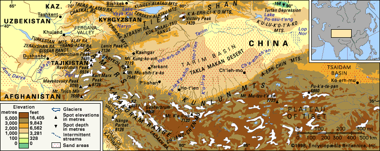
Stretching 700 miles (1,125 km), the river is formed by the junction of the Vākhān and Pamir rivers, situated between the Hindu Kush and the Pamir Mountains. Beyond its role as a border, the river is a vital headstream of the Amu Darya, sustained primarily by snowmelt and glaciers from the surrounding high-altitude mountain ranges in Central Asia.1
What historical or cultural importance does the Panj River hold for the region?
The Panj River holds significant historical and cultural importance as a defining feature of the Pamir region, serving as a natural boundary and a corridor for human activity.
Historical Context
The river valleys of the region, including those draining into the Panj, have long been integral to the broader history of Central Asia. Historically, the area was traversed by branches of the Silk Road, facilitating cultural and economic exchange between East and West. By the 19th century, the river became a focal point for the “Great Game,” as British and Russian empires sought to establish stable physiographic boundaries between their respective territories, eventually leading to the creation of the Afghanistan buffer state.2
Cultural and Regional Significance
- Settlement and Demographics: The river banks host key southwestern centers such as Khorog and Qalaikhum. These areas are home to Mountain Tajiks, who maintain distinct cultural identities, including the practice of Ismāʿīlī Shīʿite Islam and the use of eastern Iranian languages.3
- Economic Life: The valleys of the western Pamirs, fed by the Panj, have historically supported agriculture, including orchards of apples, pears, and apricots, as well as grain cultivation.3
- Modern Connectivity: The river corridor remains vital for regional infrastructure, with frontier roads supporting both local communities and military presence.3
How long is the Panj River, and what are its major tributaries?
The Panj River is 700 miles (1,125 km) long. It is formed by the junction of two primary headstreams:1
The river flows through the border region of Afghanistan and Tajikistan before joining the Vakhsh River to form the Amu Darya.1
Please note that the Panj River should not be confused with the Panjnad River in Pakistan, which is a separate waterway formed by the confluence of five different rivers.5
Where is the Panj River located, and which countries does it flow through?
The Panj River is located in Central Asia, situated between the Hindu Kush and the Pamir Mountains.
It serves as a natural border, flowing between Afghanistan and Tajikistan for its entire 700-mile (1,125 km) course. The river originates from the junction of the Vākhān and Pamir rivers along this border and eventually joins the Vakhsh River to form the Amu Darya.1
Sources
- Panj River — Encyclopædia Britannica
- Pamirs — Encyclopædia Britannica
- Pamirs - Study and exploration — Encyclopædia Britannica
- Pamirs - People and the economy — Encyclopædia Britannica
- Panjnad River — Encyclopædia Britannica
Published on · 2 min read