Pánuco River
The Pánuco River is a vital waterway in east-central Mexico, serving as a critical engine for regional economic development and environmental management.…
What is the historical significance of the Pánuco River in Mexican culture and development?
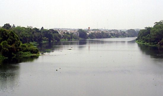
The Pánuco River is a vital waterway in east-central Mexico, serving as a critical engine for regional economic development and environmental management. Formed by the junction of the Moctezuma and Tamuín rivers, the system drains the interior plateau, including the Basin of Mexico, via a complex network of tunnels and channels.12
Its historical and economic significance includes:
- Agricultural Support: The river’s waters are essential for irrigating the fertile La Huasteca lowlands, supporting dense agricultural settlement in Veracruz state.12
- Energy and Industry: The river is central to the petroleum industry. The port of Tampico, located near the river’s mouth, became a global hub for oil exports due to its proximity to productive fields like Ebano and Pánuco. Barges transport oil along the river, and the Chijol Canal further connects these resources to regional markets.3
- Strategic Importance: Historically, the river and its port have been focal points for military and political events, including colonial-era conflicts, the Mexican War, and the 1914 U.S. occupation of Veracruz.3
Where is the Pánuco River located in Mexico, and what are its major tributaries?
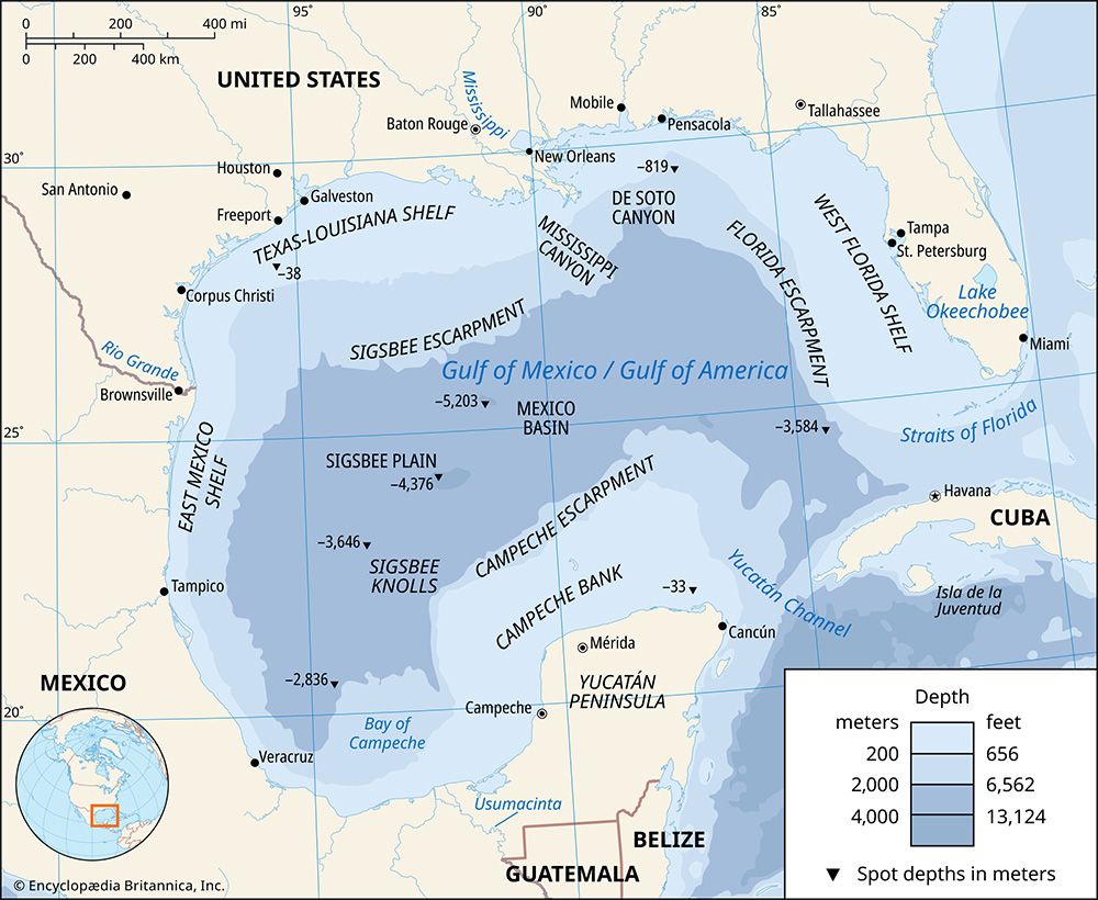
The Pánuco River is located in east-central Mexico, primarily flowing through the state of Veracruz. It originates at the border of San Luis Potosí and Veracruz and flows east-northeast, eventually emptying into the Gulf of Mexico near the city of Tampico.1
The river is formed by the junction of two major rivers:
- Moctezuma River: Flows from the mountains in southern Querétaro state.1
- Tamuín River: Formed by the Santa María River, which descends from the Sierra Madre Oriental after rising in the inland plateau near San Luis Potosí.1
Additionally, the Pánuco is joined by the Tamesí River just upstream from Tampico, which serves as the border between the states of Veracruz and Tamaulipas.1
How has the Pánuco River been used for transportation and trade historically and in modern times?
The Pánuco River has served as a critical artery for trade and transportation in Mexico, particularly through its connection to the port of Tampico.
Historical and Modern Trade
Historically, the river acted as an outlet for the fertile but underdeveloped hinterland. Its economic profile shifted dramatically in the early 20th century with the rapid exploitation of regional petroleum resources. Tampico became one of the world’s leading oil ports, utilizing the river to facilitate the movement of goods from nearby fields like Ebano and Pánuco. Today, the river remains essential for industrial logistics, with fleets of barges transporting oil from upstream locations to the coast.12
Infrastructure and Navigation
- Navigability: The lower course of the Pánuco is navigable, allowing the port of Tampico to accommodate ocean-going vessels.1
- Chijol Canal: Begun in 1901, this 75-mile (120-km) waterway connects the river southward through the oil fields to Tuxpan, providing a vital inland route for transport.2
- Port Facilities: Tampico features modern port infrastructure, including warehouses and specialized equipment for loading oil tankers, supported by integrated railway connections.2
What is the length of the Pánuco River and how does it compare to other major rivers in Mexico?
The Pánuco River system, including its principal headstream, the Santa María, has a total length of 316 miles (508 km).1
While the Pánuco is a significant waterway for the Mesa Central and the Gulf of Mexico drainage, it is one of several major river systems in Mexico. Other notable rivers include:
- Río Bravo del Norte (Rio Grande): The most important river in the arid north, serving as a lengthy international border.5
- Grijalva-Usumacinta System: Located in the southeast, this system, along with the Papaloapan River, accounts for approximately two-fifths of the total volume of all Mexican rivers.5
- Lerma-Santiago System: This system originates in the Toluca Basin and flows westward, eventually passing through Lake Chapala, the country’s largest natural lake.5
- Balsas River: A major source of hydroelectric power that drains the Balsas Depression and parts of the southern Mesa Central.5
Sources
- Pánuco River — Encyclopædia Britannica
- Tampico — Encyclopædia Britannica
- Pánuco — Merriam-Webster
- Sierra Madre - Economy — Encyclopædia Britannica
- Mexico - Drainage of Mexico — Encyclopædia Britannica
Published on · 3 min read