Paraná Plateau
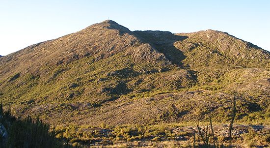
The Paraná Plateau is one of the world’s largest lava plateaus, located primarily in southern Brazil. As a component of the Brazilian Highlands, it spans the…
What is Paraná Plateau?
The Paraná Plateau is one of the world’s largest lava plateaus, located primarily in southern Brazil. As a component of the Brazilian Highlands, it spans the states of Rio Grande do Sul, São Paulo, Santa Catarina, and Paraná, with geological formations extending into Uruguay, Argentina, and Paraguay.1
The plateau is characterized by flat-topped surfaces dissected by rivers and is composed of solidified sheets of lava rock known as diabase. Where this rock is exposed, it weathers into a fertile, dark purple soil called terra roxa. This soil is highly valued for agriculture, supporting the production of coffee, cotton, corn, rice, beans, and potatoes.1
What is terra roxa soil and why is it important for farming?
Terra roxa is a deep, nutrient-rich, reddish-purple soil found primarily in the Southeast and South of Brazil, spanning regions between central Rio Grande do Sul and southern Minas Gerais. This soil is formed through the weathering of diabase, a type of solidified lava rock found on the Paraná Plateau.31
The importance of terra roxa for farming lies in its physical and chemical properties, which make it highly suitable for a variety of crops. It is well-drained and contains significant nutrients, supporting the cultivation of:
- Coffee: The soil is famously associated with large-scale coffee production.1
- Other Crops: It supports the growth of cotton, corn, rice, beans (feijão), and potatoes.1
While this soil is found in some of Brazil’s most heavily farmed areas, it is not necessarily more productive than all other soil types in the country; rather, its agricultural success is tied to its location and favorable composition.3
How do lava plateaus form over time?
Lava plateaus, also known as flood basalts or traps, form when extensive volcanic eruptions bury preexisting terrain under thick layers of lava and volcanic ash. These formations are typically associated with hot spots, where upwelling hot material from the asthenosphere melts through the lithosphere.56
The process involves the following characteristics:
- Eruption Style: Unlike typical volcanic edifices, these plateaus are often built by fluid basaltic lava erupting from long fissure vents. Because the lava is highly fluid, it can travel long distances from its source, creating a broad, relatively flat surface rather than a single mountain.57
- Scale and Thickness: The resulting volcanic rock can reach thicknesses of tens to hundreds of meters. Over time, these surfaces may become incised by canyons and valleys.5
- Geological Context: These eruptions are rare and often occur during major tectonic events, such as the rifting of continents. For example, the Paraná and Karoo basalts were produced during the opening of the South Atlantic Ocean.68
What is the significance of the Itaipu Dam on the Parana River?
The Itaipu Dam is a monumental hydroelectric project located on the Alto (Upper) Paraná River at the border of Brazil and Paraguay. Its significance is defined by several key factors:
- Power Generation: As one of the world’s largest hydroelectric projects, it features 20 massive turbine generators capable of producing 14,000 megawatts of electricity. It serves as a critical energy source for both nations, allowing Paraguay to become one of the world’s largest exporters of electricity.92
- Engineering Scale: Completed in 1982, the dam is a massive hollow gravity structure standing 196 meters (643 feet) high. The complex of dams and spillways spans nearly 8 km (5 miles), and its reservoir covers approximately 870 square miles.92
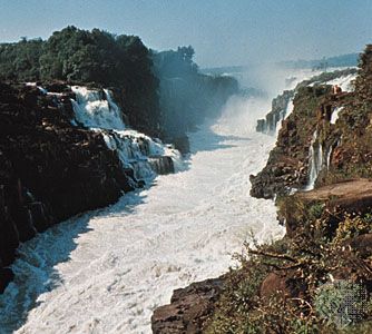
- Environmental Impact: The creation of the reservoir resulted in the total submersion of the formerly spectacular Guaíra Falls.910
- Geopolitical Cooperation: Built as a joint venture, the dam has been central to the economic relationship between Brazil and Paraguay, leading to significant historical negotiations regarding energy pricing and distribution.92
Sources
- Paraná Plateau — Encyclopædia Britannica
- Paraná River — Encyclopædia Britannica
- Brazil - Soils — Encyclopædia Britannica
- South America - Soils — Encyclopædia Britannica
- plateau - Formative processes — Encyclopædia Britannica
- plateau - Geographic distribution — Encyclopædia Britannica
- volcano - Fissure vents — Encyclopædia Britannica
- igneous rock - Flood basalts — Encyclopædia Britannica
- Itaipú Dam — Encyclopædia Britannica
- Paraguay - Energy — Encyclopædia Britannica
Published on · 3 min read