Nevado Illimani
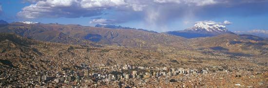
Nevado Illimani is a prominent snowcapped mountain peak located just south of La Paz, the administrative capital of Bolivia.
What is Nevado Illimani?
Nevado Illimani is a prominent snowcapped mountain peak located just south of La Paz, the administrative capital of Bolivia.1
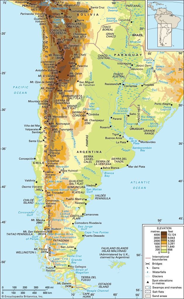
Rising to an elevation of 21,004 feet (6,402 metres), the mountain overlooks the city and serves as a significant feature of the Cordillera Real. The Cordillera Real is a major mountain system in Bolivia that separates the Amazon River basin lowlands to the east from the high plateaus of the Altiplano to the west.12
What is the Altiplano plateau?
The Altiplano is a vast, high-altitude plateau located in the Andes Mountains, spanning parts of western Bolivia and southeastern Peru. Stretching approximately 600 miles (965 km) in length, it is one of the world’s largest interior basins, characterized by a series of intermontane basins situated at elevations typically between 11,200 and 12,800 feet (3,400 to 3,900 metres) above sea level.34
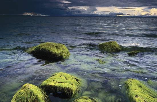
The region is bounded by two major mountain ranges: the Cordillera Occidental to the west and the Cordillera Oriental to the east. It contains significant hydrological features, most notably Lake Titicaca in the north, which drains into the smaller Lake Poopó via the Desaguadero River. The southern portion of the plateau is drier and features extensive salt flats, such as the Uyuni and Coipasa salars. While the north supports agriculture and dense human settlement, the south is more desolate but rich in mineral resources like tin, copper, and silver.34
How does the Cordillera Real influence Bolivia’s climate?
The Cordillera Real acts as a critical climatic barrier in Bolivia, effectively separating the country into distinct environmental zones by influencing moisture distribution and temperature patterns.25
- Moisture Barrier: The range serves as a significant divide between the arid high-altitude Altiplano to the west and the humid, tropical lowlands of the Amazon River basin to the east.25
- Precipitation Patterns: The eastern slopes of the Cordillera Real are exposed to moisture-laden air masses, resulting in heavy rainfall that feeds the rivers cutting through the rugged terrain of the Yungas region of the Yungas region. This creates a precipitous transition from high, snowcapped peaks to a lush, heavily forested belt.54
- Temperature and Elevation: As a high-elevation system with peaks exceeding 20,000 feet, the range maintains a permanent snow line, which influences local temperatures and supports glacial systems. The varying elevations—from the high intermontane valleys to the lower, warmer valleys—create diverse microclimates that support varied agricultural practices.542
What are the major mountain ranges in South America?
South America features several significant mountain ranges and highland regions that define its diverse topography:
- The Andes Mountains: This is the continent’s most prominent mountain system, forming an unbroken rampart that stretches approximately 5,500 miles (8,900 km) along the western edge of South America. The Andes are not a single chain but a complex series of parallel ranges, or cordilleras, interspersed with high plateaus like the Altiplano. The system contains the highest peaks in the Western Hemisphere, including Mount Aconcagua8.6
- Brazilian Highlands: Located in central and southeastern Brazil, this eroded plateau region covers more than half of the country’s landmass. It is characterized by low mountains, hilly uplands, and tabular plateaus, such as the Mato Grosso Plateau and Paraná Plateau.7
- Guiana Highlands: Situated north of the Amazon River and south of the Orinoco River, this region spans parts of Venezuela, Guyana, Brazil, and Colombia. It is geologically similar to the Brazilian Highlands and features tabular plateaus, including Mount Roraima6.8
- Sierra Nevada de Santa Marta: Located in northern Colombia along the Caribbean coast, this is a distinct mountain range known for its rich biodiversity and historical significance, including the ancient site of Teyuna.910
Sources
- Nevado Illimani — Encyclopædia Britannica
- Cordillera Real — Encyclopædia Britannica
- Altiplano — Encyclopædia Britannica
- Andes Mountains - Physiography of the Central Andes — Encyclopædia Britannica
- Bolivia - Relief — Encyclopædia Britannica
- Brazilian Highlands — Encyclopædia Britannica
- mountain - The Andes — Encyclopædia Britannica
- Andes Mountains — Encyclopædia Britannica
- Guiana Highlands — Encyclopædia Britannica
- South America - Factors influencing climate — Encyclopædia Britannica
- Sierra Nevada de Santa Marta — Merriam-Webster
- South America - Climate — Encyclopædia Britannica
- Santa Marta — Encyclopædia Britannica
Published on · 3 min read