Paricutín
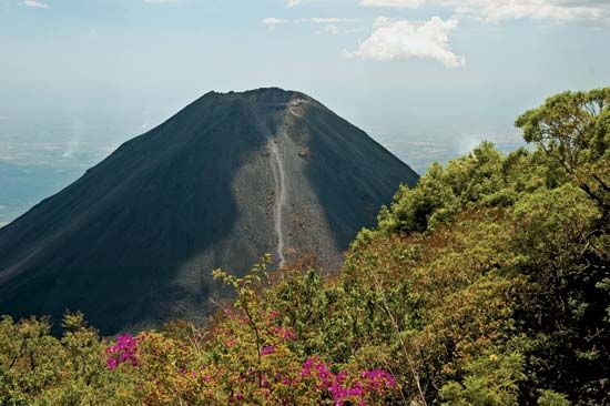
Parícutin is a cinder cone volcano, a type of volcanic landform created by the accumulation of pyroclastic rock fragments and cinders around a vent. It is…
What type of volcano is Paricutín, and how does it compare to other volcanoes in Mexico?
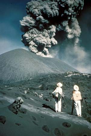
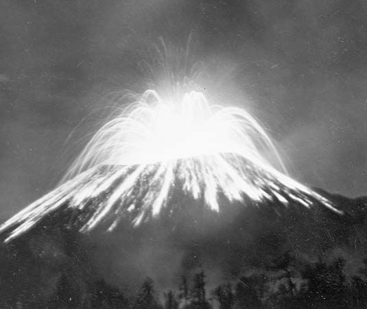
Parícutin is a cinder cone volcano, a type of volcanic landform created by the accumulation of pyroclastic rock fragments and cinders around a vent. It is famous for its rapid formation, having emerged from an open field in 1943 and grown to a height of 9,210 feet (2,808 meters) by the time its eruptions ceased in 1952.123
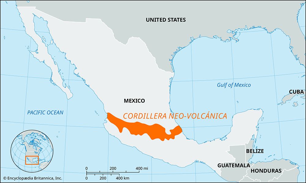
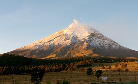
In contrast to the massive, long-standing peaks found in Mexico’s Cordillera Neo-Volcánica, such as the stratovolcanoes Popocatépetl or Pico de Orizaba, Parícutin is a relatively young and smaller-scale feature. While the major peaks of the Cordillera reach elevations exceeding 13,000 to 18,000 feet, Parícutin represents the explosive, localized activity typical of cinder cones, which are distinct from the complex, high-altitude volcanic structures that dominate much of the Mexican landscape.342
What geological features characterize the landscape around Paricutín volcano?
The landscape surrounding Parícutin is defined by its location within a volcanic field, a region characterized by numerous geologically young cinder cones and lava flows.
Key geological features of this area include:
- Volcanic Clusters: The region contains dozens of prehistoric but geologically young cinder cones, reflecting a landscape where magma conduits are scattered over a broad area rather than concentrated in a single, long-lived vent.2
- Cinder Cone Morphology: The cones in this field typically feature conical hills with bowl-shaped craters at the summit. These structures are often surprisingly enduring because their highly permeable material allows rainwater to sink into the ground rather than eroding the slopes.1
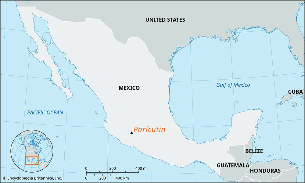
- Proximity to Major Peaks: Parícutin is situated just north of the Tancítaro Peak, highlighting the contrast between the smaller, short-lived cinder cones and the larger, more complex volcanic structures in the vicinity.62
- Eruption Deposits: The immediate area is marked by the remnants of the 1943–1952 eruption, including extensive ash and lava deposits that buried local villages, such as the partially preserved church of San Juan Parangaricutiro.67
How long did Paricutín’s eruption last, and what were its different phases?
The eruption of Parícutin lasted for nine years, spanning from 1943 to 1952.2
The eruption progressed through several notable stages:
- Precursor Activity: The event was preceded by several weeks of earthquakes before the initial eruption began on February 20, 1943, in an open field.2
- Initial Growth: During the first year, the cinder cone grew rapidly, rising 1,475 feet (450 meters) from its base and burying the village of Parícutin.2
- Continued Expansion: The volcano continued to eject ash and lava throughout its active period, eventually reaching a peak elevation of 9,210 feet (2,808 meters) by 1952.2
- Cessation: The eruptions concluded in 1952, at which point the volcano became dormant.2
While the eruption caused significant displacement and the loss of homes and farmland, no direct deaths were recorded.2
How has tourism been affected by the presence of Paricutín volcano?
The presence of Parícutin has transformed the landscape into a significant geological landmark and a popular destination for tourism in the state of Michoacán, Mexico.26
While the 1943–1952 eruption caused widespread displacement and the destruction of local villages, the site has since become a major attraction for visitors interested in its unique history and volcanic formation. Key aspects of tourism at the site include:26
- Historical Landmarks: The partially buried church of San Juan Parangaricutiro, which survived the lava flows that engulfed the surrounding village, serves as a primary focal point for tourists.26
- Geological Interest: As one of the youngest volcanoes on Earth, Parícutin draws those interested in observing the remnants of its rapid emergence from an open field.26
- Regional Integration: The volcano is frequently visited in conjunction with other nearby natural attractions, such as the Barranca del Cupatitzio National Park, which is known for its scenic trails and waterfalls.6
Sources
- cinder cone — Encyclopædia Britannica
- Paricutín — Encyclopædia Britannica
- Cordillera Neo-Volcánica — Encyclopædia Britannica
- volcano - Major types — Encyclopædia Britannica
- Paricutín — Merriam-Webster
- Uruapan: Top Questions — Encyclopædia Britannica
- volcano - Volcanic fields — Encyclopædia Britannica
Published on · 3 min read