Plain of Esdraelon
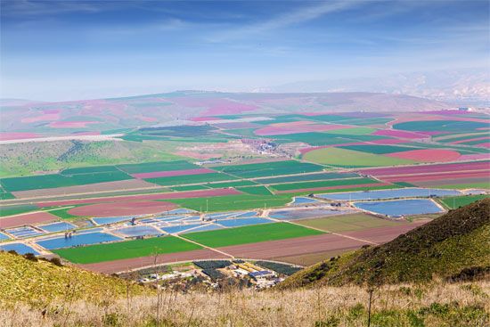
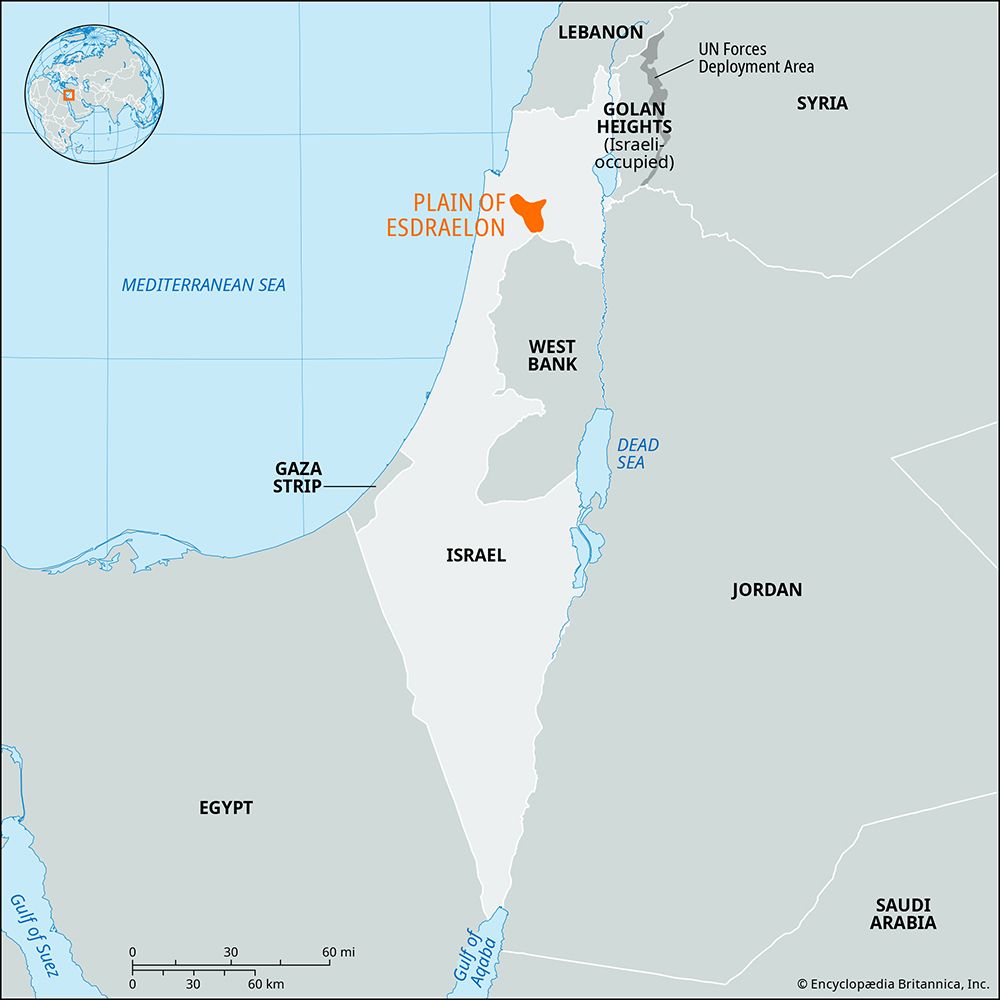
The Plain of Esdraelon (also known as the Jezreel Valley) is a lowland region in northern Israel formed by massive dislocation and block faulting.
What is the geographical location and extent of the Plain of Esdraelon in Israel?
The Plain of Esdraelon (also known as the Jezreel Valley) is a lowland region in northern Israel formed by massive dislocation and block faulting.12
Geographical Location The plain is oriented northwest-southeast, serving as a divider between the hilly regions of Galilee to the north and the mountains of Samaria to the south. Its boundaries include:12
- Northeast: The hills of Lower Galilee.1
- South and West: The Samarian hills and the Carmel ridge.1
- Southeast: An opening toward the Bet She’an valley.1
Extent The plain is roughly triangular in shape, with its apex located in the northwest. It spans approximately 25 miles (40 km) in length from its northwestern apex to the mountains of Gilboa and the Bet She’an valley. At its widest point, the plain measures about 16 miles (26 km) across.12
What is the geological formation of the Plain of Esdraelon, and how does it affect the region’s fertility?
The Plain of Esdraelon, also known as the Jezreel Valley, was formed through massive geological block faulting and subsequent subsidence1. This tectonic activity created a lowland depression that serves as a natural corridor between the hills of Galilee and Samaria.1
Regarding the region’s fertility, the Hebrew name Yizre’el—meaning “God will sow” or “May God make fruitful”—alludes to the area’s inherent agricultural potential. However, for many centuries, the plain suffered from poor natural drainage, which turned large portions of the land into sparsely inhabited swampland.1
The modern fertility of the region is a result of human intervention rather than purely geological factors. Following the lifting of land restrictions in 1920, extensive efforts were made to drain the swamps. Today, the area is highly productive, utilizing intensive agriculture supported by the Qishon River and local water management systems.13
How has the Plain of Esdraelon been important in biblical narratives?
The Plain of Esdraelon, also known as the Valley of Jezreel, holds significant importance in biblical narratives, primarily as a strategic corridor for commerce and a frequent site of military conflict.356
Key biblical events associated with the region include:
- The Victory of Deborah and Barak: The Israelites, led by the judge Deborah and her commander Barak, defeated the Canaanite forces of King Jabin and his general Sisera near the Kishon River. A timely cloudburst flooded the river, neutralizing the Canaanite chariots.5
- Gideon’s Campaign: The judge Gideon assembled his forces in the valley to defeat the Midianites and Amalekites, who had been pillaging the region.56
- The Death of King Saul: On the slopes of Mount Gilboa, overlooking the plain, King Saul and his son Jonathan were slain during a battle against the Philistines.36
- Symbolism of Megiddo: The city of Megiddo, which overlooks the plain, is the namesake for Armageddon (derived from Har Megiddo, or “Hill of Megiddo”). In apocalyptic literature, it is identified as the site for the final battle between the forces of good and evil.156
What are some of the major cities or settlements located in or near the Plain of Esdraelon?
The Plain of Esdraelon, also known as the Valley of Jezreel, features several notable urban centers and historical settlements that have evolved significantly over the last century.
Principal Urban Center
- ’Afula: This is the largest and principal urban center of the region. Founded in 1925, it serves as a hub for the plain, housing the regional hospital, a teachers’ college, and various industrial facilities, including textile mills and sugar-refining plants.19
Historical and Modern Settlements
- Megiddo: Located at the northwest edge of the plain, this is an ancient site founded in the 4th millennium BCE. It has served as a strategic location for military conflicts throughout history and remains a significant archaeological site.1
- Jezreel: An ancient city situated on a spur of Mount Gilboa, it served as a capital for the northern kingdom of Israel under King Ahab. Its historical significance is tied to various biblical narratives, including the death of King Saul.310
- Nahalal: Established in 1921, this was the first smallholder’s cooperative (moshav) founded in the region following the British mandate’s land reclamation efforts.1
- ’En Harod: Founded in 1921, this was the first large kibbutz established on the plain, representing the shift toward intensive agricultural settlement in the area.1
- Merhavya: Recognized as the first Jewish settlement established on the plain, founded in 1911.1
Sources
- Plain of Esdraelon — Encyclopædia Britannica
- Palestine - Land — Encyclopædia Britannica
- Jezreel — Encyclopædia Britannica
- Israel - Drainage — Encyclopædia Britannica
- Megiddo — Encyclopædia Britannica
- biblical literature - The roles of Deborah, Gideon, and Jephthah — Encyclopædia Britannica
- Jezreel, Valley of — Merriam-Webster
- Esdraelon, Plain of — Merriam-Webster
- ʿAfula — Encyclopædia Britannica
- Jezreel — Merriam-Webster
- Jerusalem - City layout — Encyclopædia Britannica
- Hula Valley — Encyclopædia Britannica
Published on · 3 min read