South China Sea
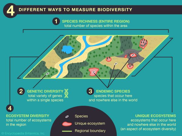
The South China Sea is a vital marine region characterized by high biological productivity and significant marine biodiversity. Its ecological richness is…
What role does the South China Sea play in regional ecosystems and marine biodiversity?
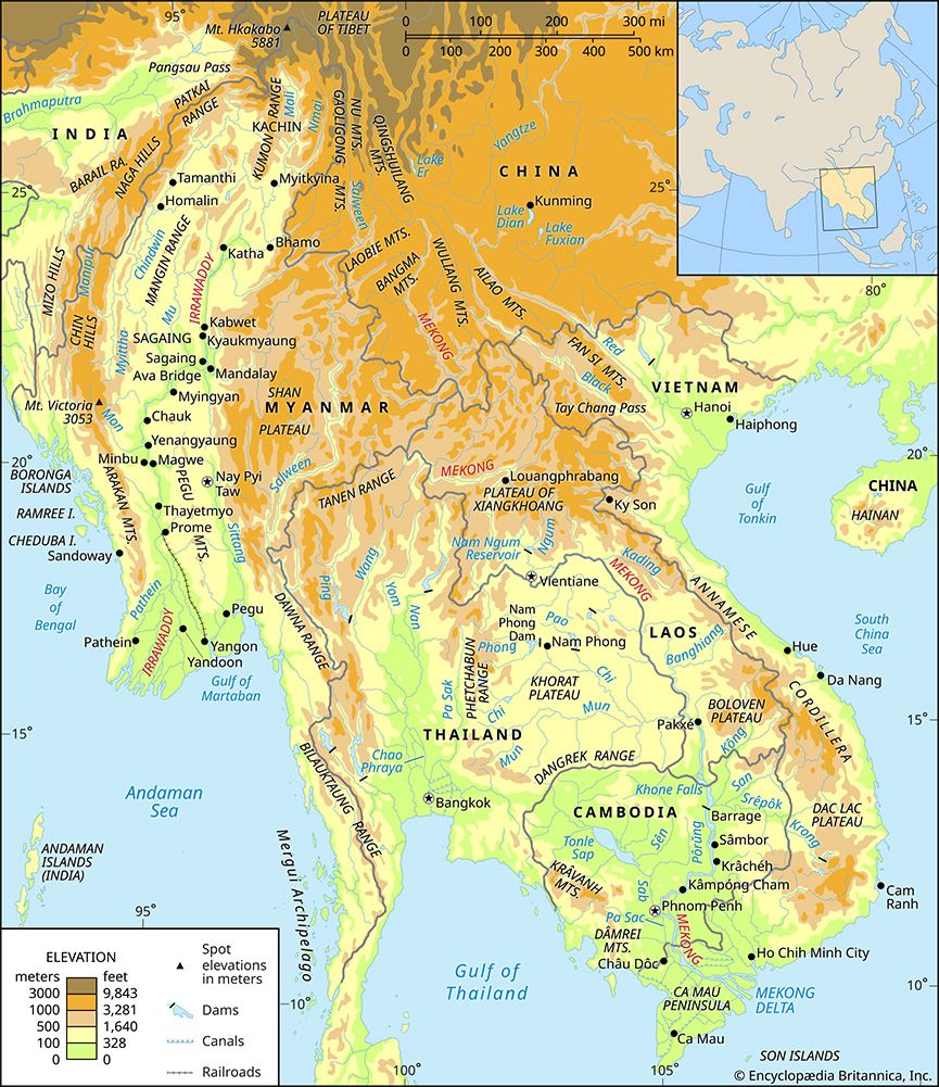
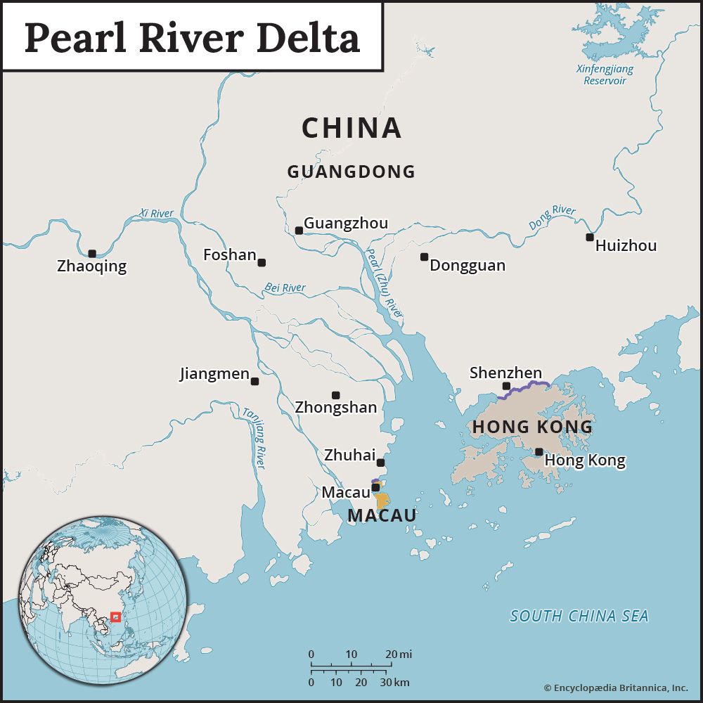
The South China Sea is a vital marine region characterized by high biological productivity and significant marine biodiversity. Its ecological richness is primarily driven by two factors: the extensive runoff of nutrient-laden waters from major rivers, such as the Mekong and the Pearl River, and the occurrence of upwelling areas, particularly off the coast of central Vietnam, which bring nutrient-rich, colder water to the surface.1
These conditions support a diverse array of marine life, including numerous species of tuna, mackerel, anchovy, and shellfish, which serve as a critical source of protein for the surrounding populations. The region also features complex habitats, including coral reefs and atolls, which provide essential shelter and breeding grounds for aquatic species. Furthermore, parts of the southern South China Sea are ecologically linked to the Coral Triangle, a global center of marine diversity that hosts a vast majority of the world’s coral and reef fish species.12
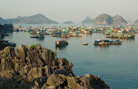
What are the geographical boundaries and key features of the South China Sea?
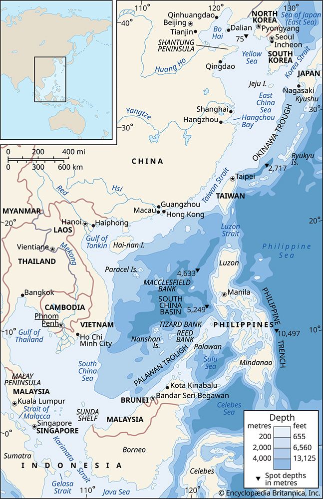
The South China Sea is the largest marginal sea of the western Pacific Ocean, covering approximately 1,423,000 square miles (3,685,000 square km) with a mean depth of 3,976 feet (1,212 meters).2
Geographical Boundaries
The sea is bounded by the following regions:
- North: The Asian mainland and the coast of Fujian province, China.2
- Northeast: The Taiwan Strait, which connects it to the East China Sea the East China Sea.1
- East: Taiwan and the Philippines.2
- Southeast and South: Borneo, the Gulf of Thailand, and the Malay Peninsula.2
- West: The Southeast Asian mainland.2
Key Features
- Physiography: The sea features a deep, rhombus-shaped basin known as the China Sea Basin, which reaches a maximum depth of 16,457 feet (5,016 meters). The region includes the Sunda Shelf in the south and extensive continental shelf areas in the northwest.2
- Land Features: Notable features include the Paracel Islands, Spratly Islands, and Scarborough Shoal.4
- Climate and Hydrology: The climate is tropical, governed by monsoons that dictate surface currents and seasonal wind patterns.2
- Economic Importance: The region contains vital global shipping lanes and significant reserves of crude oil and natural gas.42
How does the South China Sea impact global trade and maritime routes?
The South China Sea serves as one of the world’s most critical arteries for global commerce. By forming a primary transport route between the Pacific Ocean and the Indian Ocean via the Strait of Malacca, the region facilitates the movement of vast quantities of goods and energy resources.25
Key impacts on global trade include:
- Economic Volume: The sea carries a massive share of international trade. A 2017 study by ChinaPower estimated that approximately $3.4 trillion in trade passed through these waters in 2016, accounting for roughly one-fifth of global trade.1
- Resource Transit: The shipping lanes are vital for the movement of energy and raw materials; generally, crude oil and minerals are transported northward, while food and manufactured goods move southward.5
- Strategic Importance: Beyond transit, the seabed itself has become a focus for economic activity, with undersea explorations uncovering reserves of natural gas and oil, though the scale and rights to these resources remain subjects of intense international dispute.15
How has the United Nations Convention on the Law of the Sea (UNCLOS) influenced territorial claims in the South China Sea?
The United Nations Convention on the Law of the Sea (UNCLOS) serves as the primary legal framework for maritime boundaries, establishing that coastal states may claim an exclusive economic zone (EEZ) extending 200 nautical miles from their shores. In the South China Sea, UNCLOS has become the central point of contention between established international law and China’s expansive territorial assertions.467
Influence on Territorial Claims
- Invalidation of Historical Claims: China and Taiwan base their claims to roughly 90 percent of the sea on a “9-dash line,” which they argue represents “historical waters”. However, in a 2016 ruling by an arbitral tribunal, the court determined that these historical claims are superseded by UNCLOS boundaries, effectively invalidating the legal basis of the 9-dash line.78
- EEZ Conflicts: Several Southeast Asian nations, including the Philippines, Vietnam, and Malaysia, utilize UNCLOS to assert their sovereign rights to resources within their respective 200-nautical-mile EEZs. China’s activities, such as land reclamation and the deployment of fishing fleets within these zones, have been ruled unlawful under UNCLOS provisions.798
- Arbitration and Compliance: While the 2016 tribunal ruled largely in favor of the Philippines, China rejected the court’s jurisdiction and the resulting award, maintaining its presence in disputed areas like Scarborough Shoal.98
We could dive deeper into the specific mechanisms of international arbitration or the broader geopolitical implications of these maritime disputes.
Sources
- South China Sea — Encyclopædia Britannica
- territorial disputes in the South China Sea - Physiography and economic factors — Encyclopædia Britannica
- Coral Triangle — Encyclopædia Britannica
- territorial disputes in the South China Sea — Encyclopædia Britannica
- China Sea — Encyclopædia Britannica
- exclusive economic zone — Encyclopædia Britannica
- Law of the Sea — Encyclopædia Britannica
- Scarborough Shoal — Encyclopædia Britannica
- territorial disputes in the South China Sea - Early 21st-century developments — Encyclopædia Britannica
Published on · 4 min read