Ramu River
The Ramu River in Papua New Guinea is fed by numerous streams that drain the surrounding mountain ranges, specifically the Bismarck Range to the south and…
What are the major tributaries of the Ramu River?
The Ramu River in Papua New Guinea is fed by numerous streams that drain the surrounding mountain ranges, specifically the Bismarck Range to the south and the Finisterre and Adelbert ranges to the north.1
The river’s principal tributary is the Sogeram River, which joins the Ramu in its swampy, lower course before it empties into the Bismarck Sea.1
How does the Ramu River compare to other major rivers in Papua New Guinea?
The Ramu River is one of the longest rivers in Papua New Guinea, spanning approximately 450 miles (720 km). When compared to other major waterways in the region, such as the Sepik River, several distinctions emerge:
- Length and Scale: At 450 miles, the Ramu is significantly shorter than the Sepik, which stretches about 700 miles (1,100 km) and drains a vast area of 30,000 square miles.
- Navigability: Unlike the Sepik, which is navigable for over 300 miles by larger vessels and 550 miles by canoe, the Ramu is generally considered unnavigable.
- Geography and Flow: Both rivers flow through the great Central Depression of New Guinea and empty into the Bismarck Sea. The mouth of the Ramu is located just 20 miles southeast of the Sepik’s mouth.
- Human Impact: The Ramu is notable for the Yonki hydroelectric project, which provides essential electricity to the highlands, whereas the Sepik is primarily recognized for the unique artistic traditions of the isolated tribal groups living along its banks.
Are there any important cultural or historical sites along the Ramu River?
While the Ramu River is not primarily defined by major historical monuments, its lower reaches are culturally significant due to their proximity to the Sepik River basin.
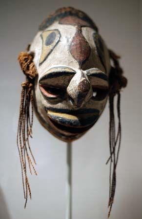
The artistic traditions of the region, often categorized under the Sepik River style, extend into the adjacent areas of the lower Ramu. These traditions are renowned for their highly developed ornamentation of household and cult objects, weapons, musical instruments, and architecture. Notable features of this artistic heritage include:
- Sculpture and Masks: Characterized by a distinctive hooked or beaked style, often featuring elongated noses.
- Ceremonial Practices: A unique tradition of modeling faces in clay over human skulls.
- Architecture: The construction of high-gabled houses featuring elaborately decorated house posts.
While the Ramu itself is characterized more by its industrial infrastructure—such as the Yonki hydroelectric project—the river serves as a corridor for these rich, indigenous cultural expressions.
Are there any significant industrial or agricultural projects associated with the Ramu River?
The Ramu River plays a vital role in the infrastructure of Papua New Guinea, most notably through the Yonki hydroelectric project located on its upper course.
This significant industrial development includes:
- Dam and Reservoir: The project features a 200-foot (60-meter) high dam that impounds a reservoir to manage water flow.
- Power Generation: A power-generating station is situated 700 feet (210 meters) underground near the town of Kainantu.
- Regional Impact: This facility is essential for the region, as it supplies electricity to a large portion of the highlands.
While the river’s basin supports various settlements such as Dumpu, Bundi, and Atemble, the primary industrial focus remains the hydroelectric capacity provided by the upper reaches of the river. Information regarding large-scale agricultural projects specifically associated with the river is not detailed in the current knowledge base.
Sources
- Ramu River — Encyclopædia Britannica
- list of rivers - Oceania (Pacific region) — Encyclopædia Britannica
- Papua - Geography — Encyclopædia Britannica
- Sepik River — Encyclopædia Britannica
Published on · 2 min read