Rangitata River
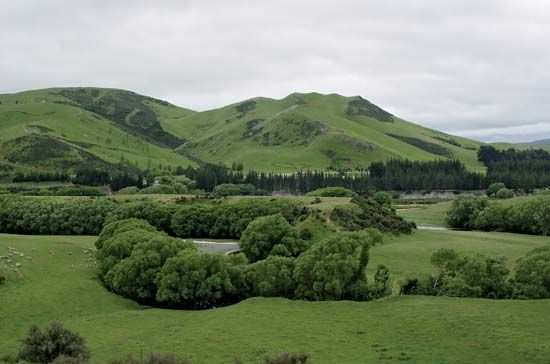
The Rangitata River is a river located in the east-central region of New Zealand's South Island. Formed by the confluence of the Clyde and Havelock rivers in…
What is Rangitata River?
The Rangitata River is a river located in the east-central region of New Zealand’s South Island. Formed by the confluence of the Clyde and Havelock rivers in the Southern Alps, its name is of Māori origin and translates to “low sky.”1
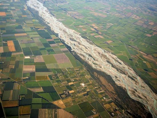
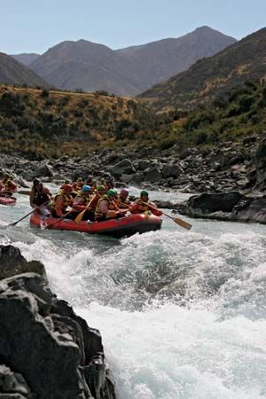
The river flows southeast for 75 miles (121 km) through the Rangitata Gorge and across the Canterbury Plains before emptying into the Pacific Ocean at the Canterbury Bight. In its lower reaches, the river is characterized by braided channels that are typically too shallow for navigation, though they may unite during floods. A notable feature of the river is a diversion canal at the mouth of the Rangitata Gorge, which transports water to Highbank on the Rakaia River to support irrigation and the generation of hydroelectric power.12
What are braided rivers and how do they form?
Braided channels are river systems characterized by a network of small, subdivided channels separated by midstream bars composed of sand or gravel. These rivers typically exhibit weak banks, a very high width-depth ratio (sometimes exceeding 1,000:1), and highly mobile bed material.3
Formation and Characteristics
Braided rivers form primarily in response to high sediment loads and fluctuating water discharge. They are frequently found near the edges of land ice and on outwash plains, such as the Canterbury Plains in New Zealand. Key factors in their development include:43
- Sediment Supply: Rivers draining meltwater from glaciers often carry large quantities of coarse sediment, which promotes the formation of bars.34
- Water Discharge: Fluctuations in water volume—often driven by seasonal or diurnal meltwater cycles—cause the river to shift and redistribute sediment.4
- Channel Efficiency: Because the subdivided channels are smaller than a single main channel, they are less efficient at transporting sediment. If a channel becomes too inefficient, it may downcut, causing the bar to stabilize and become vegetated.3
During high-water stages, these bars may be completely submerged, but they reappear as water levels drop.3
How do the Southern Alps influence New Zealand’s geography?
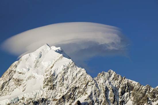
The Southern Alps (Kā Tiritiri o te Moana) are a 300-mile-long mountain chain that fundamentally shapes the geography and climate of New Zealand’s South Island.6
Climatic Influence
The range acts as a significant climatic barrier, bisecting the island and creating sharp contrasts between the west and east. Because the mountains lie across the path of prevailing westerly and northwesterly winds, they force air upward, resulting in extremely high precipitation on the western slopes—up to 250 inches annually. Conversely, the eastern side experiences a much drier climate, and the foehn effect—a warm, dry wind—often occurs in the lee of the mountains, leading to low humidity.7
Physical and Economic Impact
- Topography: The mountains contain New Zealand’s highest peaks, including Aoraki/Mount Cook, and feature an extensive system of over 360 glaciers.6
- Landscape Formation: Swift, snow-fed rivers drain from the range, building extensive alluvial features like the Canterbury Plains in the east, which contrast with the precipitous slopes of the Westland region.68
- Energy: The steep terrain and glacial runoff provide significant potential for hydroelectric power, with numerous stations established on rivers such as the Waitaki.8
What is the importance of the Canterbury Plains for agriculture?
The Canterbury Plains represent the largest low-lying farm district in New Zealand, serving as a vital hub for the country’s agricultural output since organized settlement began in the 1850s.10
Agricultural Significance
The region is highly conducive to intensive farming due to its flat topography, which facilitates mechanized agriculture. Key agricultural activities include:
- Crops: The plains are well-suited for the production of grains, pasture seed, and various fodder crops.10
- Livestock: The area is historically significant for fat-lamb raising, a practice that dates back to the introduction of merino sheep in the 19th century.10
- Diversified Farming: Near the urban center of Christchurch, the region supports dairy, poultry, and fruit and vegetable farming.10
Environmental Factors
The productivity of the plains is supported by specific soil characteristics and management techniques. The area is largely defined by yellow-gray earths, which are partially podzolized. Because the region experiences relatively low mean annual rainfall—typically less than 30 inches—irrigation plays a critical role in maintaining agricultural yields, particularly in areas around Ashburton.1110
Sources
- Rangitata River — Encyclopædia Britannica
- Rakaia River — Encyclopædia Britannica
- river - Braided channels — Encyclopædia Britannica
- Pleistocene Epoch - Fluvial environments — Encyclopædia Britannica
- Waimakariri River — Encyclopædia Britannica
- New Zealand - Relief of New Zealand — Encyclopædia Britannica
- Southern Alps/Kā Tiritiri o te Moana — Encyclopædia Britannica
- New Zealand - Climate — Encyclopædia Britannica
- Alps - Geology — Encyclopædia Britannica
- Canterbury Plains — Encyclopædia Britannica
- New Zealand - Soils of New Zealand — Encyclopædia Britannica
- Origins of agriculture - Irrigation — Encyclopædia Britannica
Published on · 3 min read