River Suir
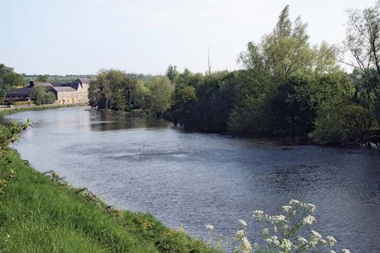
The River Suir is a significant river in Ireland, spanning 114 miles (183 km) in length. It originates in the Devil’s Bit Mountains and flows south through…
What is River Suir?
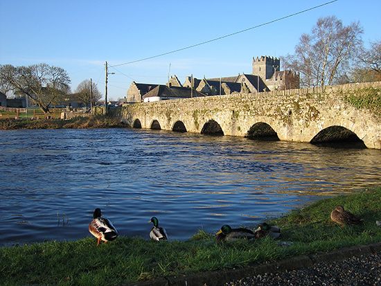
The River Suir is a significant river in Ireland, spanning 114 miles (183 km) in length. It originates in the Devil’s Bit Mountains and flows south through County Tipperary, passing through the town of Thurles.1
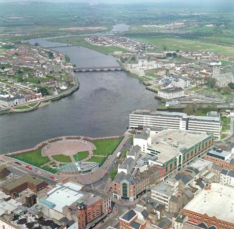
The river follows a winding path, receiving the Tar River before looping around the western edge of the Comeragh Mountains. It then travels through a west-east valley, reaching its tidal limit at Carrick-on-Suir. Navigable to Clonmel since the 1760s, the river eventually broadens into an estuary, passing through Waterford. Near the end of its course, the Suir joins the River Barrow and the River Nore, with all three emptying into the wide estuarine bay known as Waterford Harbour. The Suir is recognized as one of the major rivers in the southeast of Ireland, contributing to the country’s extensive drainage system.123
What are the Three Sisters rivers in Ireland?
The “Three Sisters” is a collective term for three major rivers in southeastern Ireland—the River Suir, the River Barrow, and the River Nore—that converge before emptying into the sea.
These rivers are geographically linked by their shared destination:
- River Suir: Rising in the Devil’s Bit Mountains, it flows 114 miles (183 km) through County Tipperary and Waterford.1
- River Barrow: Originating in the Slieve Bloom Mountains, it travels approximately 120 miles (190 km) through the Irish midlands and southeast.4
- River Nore: This river joins the Barrow before the combined flow meets the Suir.14
Together, these rivers flow into the wide estuarine bay known as Waterford Harbour, which serves as a vital maritime gateway for the region.15
How do rivers contribute to Ireland’s landscape and drainage?
Rivers play a fundamental role in shaping Ireland’s landscape and managing its water resources. The country’s drainage patterns are largely defined by its geography, which features a broad, undulating central plain ringed by coastal highlands.3
Drainage Patterns
The behavior of Irish rivers is dictated by their location:
- Coastal Rivers: Rivers rising on the seaward side of the coastal mountain fringe are typically short and rapid.6
- Inland Rivers: These streams flow more sluggishly, often traversing marshes and lakes before reaching the sea. Notable examples include the River Shannon, which drains a vast area of the central lowland, and the River Liffey, which follows a course established in preglacial times.67
- Underground Drainage: Due to the porosity of the underlying Carboniferous limestone, an extensive underground drainage system has developed, which feeds the surface network of rivers and lakes.6
Landscape Influence and Management
Ireland’s scenery has been significantly influenced by glaciation, which carved out major valleys and left behind diverse features like drumlins and marshy hollows. To optimize land use, the government has implemented arterial drainage projects to prevent flooding and improve water flow, effectively lowering lake levels to make more land available for cultivation. Additionally, state-aided farm-drainage schemes help bring marginal land into production.836
What is the difference between a river source and an estuary?
The primary difference between a river source and an estuary lies in their roles at opposite ends of a river’s course.
River Source
The source (or riverhead) is the point of origin where a stream of water begins its journey. It is the generative starting point from which the river flows, often originating from springs or other natural water-gathering features.1112
Estuary
An estuary is a partially enclosed coastal body of water found at the downstream end of a river, where the river meets the sea. Unlike the source, which is characterized by fresh water, an estuary is defined by the mixing of river water with seawater. This environment is marked by fluctuating salinity levels caused by the interaction of tidal flow and river discharge. While the source is the beginning of the river’s path, the estuary serves as a biologically productive transition zone where the river system terminates into the ocean.1314
Sources
- River Suir — Encyclopædia Britannica
- River Barrow — Encyclopædia Britannica
- Ireland - Drainage of Ireland — Encyclopædia Britannica
- Waterford — Encyclopædia Britannica
- Waterford: Top Questions — Encyclopædia Britannica
- Northern Ireland - Drainage — Encyclopædia Britannica
- Ireland - Relief — Encyclopædia Britannica
- Pleistocene Epoch - Fluvial environments — Encyclopædia Britannica
- River Liffey — Encyclopædia Britannica
- river - Non-fluvial invasion and deposition — Encyclopædia Britannica
- estuary — Merriam-Webster
- estuary — Encyclopædia Britannica
- river - Origin and classification — Encyclopædia Britannica
- riverhead — Merriam-Webster
- source — Merriam-Webster
- river - Estuaries — Encyclopædia Britannica
Published on · 3 min read