Roanoke River
The Roanoke River rises in the Appalachian Valley in Montgomery County, southwestern Virginia. It flows in a southeasterly direction for approximately 380…
Where does the Roanoke River originate, and where does it end?
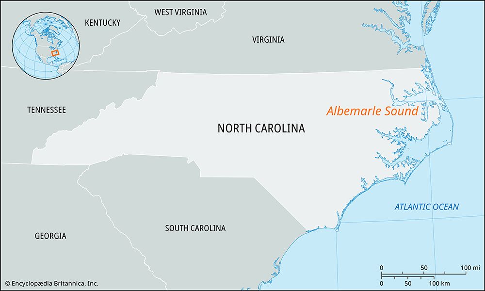
The Roanoke River rises in the Appalachian Valley in Montgomery County, southwestern Virginia. It flows in a southeasterly direction for approximately 380 miles (612 km) before emptying into the Albemarle Sound on the Atlantic coast of North Carolina.12
What are the major cities or towns located along the Roanoke River?
Several cities and towns are situated along the Roanoke River as it flows from Virginia into North Carolina:
- Roanoke, Virginia: Located in the southwestern part of the state, this city lies directly on the river at the southern end of the Shenandoah Valley.13
- Clarksville, Virginia: Situated upstream from the John H. Kerr Dam.1
- Weldon, North Carolina: Located near the Fall Line, this town marks the limit of navigability for small craft on the river.1
- Roanoke Rapids, North Carolina: Positioned near the Roanoke Rapids Dam.1
- Plymouth, North Carolina: Located 6 miles above the river’s mouth, this town is accessible to ships with a draft of up to 12 feet.1
What is the total length of the Roanoke River and which states does it flow through?
The Roanoke River has a total length of approximately 380 miles (612 km). It flows through two states: Virginia, where it originates in the Appalachian Valley in Montgomery County, and North Carolina, where it eventually empties into the Albemarle Sound on the Atlantic coast.12
What are some of the major tributaries of the Roanoke River?
The Dan River is the principal tributary of the Roanoke River. It joins the Roanoke just north of the Virginia–North Carolina border.1
Sources
- Roanoke River — Encyclopædia Britannica
- Roanoke — Merriam-Webster
- Roanoke — Encyclopædia Britannica
Published on · 1 min read