Saluda River
The Saluda River is a 145-mile-long waterway in west-central South Carolina. It originates in the Blue Ridge Mountains as North and South forks, which…
What is Saluda River?
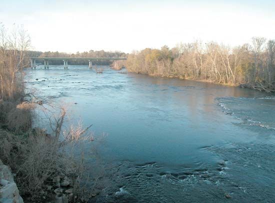
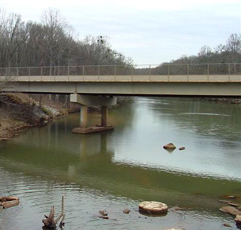
The Saluda River is a 145-mile-long waterway in west-central South Carolina. It originates in the Blue Ridge Mountains as North and South forks, which converge northwest of Greenville. The river flows southeast, eventually joining the Broad River at Columbia to form the Congaree River.12
The river is significant for its role in hydroelectric power generation, facilitated by the Saluda Dam, which creates Lake Murray, and the Buzzard Roost Dam, which creates Lake Greenwood. Its name is derived from an Algonquian-speaking tribe that inhabited the area in the 1670s, and it is believed to mean “river of corn”.1
How does a hydroelectric dam generate electricity?
A hydroelectric dam generates electricity by converting the potential energy of stored water into mechanical energy and finally into electricityscience/mechanical-energy) and finally into electricity.6
The process follows these key steps:
- Water Storage and Head: Water is collected at a higher elevation behind a dam. The vertical distance between this reservoir and the lower water level is known as the head, which determines the potential power available.45
- Conveyance: The water is directed downward through large pipes or tunnels called penstocks toward the powerhouse.4
- Turbine Rotation: As the water exits the penstocks, its force causes turbines to rotate. This movement converts the water’s energy into mechanical energy.45
- Generation: The rotating turbines drive generators, which transform the mechanical energy into electricity.4
- Transmission: Transformers increase the voltage of the generated electricity to make it suitable for long-distance transmission across the power grid.4
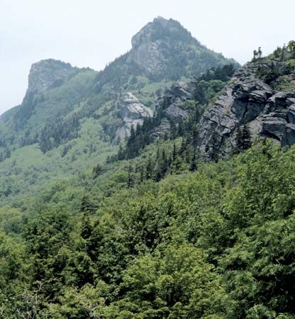
What are the characteristics of the Blue Ridge Mountains?
The Blue Ridge Mountains are a prominent segment of the Appalachian Mountains in the United States, stretching 615 miles from Pennsylvania to Georgia. This relatively narrow range, typically 5 to 65 miles wide, features average elevations between 2,000 and 4,000 feet. It contains the highest elevations in the Appalachian system, including Mount Mitchell, which at 6,684 feet is the highest peak east of the Mississippi River.910
Key characteristics include:
- Geology: The range consists of complex metamorphic and igneous rocks. On its eastern side, it descends in a dramatic escarpment to the Piedmont region.10
- Topography: The landscape is intricately dissected by streams, with major rivers like the Roanoke, James, and Potomac cutting gaps through the ridge.9
- Ecology: The region hosts hardwood forests with over 700 catalogued varieties of trees and plants, and is protected within several national forests and parks, such as Shenandoah National Park.9
- Culture: The area is renowned for its traditional, folk, and bluegrass music.9
How do rivers like the Congaree form from smaller tributaries?
Rivers like the Congaree River form through a process known as a confluence, where two or more smaller streams or tributaries merge to create a larger trunk stream. In the case of the Congaree, it is formed by the meeting of the Broad and Saluda rivers at Columbia, South Carolina.11
The development of such river systems is often driven by the competitive nature of drainage basins. Over time, streams compete for territory, and through a process called stream capture, a more powerful stream may divert the headwaters of a weaker one, increasing its own discharge and capacity for downcutting. These networks typically develop as water follows the path of least resistance, often dictated by the structural and lithologic characteristics of the landscape. As these channels collect water and sediment from their surrounding drainage basins, they evolve into the complex river systems that shape the Earth’s surface.121314
Sources
- Saluda River — Encyclopædia Britannica
- Saluda — Encyclopædia Britannica
- Broad River — Encyclopædia Britannica
- Did you know? — Merriam-Webster
- dam - Rise of environmental and economic concerns — Encyclopædia Britannica
- hydroelectric power — Encyclopædia Britannica
- turbine — Encyclopædia Britannica
- turbine - Output and speed control — Encyclopædia Britannica
- Blue Ridge — Encyclopædia Britannica
- United States - The Appalachian Mountain system — Encyclopædia Britannica
- Congaree River — Encyclopædia Britannica
- Earth - The hydrosphere — Encyclopædia Britannica
- river - Drainage diversion by stream capture — Encyclopædia Britannica
- drainage basin — Encyclopædia Britannica
- river - Braided channels — Encyclopædia Britannica
- river - Morphology of deltas — Encyclopædia Britannica
- confluent — Merriam-Webster
- piedmont — Encyclopædia Britannica
- confluents — Merriam-Webster
Published on · 3 min read