Sénégal River
Historically, the Sénégal River served as a vital transportation artery for trade in goods such as slaves, gum, gold, skins, ivory, beeswax, and ostrich…
How has the construction of dams affected the Sénégal River and its surrounding environment?
How do people use the Sénégal River for transportation and trade?
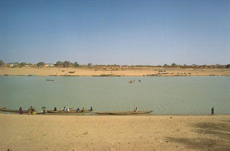
Historically, the Sénégal River served as a vital transportation artery for trade in goods such as slaves, gum, gold, skins, ivory, beeswax, and ostrich feathers. However, its significance as a major trade route declined significantly after the completion of a railway from Kayes, Mali, to Dakar in 1923, which diverted much of the traffic away from the river.12
Today, the river’s role in transportation is primarily local. Shallow-draft boats carry traffic between Saint-Louis and Kayes, while most active river transport plies between the Mauritanian ports of Rosso, Bogué, and Kaédi. Infrastructure such as minor ferries and a dry-season causeway at Kayes also facilitate movement across the river.1
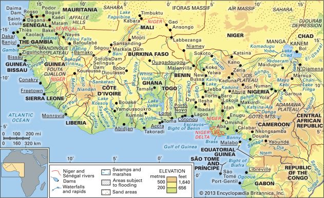
Navigation has been supported in the late 20th century by the construction of the Diama Dam and the Manantali Dam, which have helped improve water management and facilitate river transit.12
What are some of the major cities or towns located along the Sénégal River?
Several significant cities and towns are situated along the Sénégal River, serving as important hubs for trade, agriculture, and transportation. These urban centers include:
- Saint-Louis, Senegal: Located in the river’s estuary near the Atlantic coast, this historic city was founded in 1659. It is the oldest colonial city on the western African coast and serves as a key river-rail transfer point for the valley’s trade.516
- Kayes, Mali: Situated in western Mali, Kayes acts as the terminus for river traffic and is a vital stop on the Mali Railway. It has long been an important center for the region’s agricultural economy.75
- Rosso, Mauritania: A thriving urban center on the Mauritanian bank that facilitates local river transport and serves as a significant crossing point.58
- Bogué and Kaédi, Mauritania: These towns are also located along the river and have developed into important urban centers, particularly as hubs for local river traffic and regional trade.58
- Richard-Toll, Senegal: Located at the head of the delta, this town is known for its proximity to large-scale irrigation projects and agricultural development.59
- Bakel, Senegal: Positioned where the Falémé River joins the Sénégal, this town is situated in a densely populated and agriculturally productive area of the river valley.510
What is the length of the Sénégal River, and what are its major tributaries?
The Sénégal River has a total length of 1,020 miles (1,641 km).12
The river is formed by the confluence of three primary headstreams:
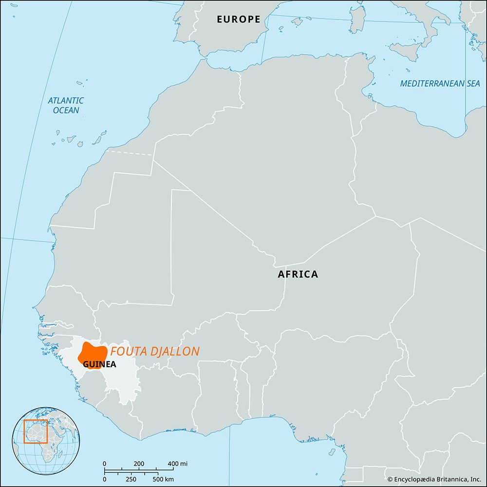
- Bafing River: Rising in the Fouta Djallon highlands of Guinea, it merges with the Bakoye River at Bafoulabé, Mali, to form the main stem of the Sénégal River.1312
- Bakoye River: Originating in western Mali, it joins the Bafing River at Bafoulabé.1012
- Falémé River: Also rising in the Fouta Djallon plateau of Guinea, this stream joins the Sénégal River further downstream near the town of Bakel, Senegal.12
Sources
- Sénégal River — Encyclopædia Britannica
- Senegal - Transportation and telecommunications — Encyclopædia Britannica
- Senegal - Agriculture, forestry, and fishing — Encyclopædia Britannica
- Senegal - Manufacturing of Senegal — Encyclopædia Britannica
- Kayes — Encyclopædia Britannica
- Saint-Louis — Encyclopædia Britannica
- Senegal - Urban settlement — Encyclopædia Britannica
- Senegal - Traditional geographic areas — Encyclopædia Britannica
- Mauritania - Settlement patterns — Encyclopædia Britannica
- Senegal - Drainage — Encyclopædia Britannica
- Dakar — Encyclopædia Britannica
- Bafing River — Encyclopædia Britannica
- Bakoye River — Encyclopædia Britannica
Published on · 2 min read