Oti River
The Oti River is a river in West Africa that spans approximately 320 miles (520 km) in length. It rises in the southern plains of Burkina Faso and meanders…
What is Oti River?
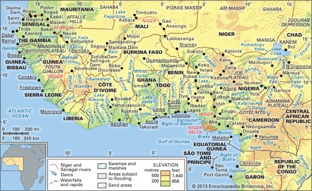
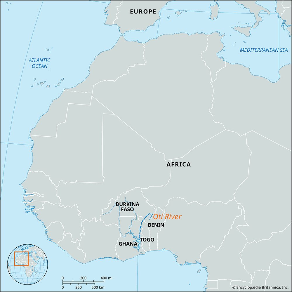
The Oti River is a river in West Africa that spans approximately 320 miles (520 km) in length. It rises in the southern plains of Burkina Faso and meanders southward through the region.1
The river’s course includes the following:
- It flows briefly along the border between Togo and Benin.1
- It cuts south-southwest across northern Togo.1
- It forms the border between Ghana and Togo for about 60 miles (100 km).1
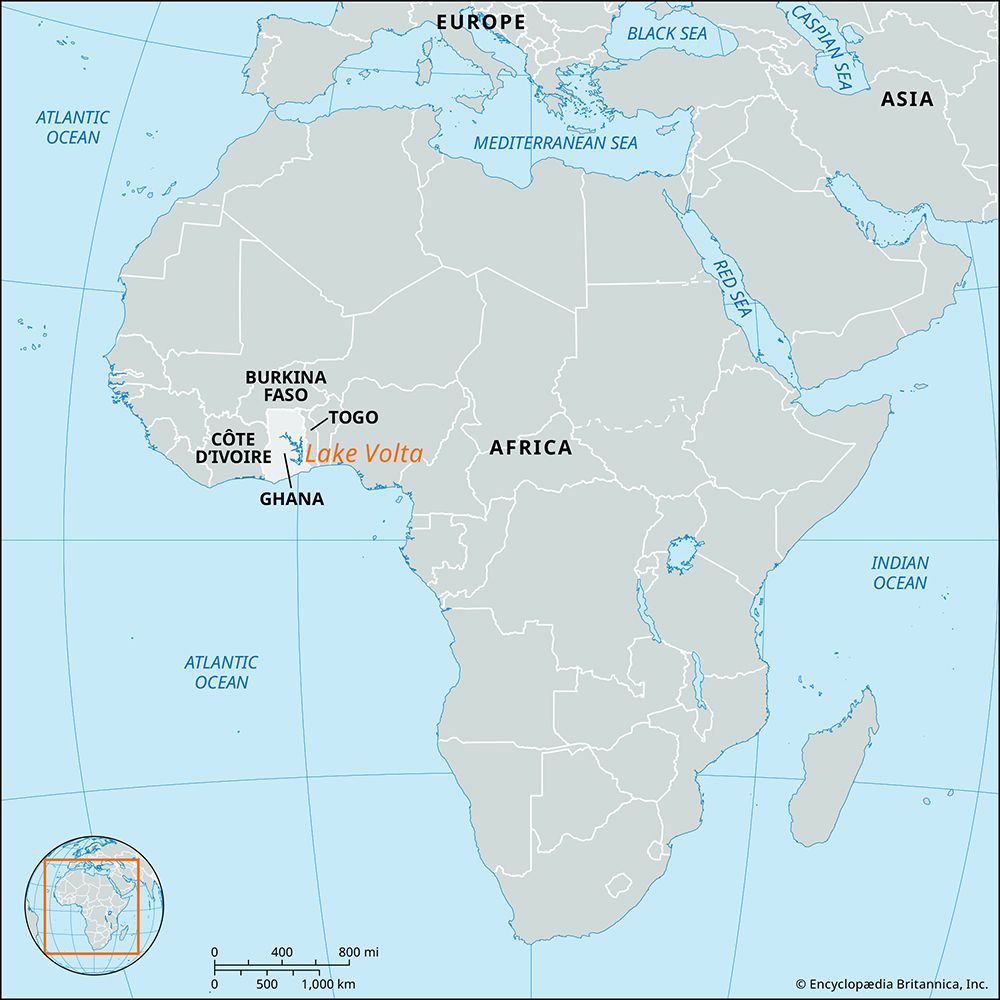
- It continues through Ghana before emptying into Lake Volta, which was created by the damming of the Volta River.1
The river basin sits at an elevation of approximately 500 feet (150 meters) above sea level, and its major riparian towns include Mango in Togo and Nambiri in Ghana. Historically, the Oti may have functioned as a tributary of the Niger River.1
How was Lake Volta created and why is it important?
Lake Volta is an artificial reservoir in Ghana created by the construction of the Akosombo Dam. Work on the dam began in 1961 and was completed in 1965, impounding the Volta River to form one of the largest artificial lakes in the world.34
The lake is vital to Ghana’s economy and infrastructure for several reasons:
- Energy: The dam provides significant hydroelectric power, currently generating over 1,000 megawatts, which supplies the majority of Ghana’s electricity and allows for exports to neighboring countries.34
- Transportation: The lake is navigable, offering a cost-effective route that connects the country’s northern savanna regions to the coast.3
- Agriculture and Industry: It serves as a major fishing ground and provides essential irrigation for farmland, particularly in the Accra Plains.34
However, the creation of the lake had profound human and environmental costs, including the displacement of approximately 80,000 people and the disruption of natural flood cycles that previously enriched agricultural soil.34
What are some other major river systems in West Africa?
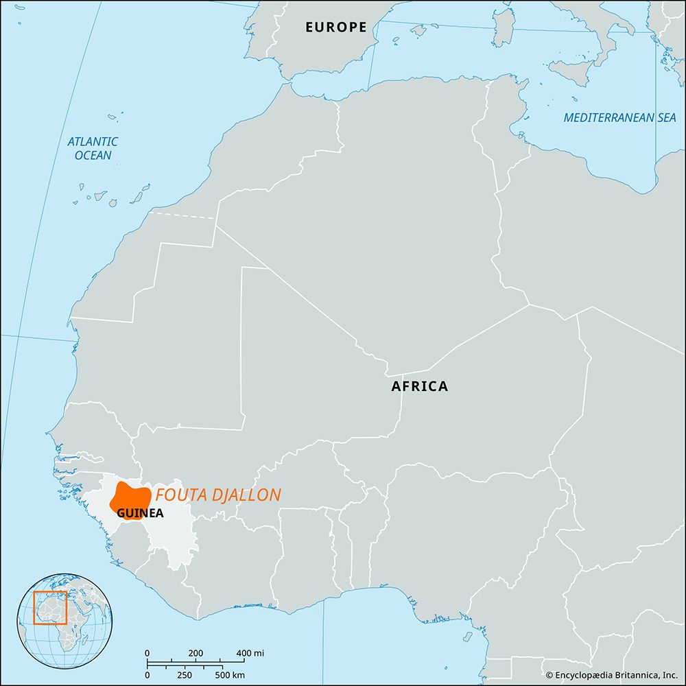
West Africa is home to several significant river systems that are essential for transportation, agriculture, and regional development. Many of these rivers originate in the Fouta Djallon highlands of Guinea, which serves as a vital watershed for the region.5
Key river systems include:
- Niger River: As the principal river of West Africa and the third-longest in Africa, it spans 2,600 miles (4,200 km). It flows in a great arc through Guinea, Mali, Niger, and Nigeria before reaching the Gulf of Guinea via a massive delta. It is a critical artery for navigation and irrigation across diverse climatic zones.678
- Sénégal River: Formed by the confluence of the Bafing and Bakoye rivers, it flows northward into Mali before turning toward the Atlantic. It has historically served as a primary route to the interior and remains essential for the agricultural economies of the countries along its banks.59
- Gambia River: Stretching 700 miles (1,120 km), it is one of the most navigable rivers in Africa and is uniquely accessible to oceangoing shipping. It acts as a unifying geographic feature for the state of The Gambia.10
These rivers are subject to monsoonal climatic regimes, characterized by distinct wet and dry seasons that influence their flow and utility for human settlement.911
How do rivers like the Oti influence the geography of Burkina Faso, Togo, and Ghana?
The Oti River serves as a significant geographic link between Burkina Faso, Togo, and Ghana. Rising in the southern plains of Burkina Faso, the river acts as a natural drainage feature that cuts across the landscape, eventually flowing southward to join the Volta River system.112
Its influence on the geography of these nations includes:
- Boundary Definition: The river plays a role in regional demarcation, notably forming a portion of the border between Togo and Benin, as well as a 60-mile stretch of the border between Togo and Ghana.1
- Hydrological Integration: As a major tributary of the Volta, the Oti contributes to the drainage basin that feeds Lake Volta, one of the world’s largest artificial reservoirs. This system is central to the hydrology of the region, particularly in Ghana.113
- Seasonal Dynamics: Like other rivers in the region, the Oti experiences great seasonal variation in flow, which dictates the agricultural and environmental conditions of the surrounding areas, often leaving riverbeds dry during the peak of the dry season.12
We could dive deeper into how these seasonal river patterns affect local agriculture or explore the broader impact of the Volta basin on West African development.
Sources
- Oti River — Encyclopædia Britannica
- list of rivers - Africa — Encyclopædia Britannica
- Lake Volta — Encyclopædia Britannica
- Akosombo Dam — Encyclopædia Britannica
- Gambia River — Encyclopædia Britannica
- Niger River - Physiography — Encyclopædia Britannica
- Niger River — Encyclopædia Britannica
- Senegal - Drainage — Encyclopædia Britannica
- Guinea - Drainage and soils — Encyclopædia Britannica
- Africa - Water resources — Encyclopædia Britannica
- Africa - Surface water — Encyclopædia Britannica
- Volta River — Encyclopædia Britannica
- Burkina Faso - Relief, drainage, and soils — Encyclopædia Britannica
Published on · 3 min read