Shashi River
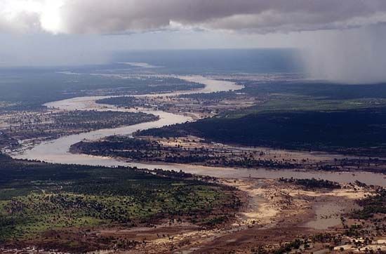
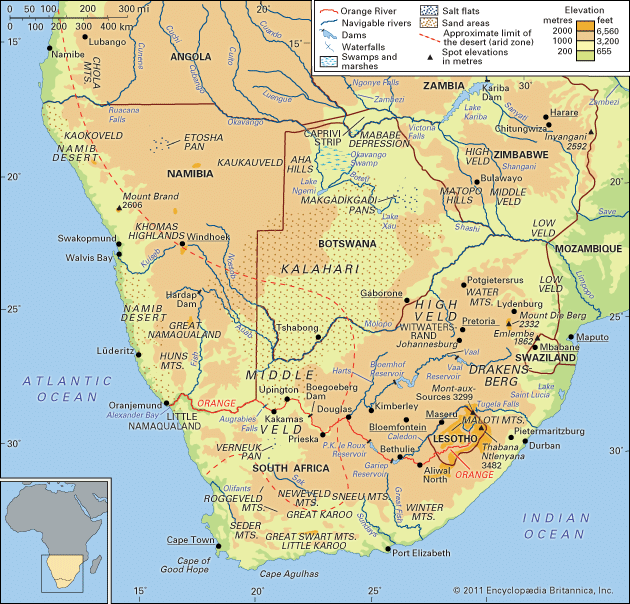
The Shashi River is a river located in southeastern Africa that originates on the border between Botswana and Zimbabwe.
What is Shashi River?
The Shashi River is a river located in southeastern Africa that originates on the border between Botswana and Zimbabwe.1
The river flows in a southward direction, passing by Francistown, Botswana. It then continues southeast, tracing the border between Botswana and Zimbabwe for approximately 225 miles (362 km) before reaching its confluence with the Limpopo River.12
What other major rivers flow through Southern Africa?
Southern Africa is home to several significant river systems that are vital to the region’s ecology and economy. Because rainfall is often limited, these rivers are essential for irrigation, hydroelectric power, and water supply.34
Major rivers in the region include:
- Zambezi River: As the fourth-largest river basin in Africa, the Zambezi flows eastward for approximately 2,200 miles to the Indian Ocean. It is famous for Victoria Falls and major hydroelectric projects like the Kariba and Cahora Bassa dams.56
- Orange River: Rising in the Lesotho Highlands, this river flows westward for about 1,300 miles to the Atlantic Ocean. It serves as a critical water source for South Africa and forms part of the border between South Africa and Namibia.32
- Limpopo River: This river follows a semicircular course through southeast Africa, eventually emptying into the Indian Ocean. It is fed by various tributaries, including the Olifants River and the Shashi River.27
- Tugela River: Located in South Africa, it is the largest river by volume in the country, draining much of the KwaZulu-Natal region.2
How do seasonal changes affect rivers like the Shashi?
Seasonal changes significantly influence rivers in southern Africa, including the Shashi River, primarily through rainfall patterns. In this region, most rivers are ephemeral, meaning they typically do not flow aboveground except during the summer rainy season.1
The flow of these rivers is directly tied to seasonal precipitation; during the dry season, groundwater contributions are generally minimal. In arid and semiarid environments, rivers can behave like arroyos, which are dry channels subject to flash flooding during irregular or seasonal storms. These events can cause rapid erosion and sediment deposition.89
Furthermore, high temperatures in the region lead to significant evaporation, which can drastically reduce water levels and the effectiveness of storage reservoirs. While some major systems are modified by dams or natural storage in lakes and swamps, many smaller rivers in Botswana and surrounding areas remain highly sensitive to these climatic fluctuations.1081
What is the historical significance of the Limpopo River?
The Limpopo River has served as a vital artery for human civilization and commerce in Southern Africa for centuries. Its historical significance is defined by its role as a gateway for international trade and the development of early urban societies.
Early Trade and Economic Development
By the 8th century, the Limpopo River valley emerged as a crucial trade route connecting the interior of Southern Africa to the Indian Ocean trading network. African intermediaries used the river to transport goods such as ivory, animal skins, copper, and gold to coastal settlements established by Arab traders. The presence of foreign artifacts, including Persian potsherds and glass beads at sites like Schroda, confirms the region’s early integration into global trade systems.212
Rise of Urban Centers
The valley was the setting for the development of Mapungubwe and Bambandyanalo, which became South Africa’s first urban centers during the 11th century. Mapungubwe grew into a sophisticated town of approximately 10,000 people, characterized by clear social stratification, where an elite class resided on a central hilltop and possessed lavish burial goods, including gold artifacts. These centers eventually declined in the 13th century, with trade influence shifting north to Great Zimbabwe.2
European Exploration
In the modern era, the river became a focal point for European exploration. Vasco da Gama first sighted the river in 1498, naming it the Espiritu Santo River. Later, in the 19th century, explorers such as St. Vincent Whitshed Erskine and Captain J.F. Elton mapped its lower and middle courses.13
Sources
- Shashi River — Encyclopædia Britannica
- Limpopo River — Encyclopædia Britannica
- Zambezi River — Encyclopædia Britannica
- Zambezi River - Physiography — Encyclopædia Britannica
- Orange River — Encyclopædia Britannica
- South Africa - Drainage — Encyclopædia Britannica
- Africa - Surface water — Encyclopædia Britannica
- arroyo — Encyclopædia Britannica
- Africa - Water resources — Encyclopædia Britannica
- Orange River - Climate and hydrology — Encyclopædia Britannica
- Botswana - Drainage — Encyclopædia Britannica
- South Africa - First urban centers — Encyclopædia Britannica
- Limpopo — Encyclopædia Britannica
- Southern Africa - Swahili culture — Encyclopædia Britannica
Published on · 3 min read