Somme River
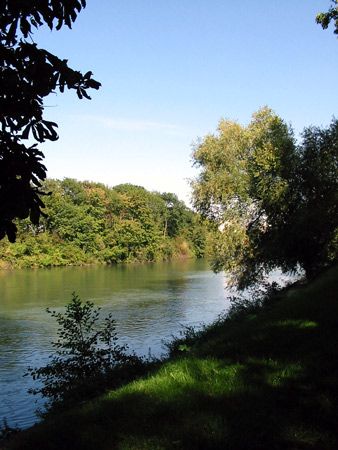
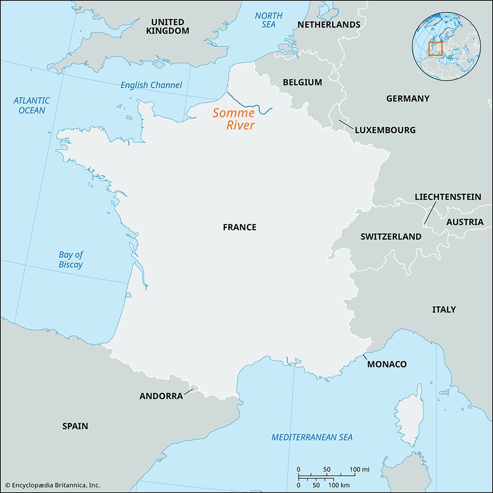
The Somme River is a 152-mile (245-km) river in northern France that flows westward from its source near Saint-Quentin to the English Channel. Its name…
What is Somme River?
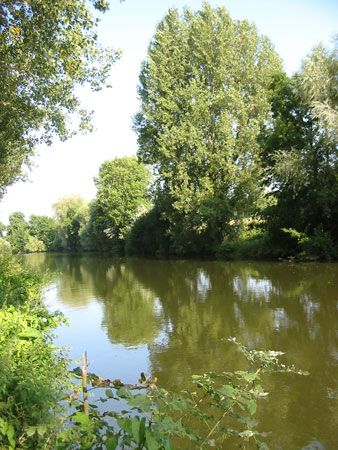
The Somme River is a 152-mile (245-km) river in northern France that flows westward from its source near Saint-Quentin to the English Channel. Its name, derived from the Celtic samara, means “tranquil,” though the river valley has historically served as a critical strategic barrier between Flanders and Paris.1
The river is notable for its marshy valley and its role in major 20th-century conflicts. During World War I, the upper basin was the site of intense combat, most notably the First Battle of the Somme in 1916 and the Second Battle of the Somme in 1918. During World War II, the valley was occupied by German forces in 1940 before being liberated by the Allies in 1944.12
Today, the river’s basin covers approximately 2,300 square miles (6,000 square km), and its canal systems provide essential links between the navigable waterways of Paris and Flanders.1
What was the significance of the Battle of the Somme in 1916?
The First Battle of the Somme (July 1–November 13, 1916) remains one of the most significant and tragic engagements of World War I. Its historical importance is defined by several key factors:
- Symbol of Futility: The battle is widely remembered for the horrific bloodshed on its first day, where the British Army suffered over 60,000 casualties—the heaviest single-day loss in its history. This event became a lasting metaphor for the indiscriminate and futile slaughter characteristic of trench warfare.31
- Tactical Failure: The offensive highlighted the catastrophic gap between outdated military planning and the reality of modern defensive technology. British commanders, including Douglas Haig, relied on rigid infantry formations against scientifically planned German defenses, which proved devastatingly ineffective.14
- Technological Innovation: The battle marked the first combat appearance of the tank on September 15, 1916. While early models had limited success due to mechanical defects and tactical mishandling, they introduced a new method for overcoming the stalemate of the Western Front.14
- Attrition: The struggle forced a shift in Allied strategy toward a war of attrition, aiming to wear down German manpower. By the end of the four-month campaign, combined casualties exceeded 1 million, imposing a severe, unsustainable strain on both sides.1
How did geography influence warfare in the Somme valley?
The geography of the Somme River valley played a decisive role in the military history of the region, particularly during the 20th century.
- Strategic Barrier: The river follows the floor of a trench across the chalk country of northern France. Its marshy valley acted as a natural defensive line and a critical strategic barrier in the approaches from Flanders toward Paris, making it a focal point for military control during World War I.1
- Terrain and Combat: The upper basin of the river, characterized by its marshy terrain, became the site of intense, large-scale combat. During the First Battle of the Somme, the landscape influenced the nature of the fighting; the rigid, trench-based defensive systems utilized by the Germans exploited the local topography to stall Allied advances, turning the valley into a symbol of the stalemate of trench warfare.16
- Logistical Links: Beyond its role as a barrier, the river’s geography provided essential connectivity. Canals linked the upper valley to the Oise and Scheldt rivers, creating a network of navigable waterways that connected the strategic hubs of Paris and Flanders.1
What other major rivers in France played a role in World War I?
Several major rivers in France served as critical strategic barriers, defensive lines, and logistical hubs during World War I. Their valleys often dictated the movement of troops and the location of major engagements:
- Marne River: Perhaps the most famous, the Marne was the site of the First Battle of the Marne in 1914, where a decisive Allied counteroffensive halted the German advance toward Paris. It remained a focal point of conflict, including the Second Battle of the Marne in 1918, which marked a turning point in the war.789
- Aisne River: Following the retreat from the Marne, German forces established a firm defensive line along the lower Aisne. The First Battle of the Aisne was instrumental in the transition to trench warfare on the Western Front.710
- Meuse River: This river valley formed a natural defensive barrier for the Paris Basin. It was the site of intense fighting, most notably during the battles of the Meuse-Argonne in 1918, the final major Allied offensive of the war.1112
- Oise River: Serving as a vital link in the canal system connecting the Paris Basin to northern industrial regions, the Oise riverbanks saw several significant battles throughout the conflict.13
- Yser River: Located in the north, the Yser became a critical defensive line. In 1914, Belgian forces famously opened the sluices at Nieuwpoort to flood the valley, effectively halting the German advance toward the coast.714
Sources
- Somme River — Encyclopædia Britannica
- Second Battle of the Somme — Encyclopædia Britannica
- First Battle of the Somme: Top Questions — Encyclopædia Britannica
- First Battle of the Somme — Encyclopædia Britannica
- tactics - The power of the defense — Encyclopædia Britannica
- Picardy — Encyclopædia Britannica
- World War I - The First Battle of the Marne — Encyclopædia Britannica
- First Battle of Ypres - The Battle of the Yser and the main German attack — Encyclopædia Britannica
- First Battle of the Marne - Outcome — Encyclopædia Britannica
- Meuse River — Encyclopædia Britannica
- battles of the Meuse-Argonne — Encyclopædia Britannica
- Second Battle of the Marne — Encyclopædia Britannica
- Marne River — Encyclopædia Britannica
- Oise River — Encyclopædia Britannica
- Battle of the Frontiers — Encyclopædia Britannica
Published on · 4 min read