Sonora River
The Sonora River is a waterway located in the state of Sonora, in northwestern Mexico. It originates south of Cananea, near the border with the United…
What is Sonora River?
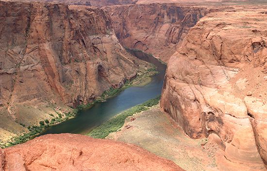
The Sonora River is a waterway located in the state of Sonora, in northwestern Mexico. It originates south of Cananea, near the border with the United States, and flows for approximately 250 miles (400 km) in a southward and southwestward direction through the western flanks of the Sierra Madre Occidental.1
Several settlements are situated along its course, including Arizpe, Bacoachi, Huépac, and Ures. While the river passes through the coastal lowlands below the state capital of Hermosillo, it no longer reaches the Gulf of California due to the extensive use of dams and irrigation canals. It is distinct from the Yaqui River, which serves as the largest river system in the state.12
What is the Sierra Madre Occidental mountain range?
The Sierra Madre Occidental is a major mountain range in northwestern Mexico that runs parallel to the Pacific coast. Extending approximately 700 miles (1,100 km) in length and ranging from 100 to 300 miles (160 to 480 km) in width, the range serves as the western boundary of the Mexican Plateau.345
Physical Features
The topography of the Sierra Madre Occidental is characterized by its rugged, deeply dissected landscape. While it was once thought to be a simple structure of horizontal lava flows, it is now understood to have a complex history involving folding, faulting, and igneous intrusions. From the west, the mountains appear as formidable escarpments that drop into deep, angular canyons known as barrancas, the most famous of which is the Copper Canyon (Barranca del Cobre). Summits typically exceed 6,000 feet (1,800 meters), with some peaks rising above 10,000 feet (3,000 meters).54
Climate and Ecology
The range plays a critical role in regional climate, acting as a barrier that influences precipitation patterns. Its diverse elevations support distinct vegetation zones, ranging from conifer forests in the tierra fria to oak-pine forests in the tierra templada and drought-tolerant scrub at lower elevations. Wildlife in the region includes deer, coyotes, and black bears, with gray wolves still inhabiting remote northern areas.67
How do dams affect river ecosystems?
Dams significantly alter river ecosystems by transforming natural environments to serve human needs, often resulting in the loss of flora, fauna, and landscapes. While some structures, such as beaver dams, act as “ecosystem engineers” by creating ponds and wetlands that support diverse aquatic life, large-scale human-made dams frequently cause widespread environmental disruption.910
Key impacts include:
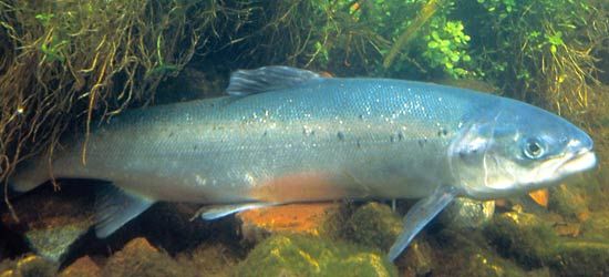
- Disruption of Migratory Species: Dams often block or impede the movement of spawning fish, such as salmon. While technologies like fish passes (ladders and locks) attempt to mitigate this, they have struggled to prevent dramatic population declines on many rivers.119
- Sediment Trapping: Reservoirs hold much of a river’s sediment load, preventing it from moving downstream. This alters the natural deposition processes that maintain riverbeds and coastal features like deltas.12
- Habitat Inundation: Large reservoirs often flood vast areas, destroying terrestrial habitats and displacing human communities, which has led to significant political and social opposition.9
- Flow Alteration: Diversion for hydroelectric power and irrigation reduces the water available for downstream ecosystems, further impacting sediment transport and riparian health.129
We could dive deeper into the specific conservation efforts used to protect fish populations or the ongoing debates surrounding dam removal initiatives.
What are the major cities in the state of Sonora?
The state of Sonora, located in northwestern Mexico, features several major cities where the population is primarily clustered. These urban centers serve as vital hubs for commerce, agriculture, and cross-border trade.14
The major cities in Sonora include:
- Hermosillo: The state capital and a central hub for the region.14
- Heroica Nogales: Located at the border with Arizona, this city is a significant point of cross-border activity.14
- Ciudad Obregón: Situated in the Yaqui River valley, it is a key agricultural center.14
- Guaymas: A prominent gulf port and deep-sea fishing resort.14
- San Luis: Located on the U.S. border near the Colorado River, this city is a major commercial and manufacturing center for the surrounding irrigated agricultural region.15
These cities have flourished since the 1940s, supported by irrigation projects and, more recently, the growth of export-oriented assembly plants known as maquiladoras.14
Sources
- Sonora River — Encyclopædia Britannica
- Yaqui River — Encyclopædia Britannica
- Sierra Madre - Physiography of the Sierra Madre — Encyclopædia Britannica
- Sierra Madre Occidental — Merriam-Webster
- Sierra Madre - Geology — Encyclopædia Britannica
- Sierra Madre - Plant and animal life — Encyclopædia Britannica
- Sierra Madre - Climate — Encyclopædia Britannica
- Mexico - Climate — Encyclopædia Britannica
- dam - Fish passes — Encyclopædia Britannica
- Why do beavers build dams? — Encyclopædia Britannica
- river - Environments of deposition — Encyclopædia Britannica
- dam - Construction techniques — Encyclopædia Britannica
- dam - Rise of environmental and economic concerns — Encyclopædia Britannica
- Sonora — Encyclopædia Britannica
- San Luis — Encyclopædia Britannica
Published on · 3 min read