Sous River
The Sous River is a waterway located in southern Morocco. It originates from various headstreams in the High Atlas mountains and travels westward for 112…
What is Sous River?
The Sous River is a waterway located in southern Morocco. It originates from various headstreams in the High Atlas mountains and travels westward for 112 miles (180 km) before reaching the Atlantic Ocean just south of Agadir.1
The river’s alluvial basin is shielded from the Sahara by the Anti-Atlas Mountains, creating one of the most fertile agricultural regions in the country. This area supports the production of fruits, cotton, vegetables, sugar, and olives, many of which are intended for export. The primary urban centers within this region include the market town of Taroudant and the commercial port of Agadir.1
What are the main characteristics of the High Atlas mountains?
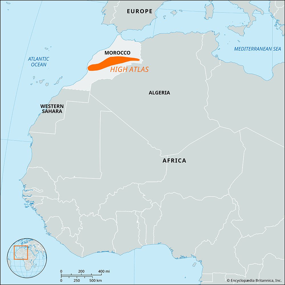
The High Atlas is a prominent mountain range in central Morocco, extending 460 miles (740 km) from the Atlantic coast to the Algerian border. It is characterized by several distinct features:2
- Elevation and Peaks: The range contains the highest points in the Atlas Mountains, with many peaks exceeding 12,000 feet (3,660 meters). The highest point is Mount Toubkal, reaching 13,665 feet (4,165 meters).23
- Climate and Vegetation: The range acts as a barrier between different air masses. Its northern slopes and lower peaks support forests of cork, oak, pine, cedar, and walnut trees. In contrast, the southern flanks are exposed to hot, dry Saharan winds and are generally barren. The mountains retain snow until the height of summer, making them a popular destination for skiing.24
- Human Geography: The lower slopes feature well-watered valleys where Berber (Amazigh) peoples cultivate small, irrigated fields.2
- Economic Resources: The region is rich in minerals, including copper, iron ore, lead, zinc, and manganese. Additionally, the mountains serve as vital catchment areas, with dams constructed to support irrigation and hydroelectric power generation.25
How does the Anti-Atlas range influence the local climate?
The Anti-Atlas range significantly influences the local climate by acting as a geographic barrier that contributes to the region’s arid conditions. Situated south of the High Atlas, the Anti-Atlas experiences very low precipitation, with annual totals remaining under 17 inches (430 mm) throughout the range.7
The mountains function as part of a broader system of Atlas Mountains that separate the Mediterranean basin to the north from the Sahara to the south. By creating a rain shadow, these ranges block moisture-bearing winds, causing desert conditions to emerge abruptly on their leeward sides. While the mountains generally serve to hinder the movement of air masses between the desert and the coast, they do not prevent it entirely; hot, dry, and dusty winds from the Sahara, known as the sharqī (chergui), can still sweep over the mountains, causing dramatic temperature spikes and potential crop damage in the lowlands.38
What is the historical importance of the city of Taroudant?
Sources
- Sous River — Encyclopædia Britannica
- High Atlas — Encyclopædia Britannica
- Atlas Mountains - Climate of the Atlas Mountains — Encyclopædia Britannica
- Atlas Mountains - Physiography — Encyclopædia Britannica
- Atlas Mountains - Resources — Encyclopædia Britannica
- Exploring 7 of Earth’s Great Mountain Ranges - Atlas Mountains — Encyclopædia Britannica
- Anti-Atlas — Encyclopædia Britannica
- Atlas Mountains — Encyclopædia Britannica
- Morocco - Climate of Morocco — Encyclopædia Britannica
Published on · 2 min read