High Atlas
The climate of the High Atlas mountains is defined by the convergence of humid, cold polar air masses from the north and hot, dry tropical air masses from…
How does the climate vary across different parts of the High Atlas Mountains?
The climate of the High Atlas mountains is defined by the convergence of humid, cold polar air masses from the north and hot, dry tropical air masses from the south. Because of the range’s significant elevation, temperatures drop rapidly as altitude increases, and the mountains experience harsh winters.1
Climate variations are heavily influenced by aspect and exposure:
- Northern Slopes: These areas receive more rainfall and are generally more temperate, supporting forests of cork, oak, pine, and cedar.12
- Southern Flanks: Exposed to hot, dry Saharan winds, these slopes are significantly drier and often lack vegetation.2
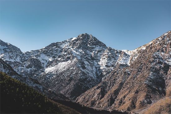
- Altitudinal Effects: While lower valleys are well-watered and support agriculture, the highest peaks, such as Mount Toubkal, remain covered in snow until the height of summer.12
Rainfall is generally more plentiful in the northeastern parts of the broader Atlas Mountains system compared to the southwest, and the High Atlas serves as a critical barrier that limits moisture reaching the regions to its south.1
What are some popular outdoor activities and tourist attractions in the High Atlas region?
The High Atlas region in Morocco offers a variety of outdoor activities that capitalize on its dramatic topography and seasonal climate.
Popular Outdoor Activities
- Hiking and Trekking: The region is a premier destination for hikers, particularly during the summer months when the weather is more accessible.3
- Winter Sports: When snow covers the higher elevations, the mountains become a popular destination for skiing.36
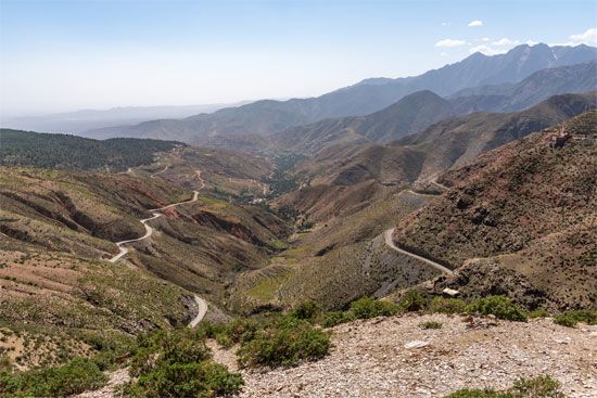
- Scenic Exploration: Travelers often traverse the region’s well-known mountain passes, such as Tichka, Test, and Talrhemt, which provide access to the rugged interior.3
Key Tourist Attractions
- Toubkal National Park: This is the central attraction of the region. It is home to Mount Toubkal, which, at 13,665 feet (4,165 meters), is the highest peak in the Atlas Mountains.36
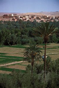
- Cultural Landscapes: Visitors can explore the well-watered valleys where Berber (Amazigh) communities maintain traditional agricultural practices in small, irrigated fields.3
While the Middle Atlas is also noted for its own hunting, fishing, and skiing opportunities, the High Atlas remains the primary focus for the developing tourism industry in the Moroccan mountain massifs.78
What is the geographical location and extent of the High Atlas Mountains in Morocco?
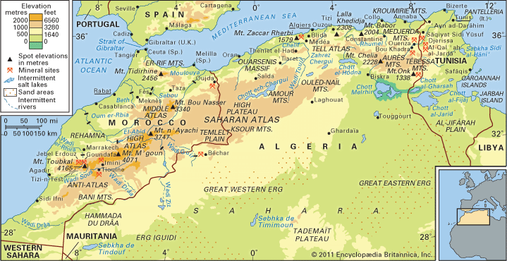
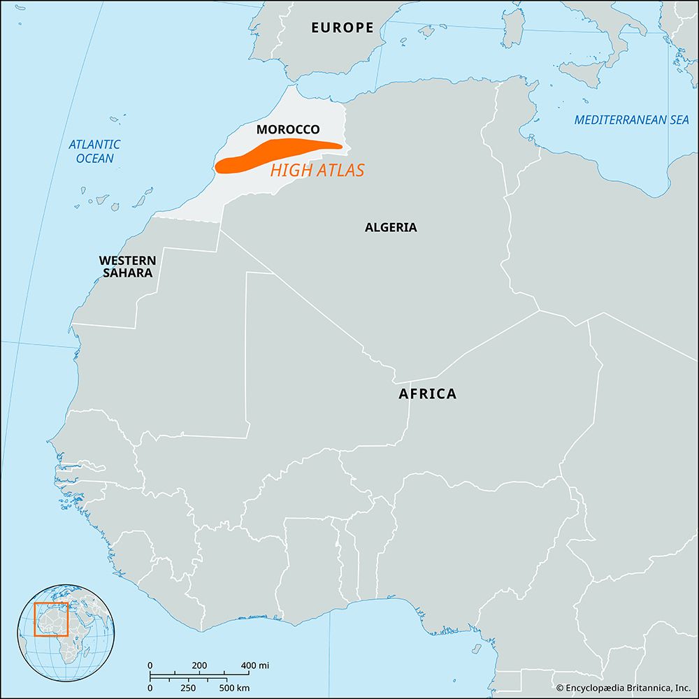
The High Atlas is a prominent mountain range located in central Morocco. It serves as a major geographical barrier, extending northeastward for approximately 460 miles (740 km) from the Atlantic Ocean coast to the border with Algeria.39
The range begins as small hills near the Atlantic edge and rises rapidly in elevation, reaching its highest point at Mount Toubkal, which stands at 13,665 feet (4,165 meters). As part of the broader Atlas Mountains system, the High Atlas acts as a central divide, separating the plains of Atlantic Morocco from the arid regions to the south and southeast that mark the limit of the Sahara. The range is characterized by rugged terrain, including numerous peaks exceeding 12,000 feet and several well-known mountain passes, such as Tichka, Test, and Talrhemt, which facilitate travel through the interior.9103
What geological processes led to the formation of the High Atlas Mountains?
The formation of the High Atlas Mountains is a complex geological process involving both ancient structural foundations and more recent tectonic activity.
The range is primarily the result of the mighty folding of the Earth’s crust that uplifted fragments of the ancient African base rock. Specifically, the Moroccan High Atlas constitutes a horst, which is an uplifted block of the Earth’s crust. This structural development was significantly influenced by the folding and crumpling of the crust during the Jurassic Period (about 200 to 145 million years ago) and the Cretaceous Period (about 145 to 65 million years ago).11
Furthermore, the broader Atlas system underwent significant elevation during the Paleogene and Neogene periods (between about 65 and 2.6 million years ago). During this time, the folding and uplifting of sediment that had accumulated in the Tethys Sea—which bordered the northern coast of Africa—contributed to the creation of these mountain chains.10
Sources
- Atlas Mountains - Climate of the Atlas Mountains — Encyclopædia Britannica
- Sahara - Climate of the Sahara — Encyclopædia Britannica
- High Atlas — Encyclopædia Britannica
- Exploring 7 of Earth’s Great Mountain Ranges - Atlas Mountains — Encyclopædia Britannica
- The Sahara Was Once Green: Top Questions — Encyclopædia Britannica
- Mount Toubkal — Encyclopædia Britannica
- Middle Atlas — Encyclopædia Britannica
- Atlas Mountains - Resources — Encyclopædia Britannica
- Atlas Mountains - Physiography — Encyclopædia Britannica
- Morocco - Relief of Morocco — Encyclopædia Britannica
- Atlas Mountains - Geology — Encyclopædia Britannica
- Africa - Tectonic movements — Encyclopædia Britannica
Published on · 3 min read