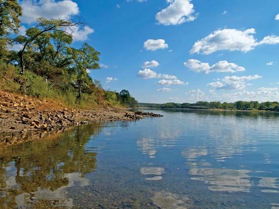
Ussuri River
The Ussuri River is a northward-flowing tributary of the Amur River located in East Asia. It serves as a significant international boundary, separating…
Where is the Ussuri River located, and what countries does it border?
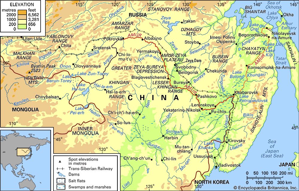
The Ussuri River is a northward-flowing tributary of the Amur River located in East Asia. It serves as a significant international boundary, separating China—specifically the Heilongjiang province—from Russia, where it flows through the region of Siberia1.
The river originates from the confluence of the Sungacha, Ulakhe, and Arsenyevka rivers, which rise in the Sikhote-Alin mountain range. It eventually joins the Amur River near the city of Khabarovsk. Historically, the river was the site of territorial disputes between China and the Soviet Union, including an armed conflict in 1969, though these border issues were formally resolved between China and Russia in 2004.1
What is the significance of the Ussuri River in terms of international boundaries?
The Ussuri River holds major geopolitical significance as it serves as a natural international boundary for a considerable distance between China (Heilongjiang province) and Russia (Siberia).1
Historically, this border was a source of intense friction. During the 1960s, large sections of the river were subject to territorial disputes between China and the Soviet Union, culminating in a sharp armed conflict in 1969. Following years of tension, the two nations established limited navigation rules in 1977. The long-standing border dispute was finally resolved through formal negotiations between China and Russia in 2004, stabilizing the region’s political geography.1
How long is the Ussuri River, and what are its major tributaries?
The Ussuri River measures 565 miles (909 km) in length, measured from the source of the Ulakhe River.1
The river is formed by the confluence of several major tributaries:
- Sungacha (Song’acha) River: The outlet of Lake Khanka.1
- Ulakhe River: One of the primary headwater streams rising in the Sikhote-Alin mountains.Alin](https://www.britannica.com/place/Sikhote-Alin) mountains.1
- Arsenyevka River: Also originating on the southwestern slopes of the Sikhote-Alin range.1
Additionally, the river becomes navigable starting from its confluence with the Great (Bolshaya) Ussurka.1
What is the climate like in the Ussuri River region?
The Ussuri River region is characterized by a temperate, wet climate. As part of the broader Amur River basin, the area is significantly influenced by monsoon winds that alternate seasonally, shaping the weather patterns of East Asia.21
Key climatic features include:
- Seasonal Extremes: The region experiences severe, frigid winters dominated by polar, continental air masses, followed by short, warm summers influenced by subtropical maritime air.12
- Precipitation: The Ussuri drainage basin is relatively wet compared to more continental interior regions. Precipitation is unevenly distributed, with the heaviest rainfall occurring in the maritime and southern sections, typically ranging between 24 and 36 inches (600 to 900 mm) annually.1
- Summer Peak: The majority of annual precipitation falls during the summer months, which coincides with the region’s short growing season.12
Sources
- Ussuri River — Encyclopædia Britannica
- Amur River - Climate of the Amur River — Encyclopædia Britannica
- Yenisey River - Climate — Encyclopædia Britannica
- Heilongjiang - Climate — Encyclopædia Britannica
- Sikhote-Alin — Encyclopædia Britannica
Published on · 2 min read