Verdon River
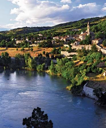
The Verdon River is a 125-mile (200-km) river located in southern France. It originates in the Les Trois Évêchés mountains, south-southwest of Barcelonnette…
What is Verdon River?
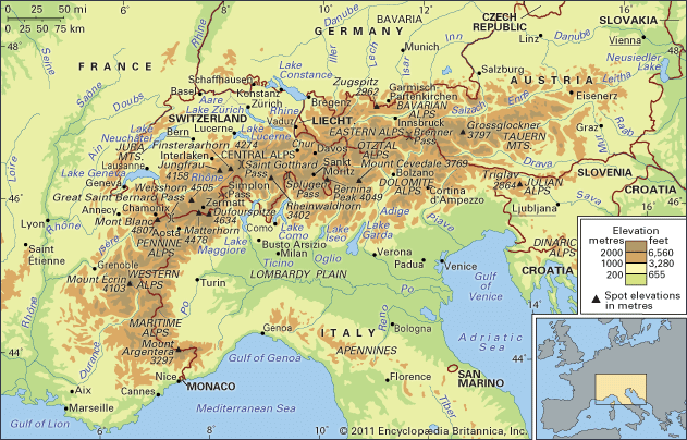
The Verdon River is a 125-mile (200-km) river located in southern France. It originates in the Les Trois Évêchés mountains, south-southwest of Barcelonnette, and flows southward through towns such as Allos, Saint-André-les-Alpes, and Castellane before turning west to join the Durance River below Manosque.1
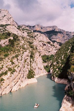
The river is most famous for its spectacular gorges, often referred to as a “Grand Canyon,” which can be viewed from a scenic 12-mile (20-km) road situated between Pont de l’Artuby and Aiguines on the border of the Alpes-de-Haute-Provence and Var departments. To manage its flow, the river has been dammed at several points both above and below these gorges.1
How are river gorges formed by erosion?
River gorges and canyons are primarily formed through the process of river erosion, where a river carves the valley through which it flows. This process is often accelerated by tectonic activity, specifically vertical uplift, which reinvigorates a river’s erosive power—a phenomenon known as rejuvenation.23
As a river flows, it scours its banks and bed, entraining sediments that act as abrasive tools to deepen and widen the channel. The formation of these deep, narrow valleys depends on the rate of river downcutting relative to the rate of regional uplift. Several specific mechanisms explain how these features develop:43
- Antecedent Canyons: These form when a river is already established in a landscape before tectonic features like folds or faults rise across its path. If the river’s rate of downcutting keeps pace with the rising land, it maintains its course, carving a gorge through the emerging structure.3
- Superimposed Canyons: These occur when a river develops on a layer of younger sediment covering a complex, folded, or faulted bedrock. As the river erodes downward, it is “let down” onto the underlying resistant rock, cutting a canyon across structures that were previously buried.3
- Transverse Erosion: Rivers may also preferentially expand through fault zones or areas of geologic weakness, allowing them to cut across resistant ridges.3
What are the main tributaries of the Durance River?
The Durance River is the principal river draining the French side of the Alps toward the Mediterranean. Throughout its 189-mile (304-km) course, it receives several significant tributaries, including:
- Clairée and Guisane: These streams join the Durance above and in Briançon.
- Ubaye: This river converges with the Durance near the Serre-Ponçon Dam.
- Buech: A wild torrent that joins the Durance above Sisteron.
- Bléone and Asse: These rivers join the Durance after it passes the Châteauneuf-Arnoux Dam.
- Verdon: This river joins the Durance below Manosque.
These tributaries, along with the Durance itself, have been extensively managed through dams for hydroelectric power and irrigation projects, particularly following World War II. The Durance eventually flows into the Rhône River below Avignon.51
Why are dams built along rivers like the Verdon?
Dams are constructed along rivers like the Verdon and the Durance primarily to support large-scale infrastructure projects. Following World War II, these rivers became the focus of extensive development aimed at two critical objectives:
- Hydroelectric Power: The dams harness the flow of the rivers to generate electricity, providing a significant source of renewable energy for the region.5
- Irrigation and Water Supply: By creating artificial lakes and reservoirs, these structures allow for the controlled storage and distribution of water, which is essential for agricultural irrigation and regional water supply needs.5
In addition to these functional roles, the dams help manage the flow of rivers that are otherwise characterized by their wild, torrential nature, effectively “taming” them to prevent flooding and ensure a consistent water supply throughout the year.51
Sources
- Verdon River — Encyclopædia Britannica
- river - Valleys and canyons — Encyclopædia Britannica
- river - Formation of canyons and gorges — Encyclopædia Britannica
- erosion — Encyclopædia Britannica
- Durance — Encyclopædia Britannica
- France - The Rhône system — Encyclopædia Britannica
Published on · 3 min read