Zagros Mountains
The Zagros Mountains have served as a formidable natural barrier, historically shaping the region's cultural and political landscape by acting as a boundary…
How have the Zagros Mountains influenced the development of different ethnic groups and languages in the region?
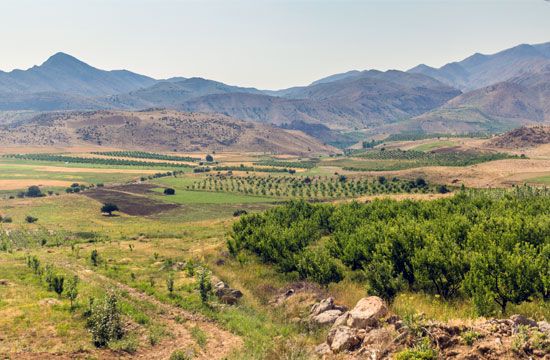
The Zagros Mountains have served as a formidable natural barrier, historically shaping the region’s cultural and political landscape by acting as a boundary between distinct entities, such as the early Mesopotamian and Median cultures, and later the Persian and Ottoman empires.1
This rugged terrain has influenced the development of diverse ethnic groups by providing isolated environments that fostered distinct identities. The mountains and their foothills are home to various groups, including Kurds, Lurs, Bakhtyārī, and Qashqā’ī tribes. Many of these populations, particularly the Kurds and seminomadic Lurs, have maintained unique social structures and, in some cases, resisted assimilation into mainstream national life.12
Linguistically, the region is home to diverse dialects. For instance, Gorānī is spoken primarily within the Zagros range and exhibits strong influences from surrounding Kurdish dialects, while also retaining archaic features. The geography has effectively preserved these linguistic variations by limiting interaction between intermontane valleys.31
Where are the Zagros Mountains located, and what countries do they span?
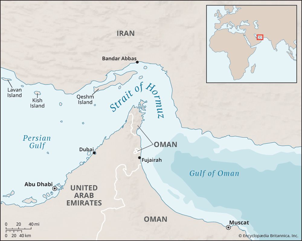
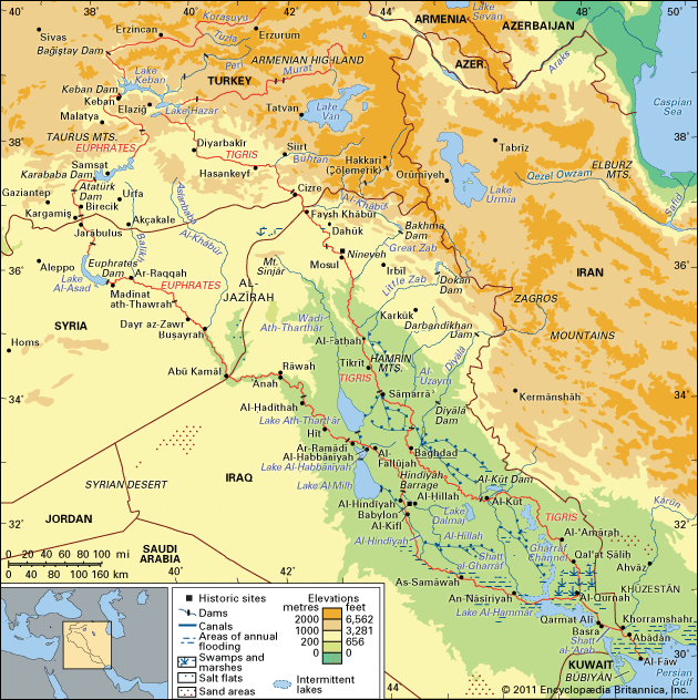
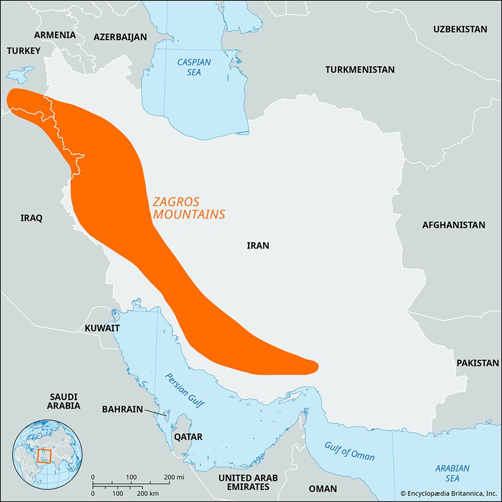
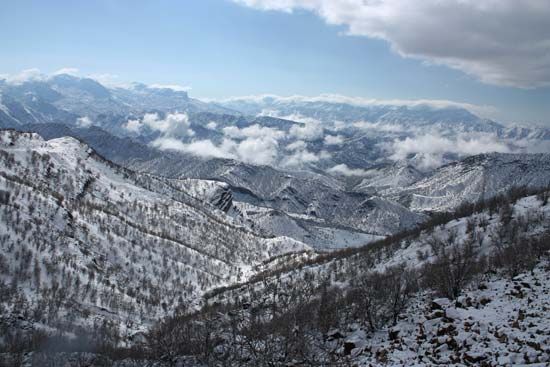
The Zagros Mountains are a major mountain range located primarily in southwestern Iran. The range extends approximately 990 miles (1,600 km) in a northwest-southeast direction, forming the western boundary of the Iranian plateau.1
While the vast majority of the range is situated within Iran, its foothills and border areas extend into neighboring countries, specifically Turkey and Iraq. The range stretches from these border regions in the northwest all the way to the Strait of Hormuz in the southeast.14
What significant historical and cultural sites can be found in the Zagros Mountains?
The Zagros Mountains have served as a vital corridor and boundary for civilizations for millennia, resulting in a landscape rich with historical and cultural significance.
Bīsitūn (Behistun)
Perhaps the most famous site in the region is Bīsitūn, located at the foot of the mountains in the Kermanshah region of Iran. This site is home to a monumental trilingual inscription and bas-relief carved into a precipitous rock face by the Achaemenid king Darius I. Written in Old Persian, Babylonian, and Elamite, the inscription records Darius’s rise to power and the organization of the Persian Empire. Its decipherment in the 19th century provided a critical key to understanding cuneiform scripts. In 2006, Bīsitūn was designated a UNESCO World Heritage site.
Historical Significance
The mountains have historically functioned as a natural barrier between major powers, including the Mesopotamian and Median cultures, as well as the Parthian, Roman, Persian, and Ottoman empires. The region’s topography, characterized by fertile intermontane plains and deep gorges, facilitated the movement of ancient nomadic tribes, such as the Medes and Persians, who migrated into the area during the Iron Age.
What role did the Zagros Mountains play in ancient Persian empires and trade routes?
The Zagros Mountains served as a critical geographic and political feature for ancient Persian empires, acting as both a formidable natural barrier and a strategic corridor for migration and trade.1
Strategic Role and Boundaries
The range functioned as a traditional boundary between major political entities, separating the Mesopotamian lowlands from the Iranian plateau. For empires like the Medes and the Persians, the mountains provided a defensive perimeter against external powers such as Assyria, Urartu, and Elam.19
Migration and Trade Routes
The topography of the Zagros, characterized by fertile intermontane plains and deep ravines, dictated the movement of people and goods. During the Iron Age, Iranian tribes utilized the natural alignment of the mountains to migrate from the east, spreading northwest and southeast. They relied on major mountain passes—such as the route between Hamadan and Kermanshah—to infiltrate westward toward the borders of Mesopotamia. These routes were essential not only for the expansion of the Median and Persian kingdoms but also for the movement of trade and cultural exchange across the region.19
Sources
- Zagros Mountains — Encyclopædia Britannica
- Iran - Ethnic groups — Encyclopædia Britannica
- Iranian languages - Dialects — Encyclopædia Britannica
- Zagros Mountains — Merriam-Webster
- Stone Age - Incipient cultivation and domestication — Encyclopædia Britannica
- Bīsitūn — Encyclopædia Britannica
- epigraphy - Other countries of the ancient Middle East — Encyclopædia Britannica
- Iran - Relief of Iran — Encyclopædia Britannica
- ancient Iran - The coming of the Iranians — Encyclopædia Britannica
Published on · 3 min read