Safid River
The Safid River (also spelled Sefid) is the longest river in northern Iran. Stretching approximately 600 miles (1,000 km) when including its main tributary…
What is Safid River?
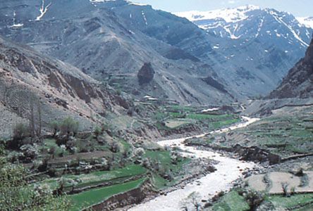
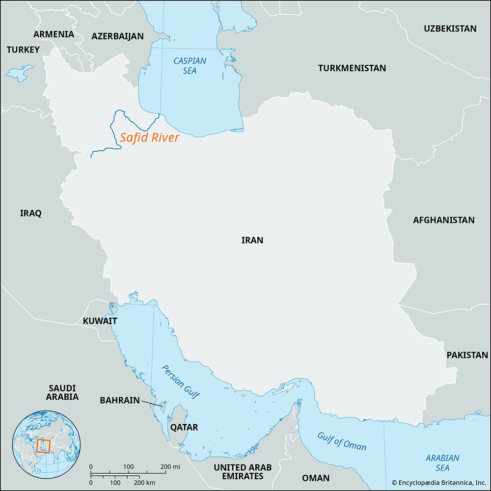
The Safid River (also spelled Sefid) is the longest river in northern Iran. Stretching approximately 600 miles (1,000 km) when including its main tributary, the Qezel Owzan, the river originates in the Alborz Mountains.12
The river flows as a mountain stream for much of its length before passing through an impressive 23-mile (37 km) gorge. It eventually emerges onto the Gilan plain, where it forms a delta and empties into the Caspian Sea.12
A significant feature of the river is the dam located at Manjil, which was completed in the early 1960s. This infrastructure serves several critical functions, including flood prevention, the expansion of irrigation for agriculture, and the generation of hydroelectric power. The river system drains an area of approximately 21,700 square miles (56,200 square km).12
What are the main characteristics of the Caspian Sea?
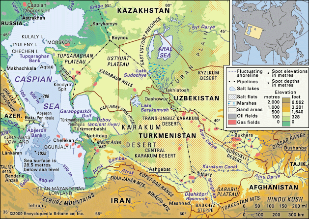
The Caspian Sea is the world’s largest inland body of water and the largest salt lake on Earth. It is an elongated basin spanning approximately 750 miles (1,200 km) from north to south, with its surface situated about 90 feet (27 meters) below sea level.345
Key Characteristics
- Geography and Borders: The sea covers an area of roughly 149,200 square miles (386,400 square km) and is bordered by Kazakhstan, Turkmenistan, Iran, Azerbaijan, and Russia3.
- Hydrology: The Volga River is the primary source of inflow, contributing significantly to the sea’s water balance. The water is saline, with an average salinity of about 12.8 parts per thousand, though this varies greatly near river outlets and in isolated areas like the Kara-Bogaz-Gol.367
- Geology: The basin has a complex structure, with the northern section resting on an ancient platform and the southern section containing deep sedimentary layers over a suboceanic-type crust.8
- Ecology: The sea hosts approximately 850 animal and 500 plant species, including many endemic varieties and the Caspian seal.9
- Economic Importance: The region is vital for petroleum and natural gas production, as well as commercial fisheries and shipping.3
How do dams like the one at Manjil help the local environment?
Dams like the one at Manjil serve several functional purposes, though their impact on the local environment is complex and often debated.
Benefits to Human and Managed Environments
Large-scale dams are primarily constructed to regulate water flow, which provides significant utility for human communities:
- Hydroelectric Power: By harnessing the potential energy of falling water, these structures generate renewable electricity, which is a clean alternative to fossil fuels.102
- Irrigation: Dams store water that can be used to irrigate agricultural fields, supporting food production and managing water supply in regions that may otherwise face seasonal scarcity.1112
- Flood Control: By regulating river levels, dams can help mitigate the damage caused by seasonal flooding.12
Environmental Considerations
While dams provide these benefits, they also introduce significant ecological challenges. They can interrupt the natural migration patterns of fish and permanently alter or submerge local habitats. Furthermore, the decomposition of vegetation in reservoirs can lead to the production of methane, and large projects have been criticized for destroying local ecosystems and livelihoods. Unlike the natural dams built by beavers—which act as “ecosystem engineers” to create beneficial wetlands and support biodiversity—large-scale human-made dams often require careful management to balance industrial progress with environmental preservation.101213
What are the major mountain ranges found in Iran?
Iran’s topography is defined by a series of massive, heavily eroded mountain ranges that surround its high interior basin. The two primary mountain systems are the Zagros Mountains and the Alborz Mountains.14
The Zagros Mountains
The Zagros range is the largest in the country, stretching approximately 990 miles (1,600 km) in a northwest-southeast direction from the borders of Turkey and Iraq to the Strait of Hormuz. Forming the western boundary of the Iranian plateau, the range broadens into a series of parallel ridges that can reach 150 miles (240 km) in width. The region is characterized by rugged terrain, fertile intermontane plains, and deep gorges. It serves as a significant cultural and political barrier and is home to diverse tribal groups and pastoral nomads.1415
The Alborz Mountains
The Alborz range extends across northern Iran, running in an arc along the southern shore of the Caspian Sea toward the Khorasan region. This system includes Mount Damavand, an extinct volcano that stands as the highest point in Iran. The range creates a sharp climatic divide: the northern slopes are humid and forested, while the southern slopes are arid and steppelike, reflecting the character of the interior plateau.1416
Sources
- Safid River — Encyclopædia Britannica
- Iran - Drainage — Encyclopædia Britannica
- Caspian Sea — Encyclopædia Britannica
- Caspian Sea - Shoreline features — Encyclopædia Britannica
- Caspian Sea - Geology of the Caspian Sea — Encyclopædia Britannica
- Caspian Sea - Hydrology — Encyclopædia Britannica
- Caspian Sea - Marine life — Encyclopædia Britannica
- Caspian Sea — Merriam-Webster
- Caspian Sea: Top Questions — Encyclopædia Britannica
- Why do beavers build dams? — Encyclopædia Britannica
- water infrastructure in India - Dams — Encyclopædia Britannica
- hydroelectric power — Encyclopædia Britannica
- Did you know? — Merriam-Webster
- Iran - Relief of Iran — Encyclopædia Britannica
- Zagros Mountains — Encyclopædia Britannica
- Alborz Mountains — Encyclopædia Britannica
Published on · 3 min read