Al-Ḥajar
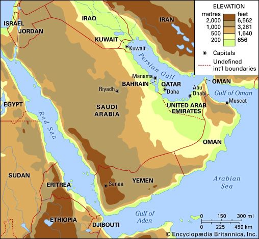
The Al-Ḥajar mountain range is located in northern Oman. It forms an arc that parallels the coast of the Gulf of Oman, stretching southeastward from the…
What is the geographical location of the Al-Ḥajar Mountains in Arabia?
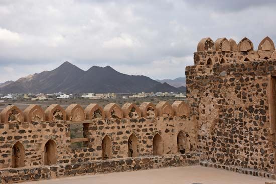
The Al-Ḥajar mountain range is located in northern Oman. It forms an arc that parallels the coast of the Gulf of Oman, stretching southeastward from the Musandam Peninsula to near Raʾs Al-Ḥadd on the extreme northeastern tip of the Arabian Peninsula.1
The range is divided into the Western Al-Ḥajar and Eastern Al-Ḥajar sections. Notable features within the chain include the Ruʾūs al-Jibāl overlooking the Strait of Hormuz and the massive Jabal Al-Akhḍar. Unlike other coastal highlands in the region, the Al-Ḥajar mountains are characterized by steep slopes on both sides, with the range reaching its highest point at Mount Shams.21
What types of flora and fauna can be found in the Al-Ḥajar Mountain range?
The Al-Ḥajar mountain range is generally characterized by a bleak landscape, though its biodiversity varies significantly based on local environmental conditions.
Fauna
The mountains are home to several species of wildlife, most notably the Arabian tahr. This sure-footed, goatlike mammal is unique to the region and is not found elsewhere in Oman. Leopards are also known to inhabit the range.13
Flora
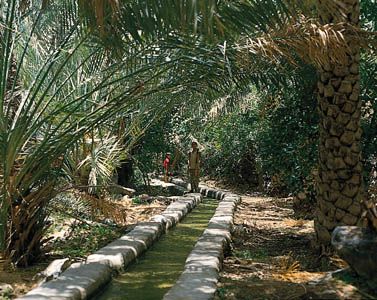
Vegetation is sparse across much of the Al-Ḥajar chain due to the arid environment. However, the Jabal Al-Akhḍar (Green Mountain) massif receives greater rainfall, which supports a more diverse range of plant life. In these areas, one can find:
- Alfalfa
- Date palms
- Lime bushes
- Various fruit trees1
How were the Al-Ḥajar Mountains formed geologically?
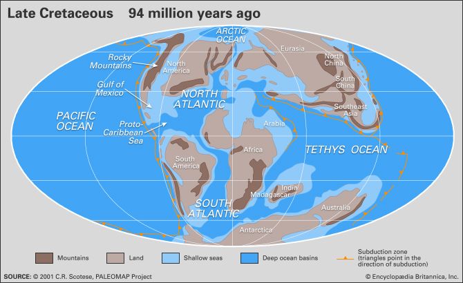
The Al-Ḥajar Mountains were formed through complex tectonic processes driven by the northward rotation and collision of the Arabian plate with the Eurasian plate.1
Geologically, the range is composed of a series of superimposed sheets known as nappes. These structures were created when compressional forces “scooped” oceanic crust from the Gulf of Oman and thrust it onto the continental crust of the Arabian plate. This process involved:51
- Ophiolite Emplacement: Slices of ancient ocean floor, or ophiolites, were thrust onto the continental margin during the Cretaceous Period (approximately 145 to 66 million years ago).5
- Sedimentary Stacking: These ophiolite sheets sit above older nappes composed of sedimentary rocks that were also deposited during the Cretaceous.5
Because of this tectonic history, the Al-Ḥajar Mountains are geologically more closely related to the Zagros Mountains of Iran than to other mountain ranges within the Arabian Peninsula.6
What is the highest peak in the Al-Ḥajar Mountains and how tall is it?
The highest peak in the Al-Ḥajar Mountains is Mount Shams (also referred to as Mount Al-Shām). It reaches an elevation of 9,777 feet (2,980 meters).19
While some sources note a slightly higher elevation of 9,957 feet (3,035 meters) for the peak in the context of the broader Arabian Peninsula’s geography, 9,777 feet is the standard elevation cited for the highest point in the Al-Ḥajar range and the country of Oman.1019
Sources
- Al-Ḥajar — Encyclopædia Britannica
- Arabia - Oman — Encyclopædia Britannica
- Algeria - Plant and animal life — Encyclopædia Britannica
- tahr — Encyclopædia Britannica
- Arabian Desert - Geology of the Arabian Desert — Encyclopædia Britannica
- Arabia - Geology — Encyclopædia Britannica
- Tethys Sea — Encyclopædia Britannica
- Oman - The early period — Encyclopædia Britannica
- Arabian Desert - Physical features — Encyclopædia Britannica
- Oman - Relief — Encyclopædia Britannica
Published on · 2 min read