Āl Wahībah Dunes
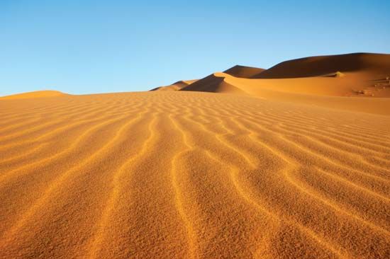
The Āl Wahībah Dunes (also known as the Wahiba Sands) is a sandy desert located in east-central Oman.
What is Āl Wahībah Dunes?
The Āl Wahībah Dunes (also known as the Wahiba Sands) is a sandy desert located in east-central Oman.1
Stretching over 100 miles (160 km) along the coast of the Arabian Sea, the region is characterized by honey-colored dunes that reach heights of up to 230 feet (70 m) and feature dark red bases. While the area has very little surface water, the Yal Wahībah nomads—the region’s sole inhabitants—traditionally access water by tunneling into the earth to reach the water table. Today, the sands are frequently traversed by vehicle tracks and routes.1
How do nomads survive in such an arid desert environment?
Nomads in arid desert environments, such as the Bedouin of the Arabian Desert or the Yal Wahībah of Oman, have historically survived through a combination of specialized pastoralism, resource management, and mobility.
Survival Strategies
- Pastoralism: Nomadic groups rely on breeding livestock—primarily camels, sheep, and goats—that are well-adapted to harsh conditions. These animals provide essential resources and can be moved to find grazing land as needed.23
- Water Access: In regions with little surface water, nomads utilize traditional techniques to secure supplies. For example, the Yal Wahībah tap into the water table by tunneling into the earth at shallow angles. In other desert areas, inhabitants rely on wells (bi’er), springs (‘ayn), or underground tunnels known as foggaras to reach groundwater.42
- Mobility: Nomads traditionally maintain a high degree of mobility to track seasonal pasturage and water sources. While historical tribal territories (dirah) once defined their range, modern technology—such as trucks—has transformed how they transport fodder, water, and livestock across the desert.3
- Economic Interdependence: Nomads often engage in trade with settled populations, exchanging livestock or goods for agricultural products like dates and grains.23
While modernization and the establishment of international borders have encouraged many to settle in urban areas or villages, some continue to practice part-time nomadism, maintaining a fragile ecological balance with the desert environment.23
What is the significance of the water table in desert geography?
The water table is the upper boundary of the zone where soil or rock is permanently saturated with groundwater. In desert geography, this level is of critical significance because it often serves as the only reliable source of fresh water in an otherwise arid environment.89210
Significance in Desert Environments
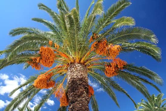
- Support for Life: The presence of a reachable water table allows for the formation of oases, which are fertile tracts of land that support sedentary populations, agriculture, and vegetation like the date palm.1112
- Resource Access: Nomadic and sedentary groups utilize various methods to tap into these underground supplies, including digging wells (bi’er), springs (‘ayn), or constructing foggaras—inclined tunnels designed to access dispersed groundwater.11
- Geological Stability: Many desert aquifers are ancient and remain unaffected by modern climatic aridity, providing a stable, albeit finite, water supply that can support human activity where surface water is absent.2
- Management Challenges: Because water availability is strictly limited, the overuse of groundwater can lead to a dangerous drop in the water level, potentially causing the drying of wells and the salinization of soil due to high evaporation rates.11
What other major deserts are found on the Arabian Peninsula?
The Arabian Desert covers almost the entire Arabian Peninsula, functioning as a vast, interconnected desert region rather than a collection of isolated deserts. Within this massive expanse, several distinct sandy areas are prominent:
- Rubʿ al-Khali: Known as the “Empty Quarter,” this is the world’s largest continuous sand desert, dominating the southern portion of the peninsula and covering over 250,000 square miles.1415
- Al-Nafūd: Located in the north-central part of the peninsula, this desert covers approximately 22,000 square miles.14
- Al-Dahnāʾ: This is a great arc of reddish sand, stretching nearly 900 miles long, that serves as a vital link connecting the Al-Nafūd desert in the north to the Rubʿ al-Khali in the south.1416
- Syrian Desert: While often categorized separately, it borders the Arabian Desert to the north, where the landscape merges into the Syrian steppe.717
Sources
- Āl Wahībah Dunes — Encyclopædia Britannica
- Sahara - People of the Sahara — Encyclopædia Britannica
- Arabian Desert - People of the Arabian Desert — Encyclopædia Britannica
- Oman - Daily life and social customs — Encyclopædia Britannica
- Oman - Settlement patterns — Encyclopædia Britannica
- Arabian Desert - Soils — Encyclopædia Britannica
- Arabian Desert - Climate of the Arabian Desert — Encyclopædia Britannica
- water table — Encyclopædia Britannica
- groundwater — Encyclopædia Britannica
- water table — Merriam-Webster
- oasis — Encyclopædia Britannica
- Asia - Groundwater — Encyclopædia Britannica
- Takla Makan Desert - Drainage — Encyclopædia Britannica
- Saudi Arabia - Relief — Encyclopædia Britannica
- Rubʿ al-Khali — Encyclopædia Britannica
- Arabian Desert — Encyclopædia Britannica
- Al-Dahnāʾ — Encyclopædia Britannica
- An Nafūd — Merriam-Webster
- Arabian Desert - Physical features — Encyclopædia Britannica
Published on · 3 min read