Ambrym
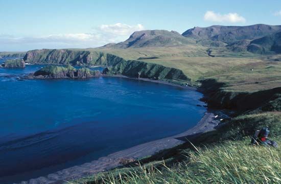
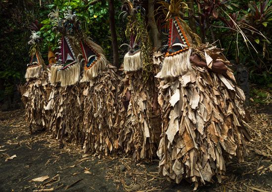
Ambrym is a volcanic island located in the southwestern Pacific Ocean and is part of the nation of Vanuatu.
What is Ambrym?
Ambrym is a volcanic island located in the southwestern Pacific Ocean and is part of the nation of Vanuatu.1
Spanning 257 square miles (665 square km), the island is defined by a large caldera that likely formed during a major eruption around 100 ce. Within this caldera sit two active volcanic vents: Marum, reaching 4,167 feet (1,270 meters), and Benbow, reaching 3,802 feet (1,159 meters). These cones have remained continuously active, frequently producing gas and ash, with notable lava flows occurring during the 1980s and 1990s. Due to the intensity of past eruptions, such as those in 1913–15, 1929, and 1951, the island’s population has occasionally required temporary evacuation.1
Economically, the island is known for the production of copra, and it is served by two airstrips located at Craig Cove and Uléi.1
How do volcanoes form a caldera?
A caldera is a large, bowl-shaped volcanic depression, typically exceeding one kilometer in diameter, formed by the inward collapse of a volcanic cone or group of cones.23
Contrary to the historical belief that these features were created by the explosive removal of a mountain’s top, scientific study has shown that they form primarily due to the loss of structural support. When a large volume of magma is rapidly expelled from an underlying reservoir during a violent eruption, the ground above the empty chamber collapses into the resulting void.243
The process varies by volcano type:
- Composite Cones: Rapid eruptions of pumice and ash empty the magma chamber, causing the summit to disappear into the void below.2
- Shield Volcanoes: Large rift eruptions or lateral intrusions drain magma from shallow chambers, leaving the surface unsupported.3
Following the collapse, the depression may be modified by minor eruptions that build smaller cones on the floor, or it may eventually fill with water to form a lake, such as Crater Lake in Oregon2.23
What is the Ring of Fire in the Pacific Ocean?
The Ring of Fire is the world’s largest and most active belt of earthquakes and volcanoes, forming a 40,000-km (24,900-mile) horseshoe-shaped path that fringes the Pacific Ocean basin.5
This region is home to approximately 75 percent of the world’s volcanoes and the vast majority of its strongest earthquakes. The belt’s intense activity is driven by plate tectonics, as oceanic plates subduct beneath continental plates. This process creates immense pressure and generates magma that fuels volcanic eruptions.5
The Ring of Fire encompasses various geomorphic features, including:
- Island arcs: Such as Tonga, Japan, the Philippines, and the Aleutians.5
- Continental margins: Including the western coast of North America and the Andes Mountains.5
While most of the belt is defined by subduction, some areas, such as parts of the North American coast, feature transform faults where plates slide past one another, resulting in frequent earthquakes but limited volcanic activity.5
How does volcanic activity affect island ecosystems?
Volcanic activity plays a dual role in shaping island ecosystems, acting as both a destructive force and a foundational creator of life.
Destruction and Primary Succession
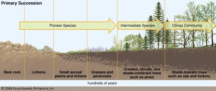
Volcanic eruptions can cause immediate, catastrophic damage to existing ecosystems through pyroclastic flows, ash falls, and lava flows that incinerate or bury vegetation and wildlife. However, these events also create barren, lifeless habitats—such as cooled lava fields—that serve as the starting point for primary succession.78
In this process, pioneer species like lichens and fast-growing grasses colonize the sterile rock. As these organisms die and decompose, they create the first pockets of soil, eventually allowing more complex plants and animals to establish themselves.910
Long-Term Benefits and Biodiversity
Over time, volcanic activity provides significant benefits to island environments:
- Soil Fertility: Volcanic ash weathers into rich, loamy soils that are highly productive for agriculture and support dense vegetation compared to non-volcanic islands.1112
- Adaptive Radiation: Volcanic archipelagoes, such as Hawaii and the Galapagos, often host high levels of endemic species. The isolation and diverse habitats created by volcanic landforms drive adaptive radiation, where groups evolve into specialized forms to fill unique ecological niches.13
Sources
- Ambrym — Encyclopædia Britannica
- Did you know? — Merriam-Webster
- caldera — Encyclopædia Britannica
- volcano - Calderas — Encyclopædia Britannica
- Ring of Fire — Encyclopædia Britannica
- Ring of Fire — Merriam-Webster
- volcano — Encyclopædia Britannica
- primary succession — Encyclopædia Britannica
- volcano - Long-term environmental effects — Encyclopædia Britannica
- ecological succession: Top Questions — Encyclopædia Britannica
- community ecology - Biogeographic aspects of diversity — Encyclopædia Britannica
- volcano - Submarine volcanoes — Encyclopædia Britannica
- adaptive radiation — Encyclopædia Britannica
- Cook Islands - Soils — Encyclopædia Britannica
- volcano - Lava , gas, and other hazards — Encyclopædia Britannica
- volcano - Determinants of size and shape — Encyclopædia Britannica
Published on · 3 min read